
The Cascades are expected to get four to eight more inches of snow Wednesday after the mountains got pounded with snow overnight.
Early reports indicate the Cascades got 10-20 inches of new snow since Tuesday. Mount Baker received nearly two feet of snow, according to the National Weather Service.
The heavy snowfall has been accompanied by very strong ridgetop winds. This has built up large areas of unstable snow (snow slabs) for high avalanche danger in the Cascades and Olympics away from avalanche controlled highways and ski areas.
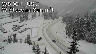
Travel conditions across the passes have been difficult with chains required across Snoqualmie Pass at times.
Related: Pass Reports | Snow reports | Webcams | Radar
Several more storms will move through the state Wednesday and Thursday for periods of heavy snow with snow levels peaking out around 3,500 feet early Wednesday. A cool easterly flow should keep the precipitation as snow for all of the ski areas except for a chance of brief rain for the Snoqualmie area bases.
Colder air begins to move in off the Pacific on Thursday with the snowfall becoming more off and on by the afternoon. Snow levels will fall dropping to 1,000-1,500 feet Friday morning.
However, the cooling may be short-lived as warmer temperatures may move back in over the weekend raising snow levels above 4,000 feet with a chance of more heavy snow or rain. Stay tuned!
Related: What is La Nina?
