
SEATTLE — Puget Sound Extended Forecast
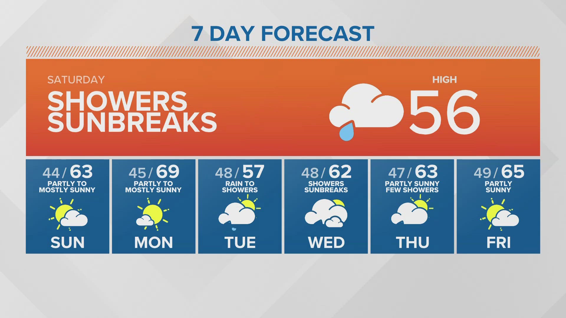
Saturday: Increasing chance of showers this afternoon - especially south of Everett Highs in the mid to upper 50s.
Sunday: Partly sunny to mostly sunny. Chance of an early morning shower. Lows in the upper 40s. Highs in the low to mid 60s.
Monday: Partly to mostly sunny. Lows in the low to mid 40s. Highs in the mid 60s.
Tuesday: Rain changing to off and on showers. Lows in the mid to upper 40s. Highs in the upper 50s and low 60s.
Wednesday: Showers and sunbreaks. Lows in the mid to upper 40s. Highs in the upper 50s and low 60s.
Thursday: Partly sunny, Few showers. Highs in the low to mid 60s.
Friday: Partly to mostly sunny. Chance of afternoon showers. Lows in the mid to upper 40s. Highs in the mid to upper 60s.
Discussion:
Saturday, another weather system is dropping down from the north for more clouds and convergence-based rain and thunderstorm potential, especially during the afternoon. Much cooler air will follow this front dropping highs Saturday into the mid to upper 50s in many places. Snow levels will drop to 3,500-4,500 feet.
Sunday will see skies clear to more sun and only a slight chance of an early morning shower. Monday looks dry and sunny. High temperatures will be at or a little below the normal mid 60s.
A stronger, more organized weather system swings into western Washington on Tuesday for a round of steady rain that should turn to off and on showers on Tuesday followed by showers and sunbreaks next Wednesday. Highs both days will be cool for this time of year with highs in the upper 50s to low 60s.
Friday looks like a partly to mostly sunny day with highs warming back up to the mid 60s to near 70 degrees.