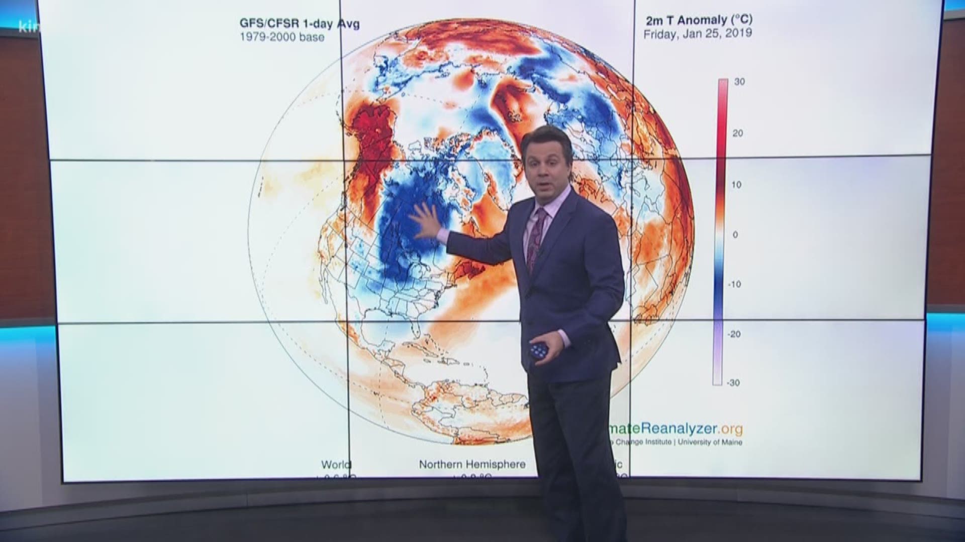
SEATTLE — The weather across the nation is going to extremes. While Western Washington is several days in a row of relative sunshine and above average temperatures, the eastern half of the nation is bracing for what looks to be the coldest outbreak of winter weather this season.
If you plan on enjoying our sunny and warm weather make sure to thank your friends and family suffering back east. As it turns out, there is a connection between the two and their pain is our gain.
RELATED: Latest forecast
The main culprit behind these extremes is an abrupt change in a typical pattern called the polar vortex. As its name suggests, the polar vortex is a region of strong winds circling the north pole. Think of it as a corral for all of the cold air trapped within its center over the Arctic. On occasion, the winds of the vortex can weaken, setting off a chain of events which can break the vortex into pieces or “lobes” which then droop south toward the mid-latitudes and the United States. This typically means a dramatic surge of cold air descending on the eastern half of the country.
So why does Western Washington get such a nice forecast out of this? When the atmosphere over one half of the country swings to such an extreme, the atmosphere over the other half usually compensates by doing the opposite.
We can think of the arctic blast of cold air sitting over the Midwest as a giant holding pattern. Something as extreme as the polar vortex can form a sort of log jam in the general flow of the atmosphere and cause areas “upstream” to get locked in the opposite extreme. In our case, we’re about to be under the influence of a dominant area of high pressure for the next five to six days, just about as long as it will take for the drama of the polar vortex to play out on the other half of the county.

