

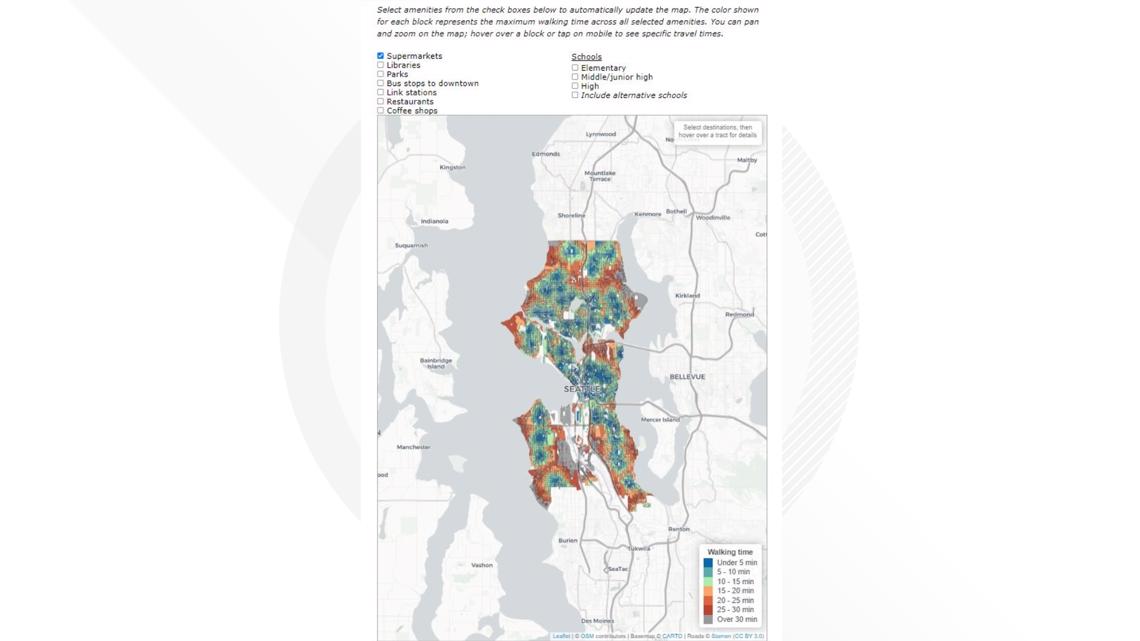
SEATTLE — Nat Henry is a geographer and recently created a viral map that shows walking times to daily necessities for every block in Seattle.
After living on Capitol Hill in the Pike/Pine area, he enjoyed being able to walk to many different amenities.
"As I was thinking where else I could live in Seattle and things like starting a family, I was wondering what other neighborhoods could I do this in," he said. "And many other people had the same question. I built this map mainly for myself but it's gotten sort of a huge reaction since, which I am very happy about."
His map has gotten over 232,000 views on Twitter and received supportive messages from locals.
One of the core aspects behind his map is the idea of a 15-minute city. This is a model that describes an area where residents can walk or bike to their daily needs, such as grocery stores and public transportation stops, within 15 minutes.
On the importance of a 15-minute city, Henry said, "As the city continues to grow and we continue to deal with things like climate change, how do we build a sustainable future for Seattle and for the world? And I think a part of that is going to be walkability."
He originally created the map as a New Year's resolution. His new goal now is to make one new map of Seattle every month.

Nat Henry is a public health researcher at the University of Washington. He makes maps of healthcare access and you can learn more about his work on his website.