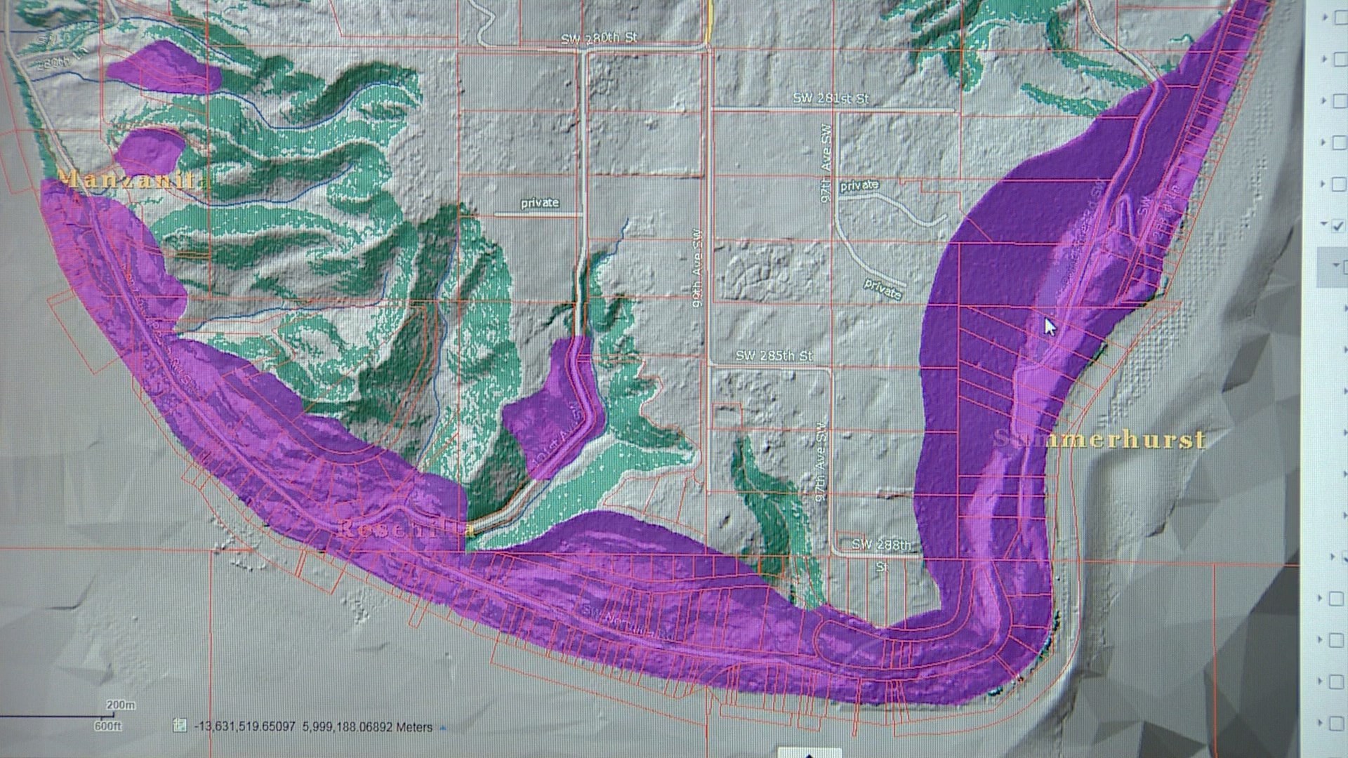
SEATTLE - The landslide map for King County and the City of Seattle is changing because of what's known as lidar.
Think of lidar like radar using light, and over the past 20 years, higher and higher resolution lidar has been employed by local governments to assess landslide risk, particularly in the wake of the March 22, 2014 Oso landslide that killed 43 people in Snohomish County. It was the nation's deadliest landslide.
At Carnation’s Tolt Middle School Thursday, citizens talked to staff and viewed updated landslide hazard maps from King County. It’s the third of five public meetings to review the county’s landslide hazards. The meeting is also the third and final one co-sponsored with the King County Flood Control District.
The importance of the maps come after a record wet October. The situation could grow worse, with November and December ahead, traditionally the wettest and second wettest months of the year respectively.
Lidar comes from specially equipped aircraft that send pulses of laser light down to the ground, which then bounces back to the aircraft where it is recorded. This creates millions of data points that can be set to filter out trees and vegetation, exposing the land, including evidence of prior landslides, for what it is. Lidar maps look like photographs, but every pixel is loaded with information.
"Typically, every year we have landslides and they're kind of a nuisance," said John Bethel, a geologist for the River and Floodplain management Section for King County's Department of Natural Resources and Parks.
Much of the county is unincorporated and for King County government, there is strong awareness is that the Oso slide happened in the neighboring county to the north.
"I just think Oso just focused in on everybody's mind the potential associated with landslides in this area." says Bethel.
But the revisions of slope hazards based on the latest lidar can affect construction permitting. The update to older techniques has in some cases added steeply sloped land to areas where construction would be difficult. In other cases the new data has removed land from areas of concern.
The City of Seattle, with well documented areas of landslide concern, has pursued a similar program, updating maps going back to the 1950s, which relied on stereo aerial photographs that could not remove vegetation and trees. The city’s rules have not changed, in terms of which slopes are considered buildable and under what circumstances. But more accurate and detailed maps, like the county, made some areas less eligible for construction while other areas more eligible.
“Using this recent lidar mapping to refine the areas of steep slopes where we think we’ll have sliding,” said Susan Chang, the Geotechnical Engineering Supervisor for the city’s Department of Construction and Inspections.
With slide records dating back to the 1800s, Chang says when slides happen, they’re usually found in areas where they’re expected. While Seattle has lots of steeply sloping terrain, there is much less concern about a massive devastating slide like Oso because of the topography.
On Friday, city departments will convene their annual landslide meeting to prepare for the upcoming season. Already there have been some minor slides in West Seattle.


