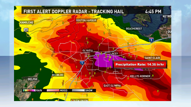
Thursday's powerful thunderstorms pounded parts of Thurston county with damaging winds. Although many people thought the damage was caused by tornadoes, the National Weather Service says it was produced by 70 mph winds caused by a wet microburst.

What is a microburst?
In strong thunderstorms, powerful updrafts can suspend large quantities of water droplets and hail high in the thunderstorm. When the updraft weakens, all of that precipitation falls like a huge weight, pulling along with it a lot of air, just like a large truck driving past you. When it reaches the earth, it slams into the ground and radiates outward with high winds.
A Doppler radar image from 4:45 p.m. Thursday shows very heavy rainfall at a precipitation rate of over 14 inches per hour, if the storm had stayed in one place. Fortunately it didn't, but even so, over an inch of rain fell in less than an hour in many places. The occurrence of this very heavy rainfall and what appears to be a "linear" pattern of damage from the winds is evidence of microburst winds (versus circular damage with a tornado).
A gif from the National Weather Service shows the occurrence of a wet microburst in the Midwest.

