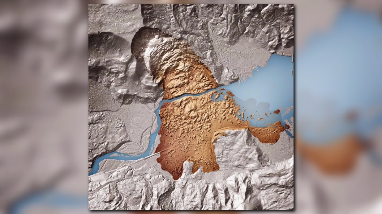
Washington state is about 85% complete with the mapping of the state west of the Cascades using Lidar -- an effort that has seen increased importance following the March 22, 2014, Oso landslide
What is Lidar? Think of it as radar, but using light. An airplane is flown back and forth over an area and sends in millions of low-power laser hits which bounce back to the aircraft instantaneously. Those hits are all elevation data. When compiled and filtered to screen out trees, bushes, and buildings, it gives geologists a clear picture of the Earth below. And as the data becomes a photograph-like image, details of just how the Earth works can be more easily understood.
This interactive map shows where Lidar has already been flown. You can zoom in and add shading to make the folds of the terrain stand out. Click along the right you can add roads to better orient yourself, and topographical maps to show elevations of the surrounding terrain.
The state Lidar project involves funding from the state, the U.S. Geological Survey, tribes, and local governments. The idea is to create a baseline for the state, as well as to flag hazardous areas for further study where trees and other heavy vegetation make geological hazards hard to spot.
"We use Lidar for a lot of things in geology," said state geologist Dave Norman. "To be able to make accurate landslide maps and other geological hazard maps, you have to have high-resolution lidar. You're left with just guesswork if you don't."
Lidar also played a role in the Oso landslide. A Lidar map was produced of the area in 2013 before anyone knew what was coming. It showed the valley surrounding the North Fork of the Stillaguamish River flanked by old landslides. By having that map, then flying Lidar again within a few days of the slide, geologists could tell first responders and search and rescue personnel just how deep the mud and debris was, and how to manage the water from both the mud and from the river which backed up.
See more spectacular Lidar images and learn more about how Lidar images are made and used at this link.
GALLERY: A look at Lidar


