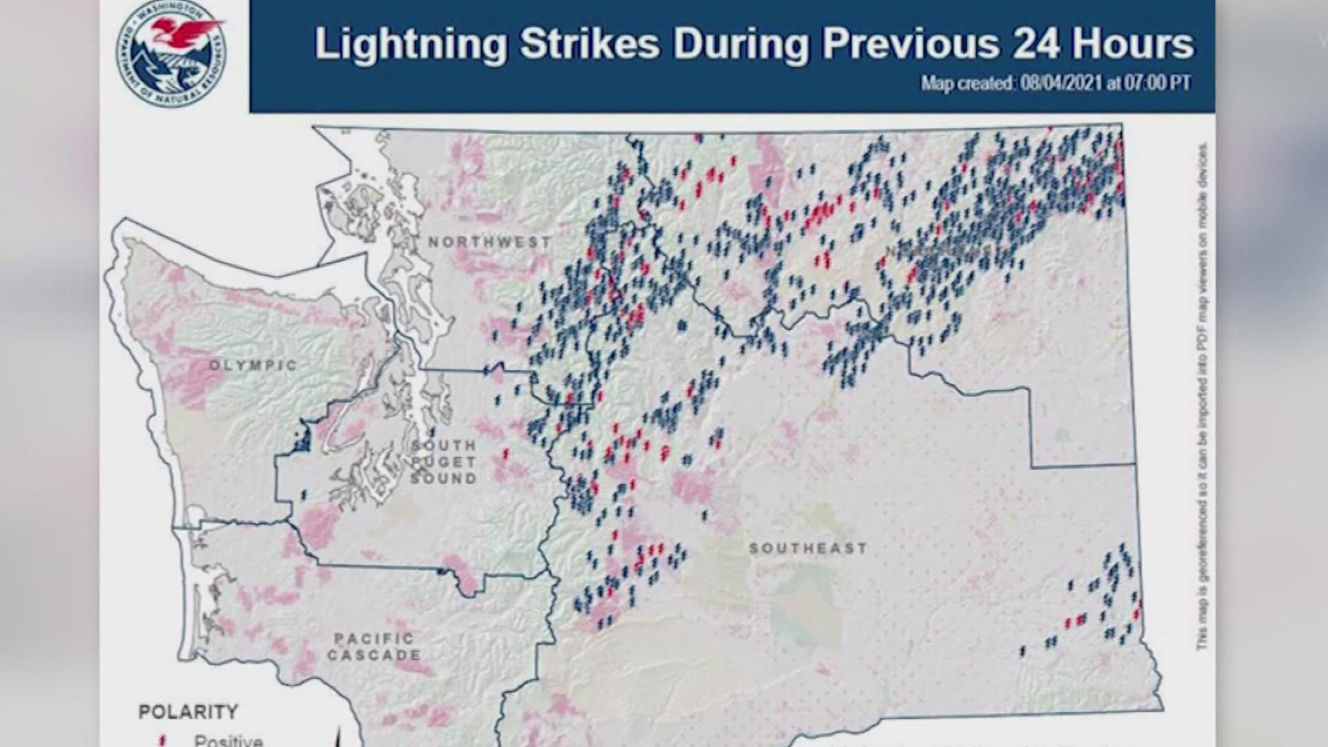
WASHINGTON, USA — More rain is in the forecast for Washington starting on Friday, but could it do anything to alleviate the summer-long drought conditions throughout much of the state?
Seattle is in a 51-day dry streak which is tied for the second-longest dry stretch in Washington history. Rain over the weekend could bring the streak to an end before it breaks the all-time dryness record of 55 days set in 2017.
However, fire season is still far from over, and in some cases, storms that bring rain could make fire conditions worse.
“That fire danger still remains extreme,” said Ryan Rodruck with the Washington Department of Natural Resources in eastern Washington.
In many places, dried out grass, brush, sticks, branches and other downed debris that are a natural part of forests have built up to dangerous levels. Should storms roll in, results could be incendiary.
"With that comes those lightning strikes, without enough, if any precipitation--so those fuels remain dry - there’s not enough moisture coming down as a result of these storms where it’s really changing the nature of these fuels at all. They still remain dry, That fire danger still remains extreme," Rodruck said.
Just this week, 31 new fires ignited in central and eastern Washington after thunderstorms swept over the state, producing lots of lightning and just a little rain.
Lightning-caused fires can also start in difficult, steep or inaccessible terrain for hand crews. The other threat – “sleeper fires,” or slow-burning ignitions that might not be large enough to immediately spot, but spiral out of control if wind increases in the days following.

