The Paradise fire has been burning for weeks in the Olympic National Park. The rainforest is so dry, firefighters believe it will keep burning until the fall.
But while the sky hasn't been dropping much rain this summer, it is helping firefighters on the ground.
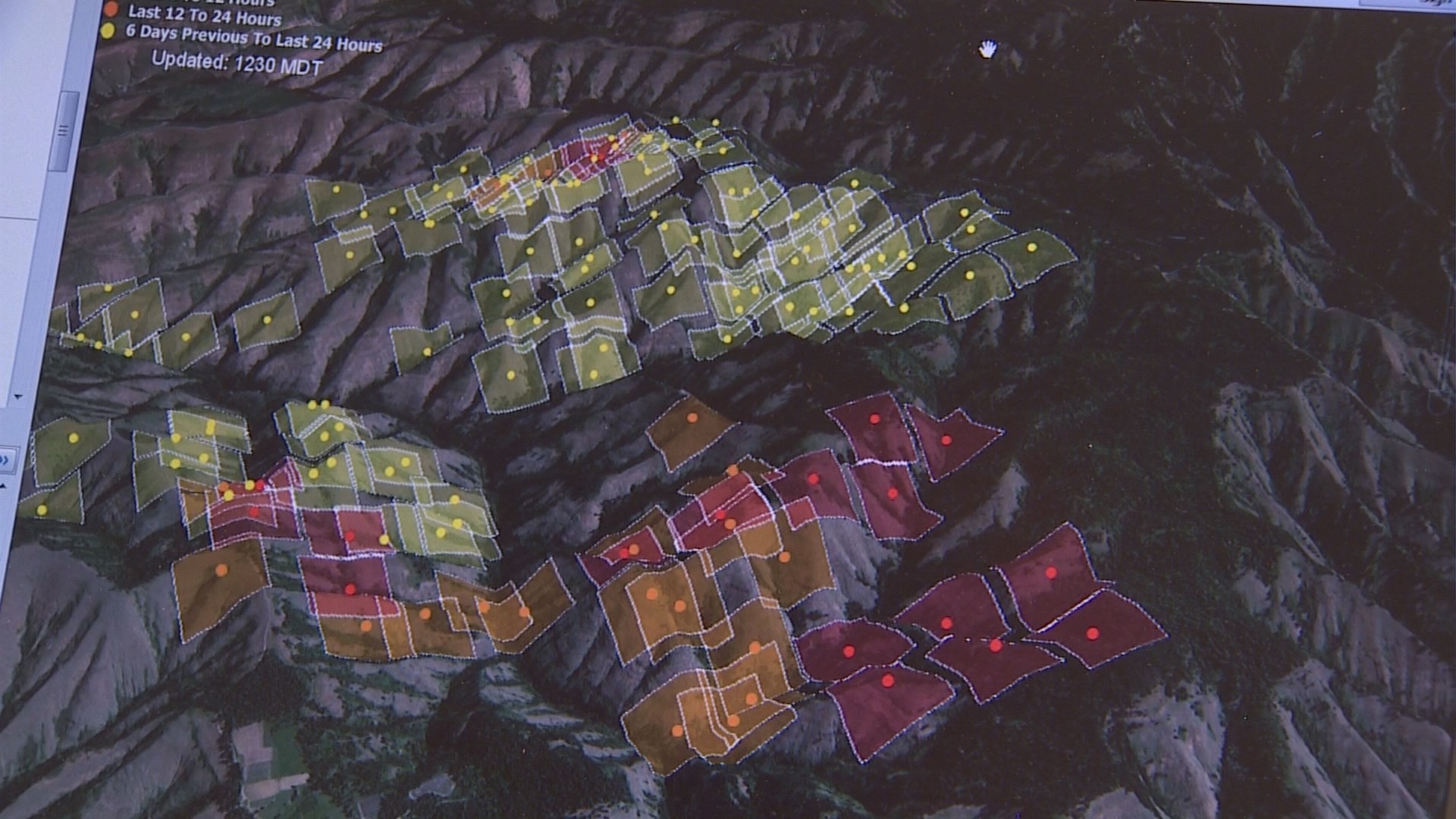
Firefighters, who still have their usual tools like hoses, axes and even helicopters, are using NASA satellites to direct crews on the ground.
The satellites sense heat from thousand of miles above and display the temperatures on the map as yellow, orange and red blobs.
Scientists can also use the satellites to predict where the fire might spread.
With these images, those on the ground can see very remote areas, very clearly.