Although we have La Niña conditions in the Pacific, our Northwest weather hasn't been behaving exactly the way we expect.
Usually, La Niña winters increase the odds of below normal temperatures and above normal precipitation with lots of snow in the mountains during the period November into April.
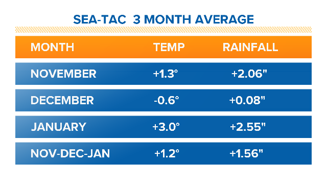
In the first 3 months of that period, Sea-Tac rainfall is above normal, as we would expect, but temperatures have been well above normal. In fact, in January the mean temperature at Sea-Tac was a significant 3 degrees above normal.
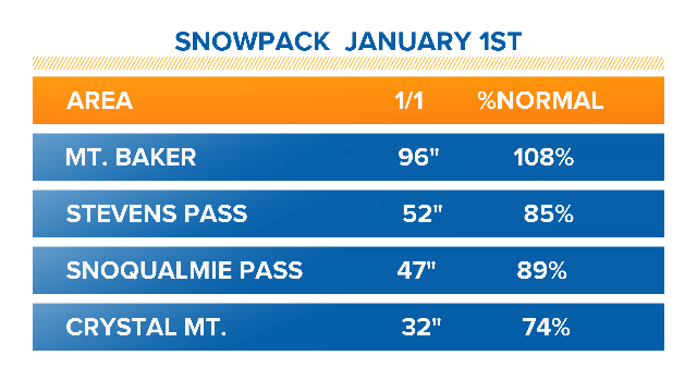
However, the mountain snowpack that was lagging behind normal at the start of the January had a good month.
All of the areas are slightly above normal with the exception of Mt. Baker which is much above normal. January was a great month for Baker. The ski area reported 225 inches of new snow in January – almost 19 feet! It's the most they have had in January in 20 years.
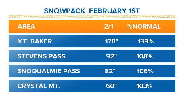
Right now we are almost exactly in the middle of winter, so we may see some changes in these averages.
However for the next week, it looks like it may feel as though spring has arrived. Over the weekend it will still be showery, but highs will push into the low to mid 50's when they would normally be in the upper 40's.
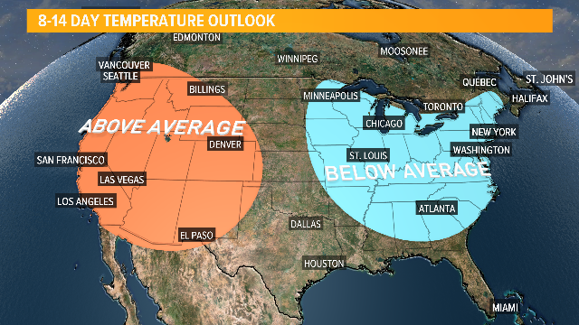
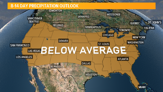
We may turn dry and mild by the middle of next week. The latest two-week forecast from the Climate Prediction Center calls for above normal temperatures and below normal rainfall for February 7-14.
We won't hear officially from the Ground Hog until Friday, but right now it looks like it might be an early spring in Washington.
