After a little taste of spring weather on Tuesday - we hit 53 degrees at Sea-Tac with lots of sun - clouds rolled in on Wednesday, and the rain spread back over Western Washington! But take heart, the weekend is going to give us an extended spring preview.
A cold front moved through western Washington Thursday for a wet and breezy day. It was a reminder to us that it is still winter, but there are only 11 days left until the spring equinox and the official arrival of spring.
The Spring Equinox is on March 20th at 9:15 a.m. PST.
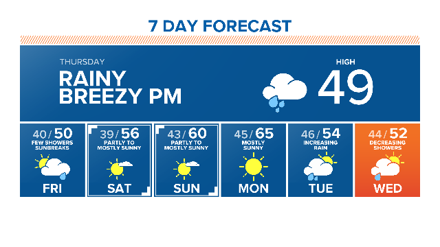
The front will moved east of us by Thursday evening, leaving behind a few off and on showers for Friday mixed in with sunbreaks. But then a large area of high pressure will begin building over the western states, and this is going to give us some great weather this weekend.

Saturday will be mostly sunny early, but you'll see the clouds increase later in the day as a weather system brushes by to the south Saturday evening. Any rainfall should be limited to the south coast.
Highs will still jump up to the mid 50's Saturday.

On Sunday and Monday, we will develop offshore wind and the air mass will be warming, pushing us up to around 60 on Sunday and into the low to mid 60's on Monday!
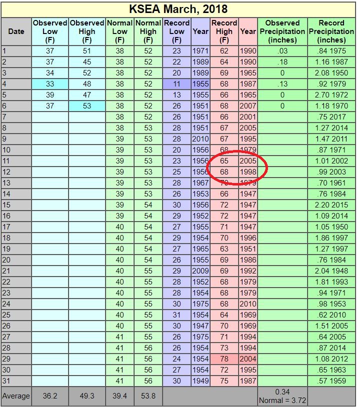
The record for Sunday is 65, and 68 for Monday, so we probably won’t break any records, but it’ll be awfully nice.
When was the last time we saw a high of 60 or warmer at Sea-Tac? You may have forgotten, but we hit 64 on January 15th!
Right now it looks like rain returns on Tuesday, and we settle into a more normal March pattern with highs in the normal range - low to mid 50's.


