
Now that we’re in the time of year where rivers will start rising in Western Washington, it’s a good time to get better acquainted with where these rivers are exactly and how they relate to where you live.
After all, we’ve got a lot of them, most of the names are difficult to pronounce, and many people may not even be sure which river they happen to be closest to or how a flood on that river may affect them directly.
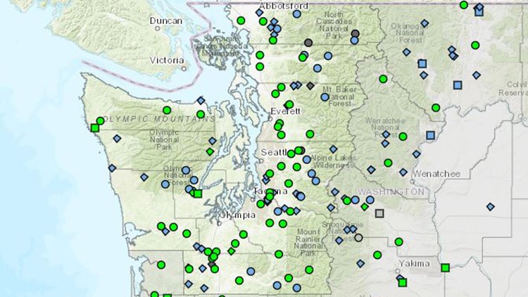
On a map from the National Weather Service, each green dot is a stream gauge in one of Western Washington’s rivers. Clicking on any dot instantly shows you how close that river might come to flooding.
