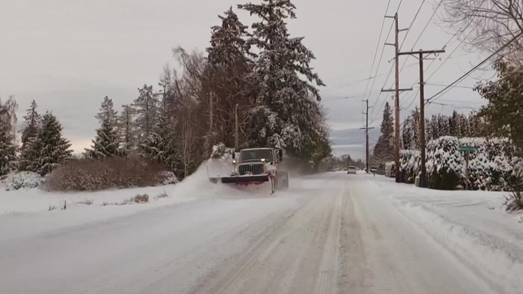
WASHINGTON, USA — Winds driving down from British Columbia are bringing much colder air to western Washington for the first days of winter.
While conditions are expected to remain relatively dry until Thursday evening, it's the drop in temperatures that is the main cause for concern. A Wind Chill Advisory continues for western Whatcom County through Thursday morning.
For those living outside or without access to a place to get out of the cold, this type of weather can be dangerous, and even deadly.
This next winter storm is also expected to bring snow, sleet, and freezing rain, which will cause travel disruptions and potentially lead to at least isolated power outages Thursday night and Friday.
Here's what to expect over the next few days:
Thursday
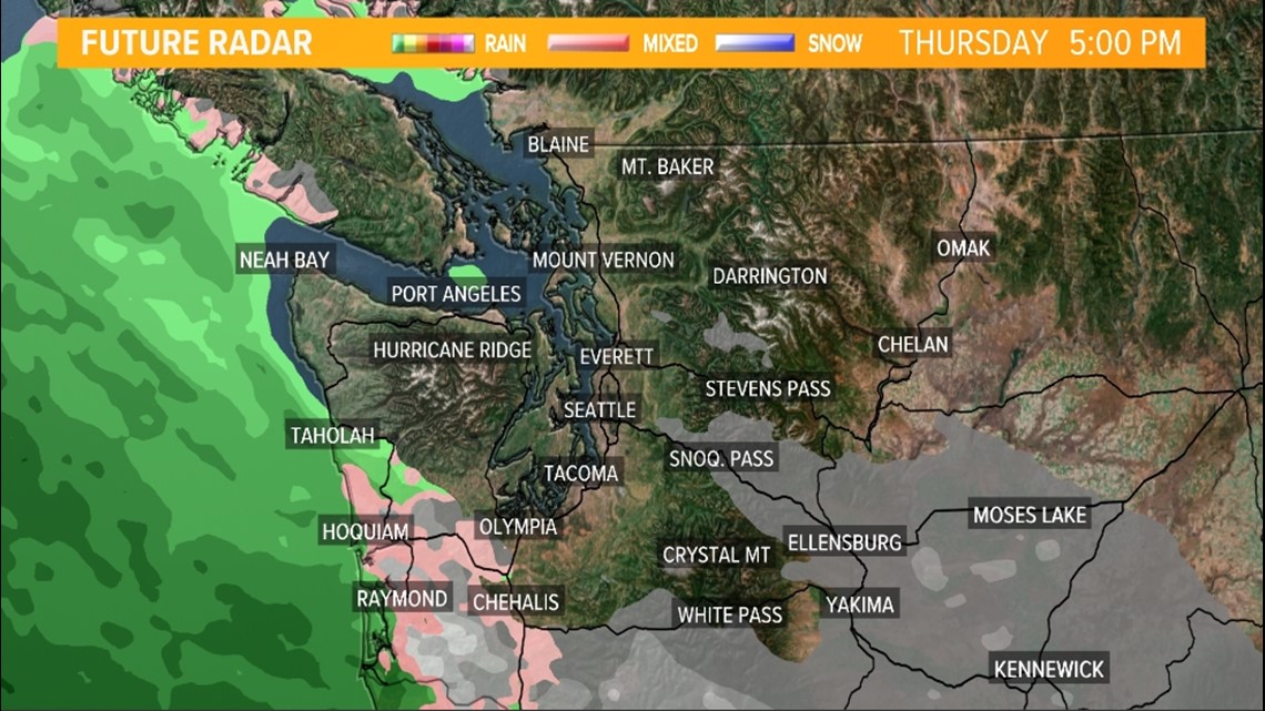
Temperatures on Thursday will remain below freezing, according to the NWS. The next system of wintry precipitation will arrive on Thursday evening, and will likely begin as snow, with the potential for periods of freezing rain as temperatures begin to warm up.
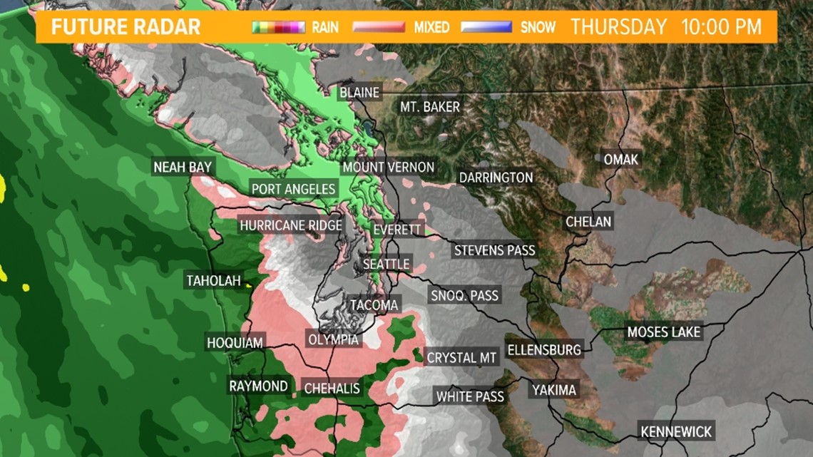
The south Puget Sound to the coast in Grays Harbor County is favored to see freezing rain, which can have significant impacts like power outages, downed trees and complicated travel.
Rain falling on accumulated snow could result in small urban and small stream flooding.
This system will slowly bring warmer air into western Washington, which will slowly eat away at the cold, arctic airmass from southwest to northeast across the area.
The initial impacts from the warmer air begin near the southwest Washington coast and Southwest Interior overnight Thursday as the snow transitions into sleet and freezing rain.
That transition from snow to sleet to freezing rain begins to occur for South Sound and Central Sound by mid-Friday morning, slowly spreading north into North Sound, the Northwest Interior, and the entire Olympic Peninsula late Friday morning into the early afternoon hours.


Friday and beyond
Temperatures are expected to rise on Friday into the upper 30s and low 40s. The warming trend will continue into Saturday with temperatures reaching into the low 50s.
By mid to late Friday afternoon, all of the lowlands should transition to all liquid rain with only wintry precipitation continuing for the mountains, including the mountain passes.
The warm-up will set the stage for moisture, resembling an atmospheric river, which has the potential to impact the region through the weekend.

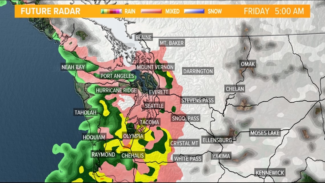

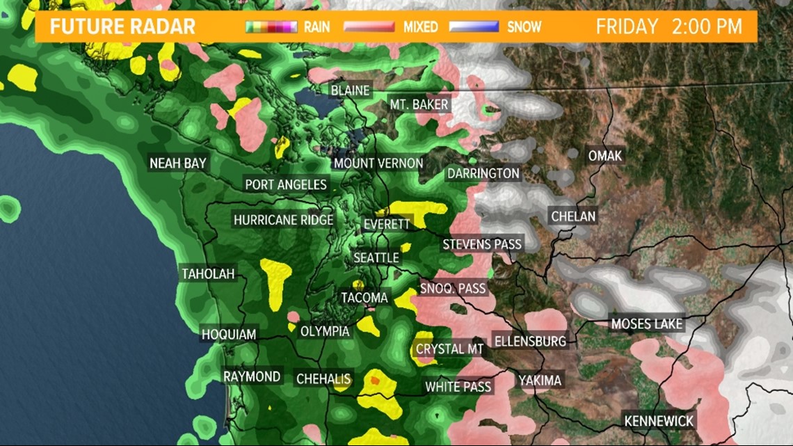
Accumulations
The snow and ice accumulation forecast is highly uncertain right now as the precipitation types, precipitation type location, and precipitation transition process from snow to freezing rain and eventually, rain is uncertain.
There's enough confidence in the potential for enough accumulations of snow and eventually freezing rain to believe travel will be impacted for most of western Washington tomorrow night and Friday morning.
The cold temperatures over the past 24 hours and the forecast cold temperatures through tomorrow will ensure grounds and roads are cold enough to quickly support ice accretion so whatever falls should quickly glaze the ground and surfaces.
At this time, it appears an additional 1-3 inches of snow could fall, Thursday night through Friday morning with around 0.10 inches of an ice glaze. Ice amounts closer to 0.25 inches are possible south of Seattle.
Amounts this high could lead to minor tree damage and isolated power outages when combined with stronger wind gusts.
These finer details on precipitation types and amounts will be ironed out over the next 12 to 24 hours.
Emergency weather shelters:
Several counties have opened emergency weather shelters in response to the dangerously cold temperatures.
Find links to cold weather shelter information below:
What to watch out for in cold temperatures
Anyone who is spending any length of time outside over the coming days should know the signs of hypothermia.
According to Public Health - Seattle and King County, these are the symptoms to watch out for:
- Uncontrolled shivering
- Slow or unclear speech
- Feeling extremely tired
- Stumbling when walking
- Confusion
- Semi-consciousness or unconsciousness
What to do if someone has hypothermia:
- If a person becomes unconscious, seek medical attention immediately
- Do not warm a person up too quickly
- Bring the person indoors or to a dry place protected from the wind
- Remove wet clothing and cover the person with dry blankets. Cover the head, hands and feet.
- Put the person in a cot or bed next to a warm, but not hot, heater
- Lie under the covers next to the person to transfer your own body heat. If possible, have someone else lie on the other side.
- Give the person warm, not hot, broth or soup. Do not give them alcohol to drink
- If an infant or a small child is presenting symptoms of hypothermia, wrap them inside your own clothing against your skin
For information on cold weather shelters, visit 211 Washington to find the closest emergency shelter near you.


