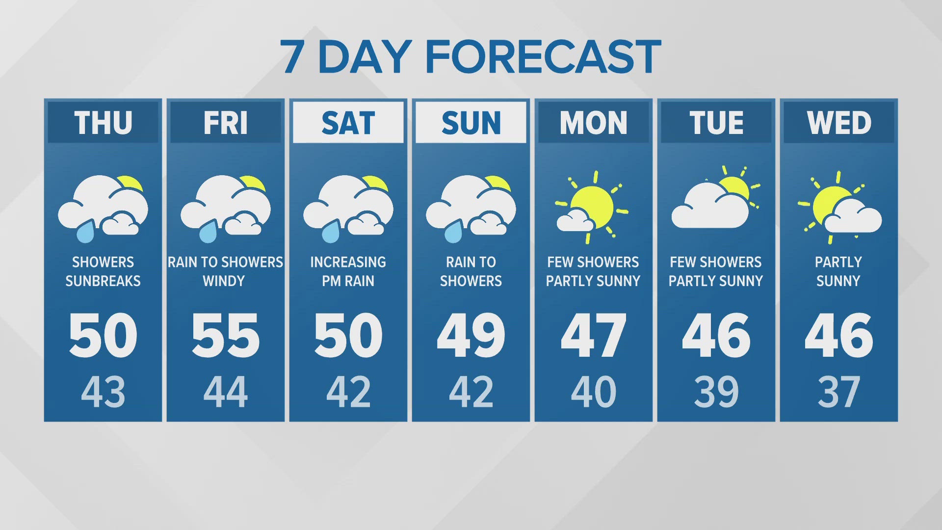
SEATTLE — The fall season started nearly a month ago, but it has felt more like summer over the past few weeks.
This past weekend was one of the warmest on record, with Sunday's temperature at Sea-Tac Airport of 88 degrees registering as the second warmest October day in the 130 years of data recording and the warmest this late in the year.
Olympia and Bellingham also saw new daily high-temperature records over the weekend.
The latest on the drought and wildfire smoke
The rain is much needed as all of western Washington has dipped into drought conditions. The latest drought monitor released on Oct. 13 indicated all of the KING 5 viewing areas are within a moderate drought.

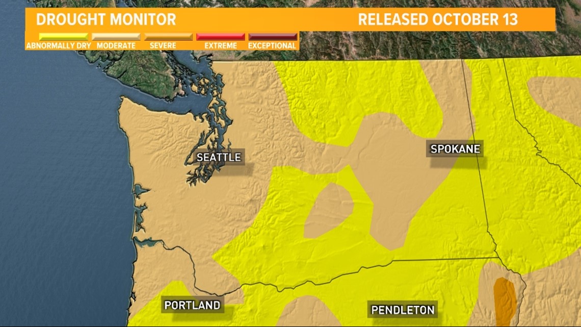
These drought conditions have led to dry vegetation allowing for several ongoing wildfires in western Washington. Get the latest wildfire updates here.
Our weather pattern flips Friday with wet and windy conditions sticking around through the weekend into the first day of next week as a series of fall weather-makers wallop western Washington with lowland rain, mountain snow and wind.
The increase in precipitation and winds will help clear the air, reducing smoke, and improving the air quality. Check out the latest air quality and air alerts for the region.
Weekend storm system impacts
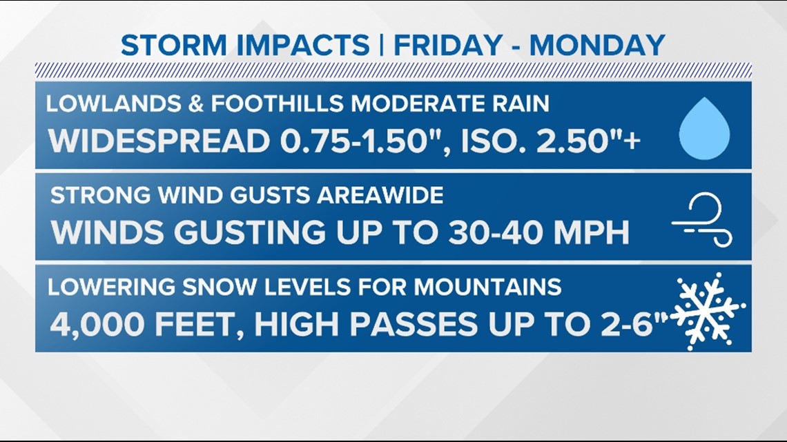
A series of weather-makers will swing through the KING 5 viewing area from Friday through Monday bringing areas of moderate rain, gusty winds and mountain snow.

Rain forecast
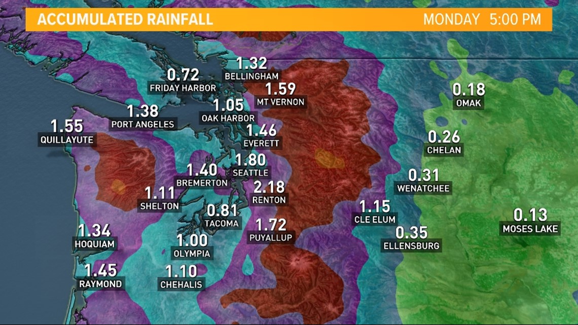
The heaviest rain accumulations are expected for the Pacific Coast and the Cascade foothills, where 2-3 inches of rain will fall from Friday through Monday.
Lighter amounts are expected for the Puget Sound lowlands, but we are still anticipating a good soaking with around 0.75-1.25 inches possible. A few areas in Snohomish and King counties could see higher amounts from enhanced Convergence Zone action.
Seattle is forecast to pick up more than an inch of rain. This is more rain than the city has seen in four months. Since June 18, Seattle has only received 0.55 inches of rain, going down as one of the driest stretches in the city's history.

Flood risk
At this time, the flood risk is expected to remain low, but this will be closely monitored. As always, if you live in a flood-prone area or near recent burn areas, it is always best to stay weather aware.
The areas near burn scars have a higher chance to see isolated flooding and even debris flows. There is a particular concern near the Bolt Creek Fire.
The National Weather Service tweeted about guidance for preparing for debris flow. They advise having an emergency kit and an evacuation route planned.
The Washington State Department of Transportation (WSDOT) urged people living near the Bolt Creek Fire to go to the grocery store, pick up prescriptions and restock emergency supplies in case debris forces U.S. 2 to close.
Snow forecast
Snow will fall in the higher elevations of the Olympics and Cascades. The highest passes will be impacted by either wet snow or a rain/snow mixture as snow levels dip down to 4,000 feet on Saturday, with the potential for a rain/snow mixture as low as 3,500 feet.
This means Stevens and White passes could potentially see some light slushy accumulations. Higher accumulations are expected for the highest peaks, including Mount Baker and Mount Rainier. Right now, it appears up to 2-6 inches of slushy snow could fall as low as Stevens Pass.
Gusty winds are possible at times with each weather-maker. While sustained winds generally remain below 20 miles per hour, some gusts could exceed 30 to 40 miles per hour, with higher gusts near the Strait and for gap areas. While these winds should not be enough to cause widespread tree or powerline issues, with foliage remaining on trees, some branches could come down and isolated power outages are possible.
This is not expected to be a major or widespread concern at this time.
Rain and snow timeline
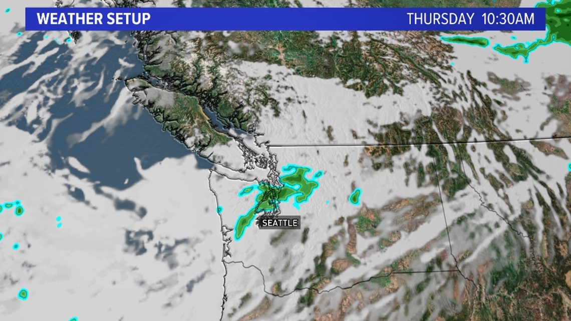
Very spotty light rain enters the forecast for Thursday as a weak, dissipating cold front enters the region. This could create a few spotty, light, quick-hitting showers late Thursday morning into Thursday afternoon with some drizzle in the Cascade foothills.
Thursday morning future radar

The first potent system arrives Friday as the first fall weather maker zips into the area. This fall cold front is the first in a series of weather-makers, which will move out of British Columbia during the second half of Friday, increasing rain chances throughout the day.
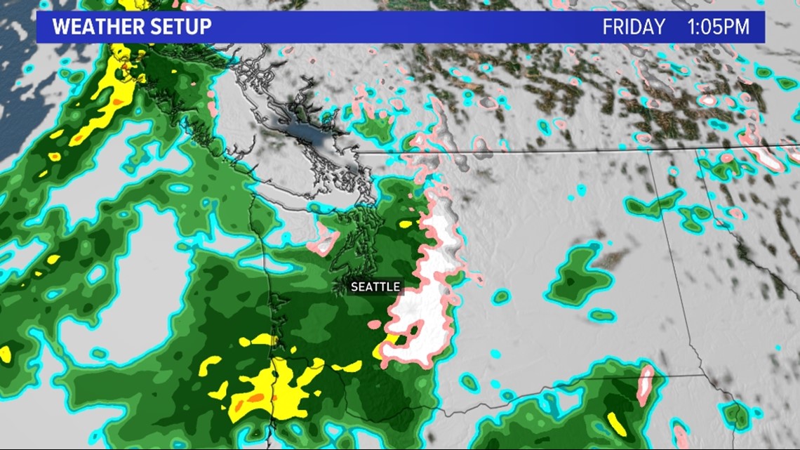
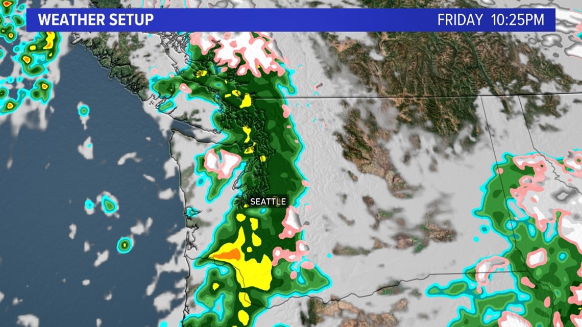
Rain increases from west to east beginning late Friday morning and will continue into the afternoon hours with another round of precipitation Friday evening.
Initially, the rain begins for the Pacific Coast and along the North Coast near the Strait, overspreading the Olympic Peninsula and eventually Puget Sound and the Cascades later in the day.
Friday afternoon future radar

Friday evening future radar

As the cold front scoots out of the area, it'll bring cooler air and eventually start to dry out western Washington before the next weather-maker arrives on the front's heels on Sunday.
Despite the gradual drying trend on Saturday, it appears a Convergence Zone could set up across King and Snohomish counties throughout the afternoon on Saturday. This would increase rain accumulations in the area and potentially lead to some snow accumulations in the Cascades due to the cooler temperatures.
The cooler temperatures will lower the snow levels to 4,000 feet on Saturday, with the possibility of a rain/snow mixture as low as 3,500 feet Saturday morning. Snow levels this low will impact some of the higher passes in western Washington over the weekend.
Saturday evening future radar

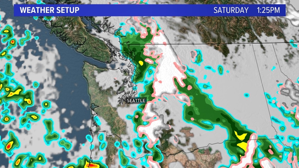
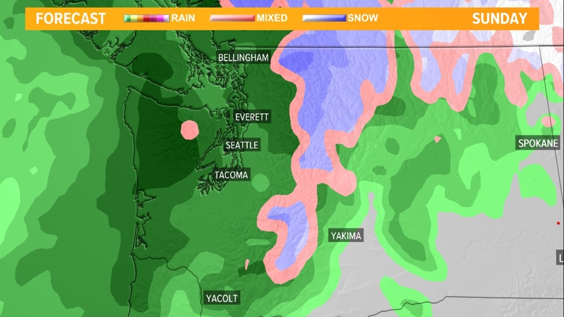
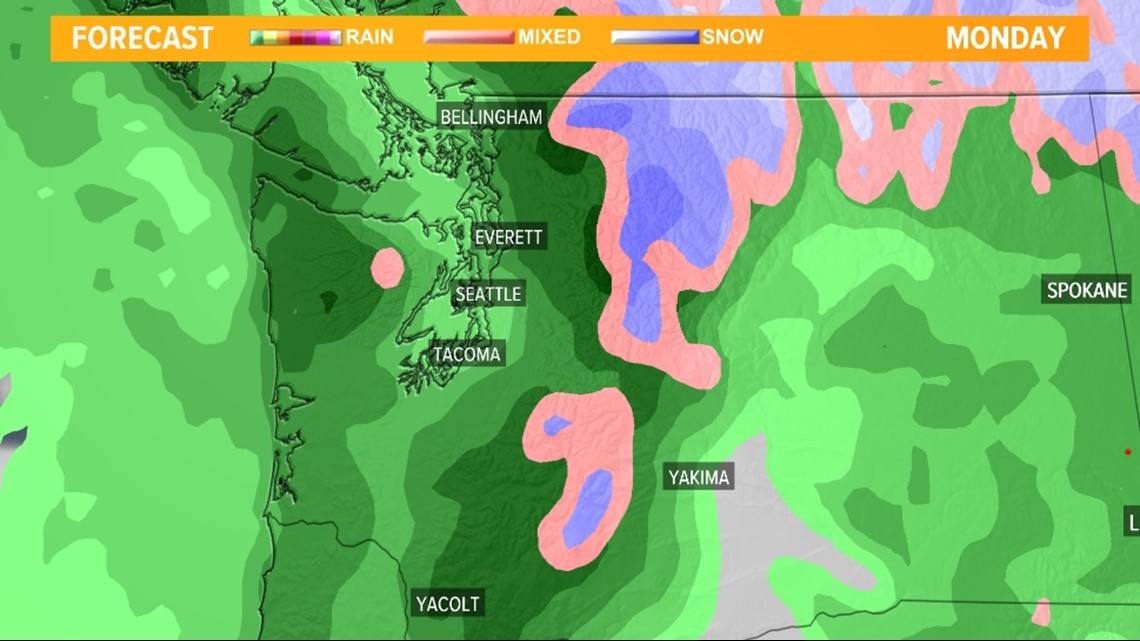
Expect the decrease in coverage and intensity of precipitation to continue late Saturday into early Sunday before another weather maker arrives later Sunday into Monday. This will create another round of lowland rain with additional mountain snow.
The snow levels will slightly rise with this system as there's less cold air, but snow levels will still range between 4,500 feet to 5,000 feet late Sunday into Monday.
Sunday evening future radar

Monday morning future radar

Watch the mountain and pass cameras as snow falls
Interested in seeing the first snow of the season or just want to check the latest road conditions for some of the local passes?
Watch the latest conditions at areas of mountains and passes as the snow begins to fall over the weekend.
Top of Mount Rainier gondola at Crystal Mountain, 6,872 feet
White Pass US 12, 4,500 feet
Stevens Pass US 2, 4,061 feet
Snoqualmie Pass I-90, 3,022 feet
This an important reminder to give yourself extra time on area roadways with rain moving in. It has been a while since we have experienced widespread wetting rain, so area roadways could become slick due to dust, smoke, and oil buildup.
Also, with foliage still on trees, any leaves that fall on roadways when paired with water are as slick as ice. This means braking fast could cause issues.


