Not all wind storms are created equal and for Puget Sound area communities to experience winds like on Sunday morning, location is everything.
By early morning, the center of an area of low pressure that had been along the Washington coast for much of Saturday finally made it to Vancouver Island. In particular, the low pressure was centered over southernmost Vancouver Island and that meant it was in the exact location necessary to drive strong winds through Puget Sound.
Areas of low pressure like Sunday's act to pull the surrounding atmosphere into their centers. Because this one just happened to be positioned at the southern tip of Vancouver Island, or more appropriately at the very northern opening of Puget Sound, it had a very strong pull on the air within Puget Sound. Think of it as a large suction machine sweeping by the opening of the Sound. All of that air rushing through the Sound on it's way to the center of the area of low pressure just happened to rush right over all of the major communities of the sound.
This scenario is one of the more classic situations for strong wind events within the Puget Sound region. The previous wind storms so far this season have done most of their damage along the coast or the far northwest interior. Those storms brought their centers over the far northern edge of Vancouver Island, too far away to create a strong enough "pull" on the air in the Puget Sound.
What really sets Sunday's storm apart from others is the speed with which the winds seemingly kicked in out of nowhere. In a way, it's as as if we went from zero to 60 in less than an hour. By that I mean the intensity of the winds went from a very mild 10 mph breeze at 1 a.m. to roaring 60 mph gusts the next hour.
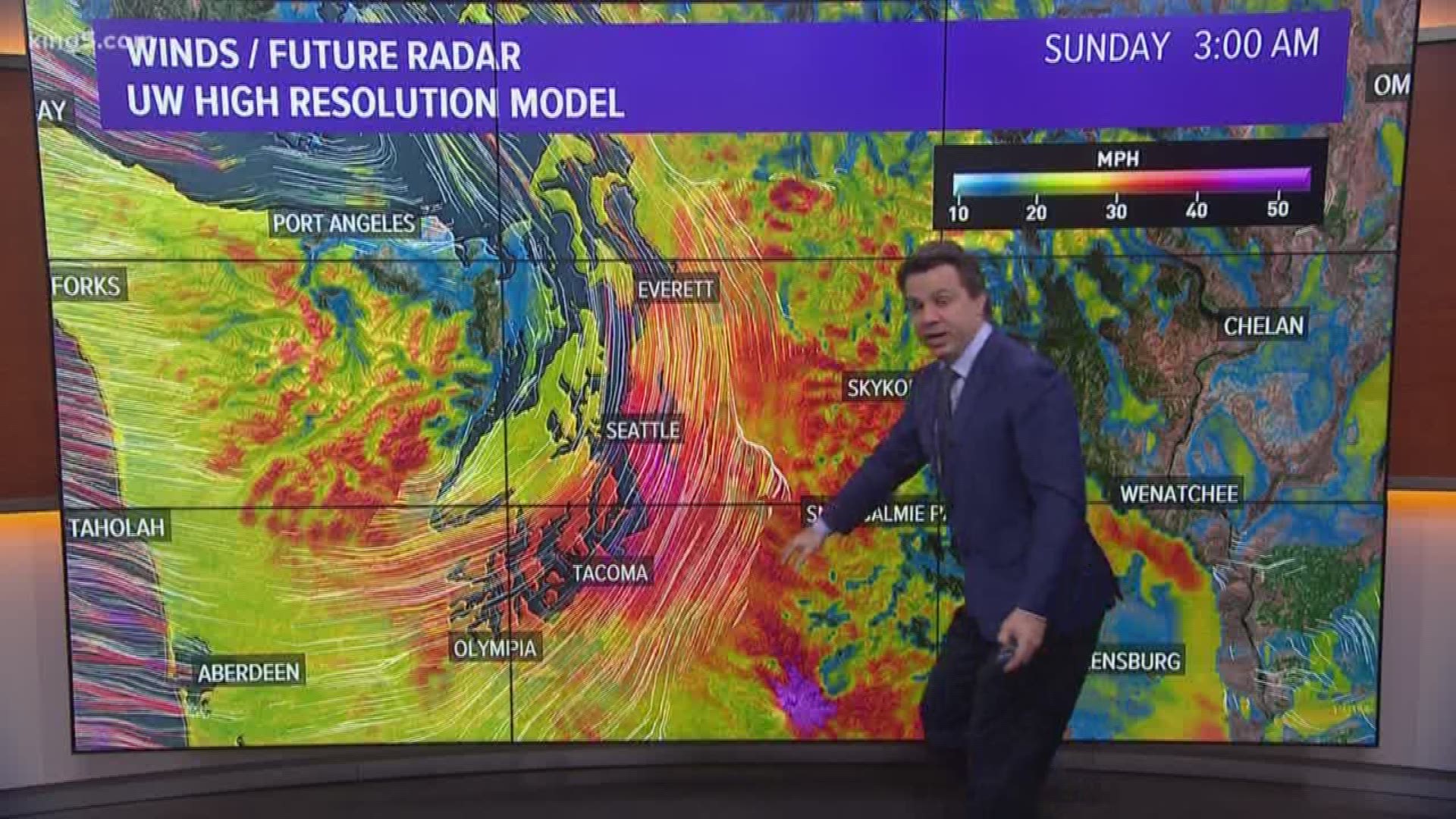
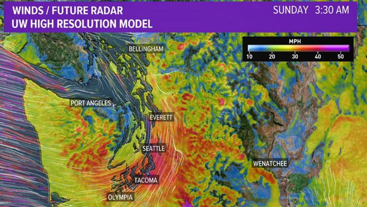
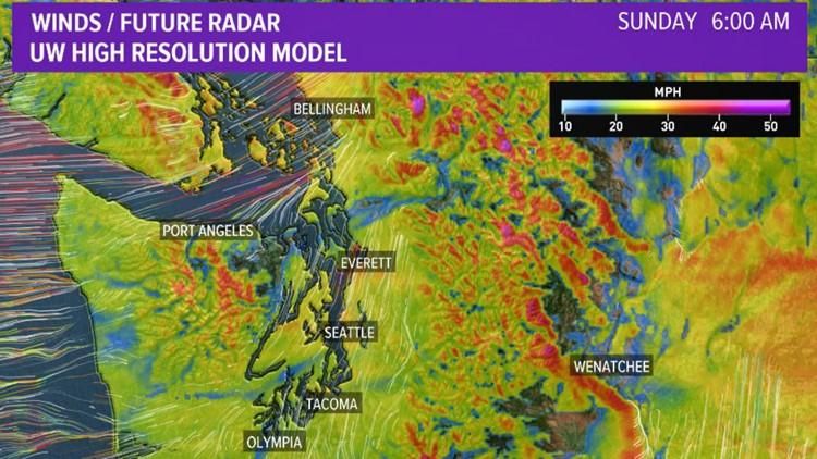
One of the more visual ways to understand how the strongest winds moved across Puget Sound is to look at our University of Washington High Resolution forecast images from this morning. Below are the timestamps from 1:30 a.m., 3:30 a.m., 4:30 a.m. and 6 a.m. When looking at them in chronological order, you can clearly see the areas of higher intensity winds shaded in red march across the Sound from south to north. That band of red (aka strongest winds ) moved in lock step with the center of the area of low pressure as it moved farther away to the north.


