
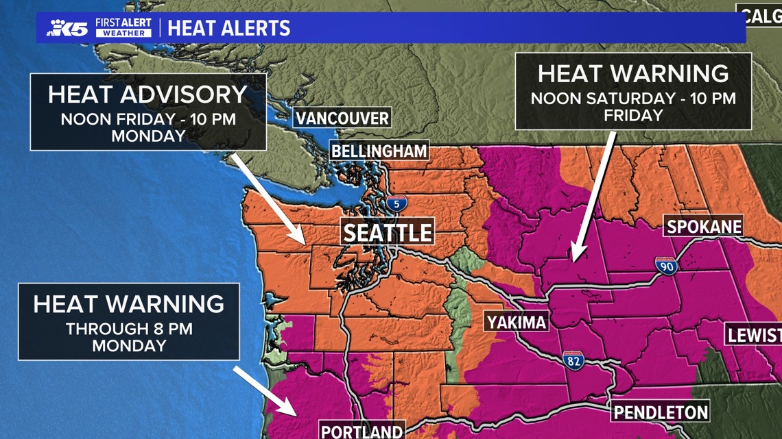
SEATTLE — A Heat Advisory issued for much of western Washington took effect on Friday at noon as temperatures are expected to approach and even exceed 90 degrees over the weekend.
The National Weather Service (NWS) said the heat advisory will run through 10 p.m. Monday. The advisory area extends north to the Canada-U.S. border, east to North Bend, south to Chehalis and Randle and west to the Olympic Peninsula.
KING 5 has activated First Alert for this weather event, which could affect lives, property or travel in the Pacific Northwest region. During this event, the First Alert Weather Team will bring you the latest information to keep you and your family safe.
The NWS said the higher-than-average temperatures mean people face a moderate to major risk of heat-related illness, especially those who are heat sensitive and people without effective cooling or adequate hydration. Low temperatures will only fall into the 60s, meaning homes will not have much opportunity to cool off before temperatures start to climb again.
According to the NWS, temperatures will continue to be well above average beyond the advisory timeline into next week.

People are advised to drink plenty of fluids, stay in air-conditioned spaces, stay out of the sun, and check in on neighbors and relatives who may be more sensitive to heat-related illnesses.
Western Washington forecast
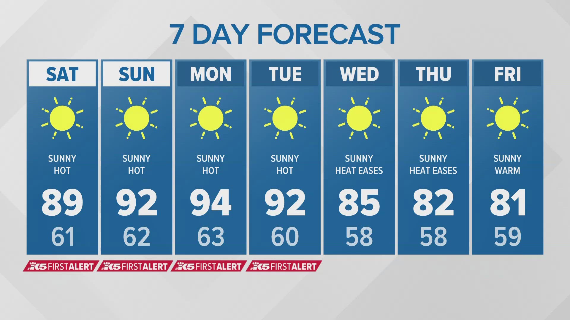
High pressure will settle along the coast on Friday into Saturday, pushing high temperatures into the mid 80s with a few warmer spots in the 90s.
Saturday through Monday will be unusually hot for Puget Sound with Sunday looking to be the hottest day by a few degrees over Saturday and Monday. Sunday highs may be in the mid-80s to the mid-90s with some of the hottest places approaching the upper 90s.
Saturday through Monday are First Alert weather days due to the hot temperatures occurring over a series of hot days allowing heat to build up, especially in urban areas and in communities with vulnerable populations.
As the ridge of high pressure moves east of the Cascades Monday we should see a little cooling, dropping highs into the 80s to low 90s in most places in the interior of western Washington with some minor relief.
However, the high pressure will take up residence near Idaho and western Montana for the remainder of the week. This should put Puget Sound in a sunny and slowly cooling pattern with highs mostly in the upper 70s and 80s through at least midweek.