SEATTLE —
The latest projections from NOAA’s Climate Prediction Center show a weak La Niña is expected to return to western Washington this upcoming winter.
As of August, El Niño neutral conditions continued, but the transition should arrive into the fall and continue through early 2025.
Washington State Climatologist Guillaume Mauger said these patterns are not guarantees, but a tilting of the odds. He also added that the pattern typically has a stronger impact on temperature, but moisture is not as high of an impact.
“What the La Niña is going to do is going to tilt the odds. It means the odds are tilted toward cooler than normal conditions. We can be more confident that that’s what we’re going to see,” said Mauger.
Scientists look at ocean temperatures along the equator to gauge the winter season for the United States. Trade winds push water east and west along the equator, and the strength of those trade winds have a domino effect.
“Because water holds so much more heat than air, that has consequences all across the globe for temperatures and weather effects” said Mauger.
During an El Niño pattern, the trade winds weaken and warm water stays to the east, collecting off the coast of Peru. That impacts the jet stream, which is essentially a pathway that pushes storms along the United States. The warm water pushes the jet stream south, driving storms into the southwest parts of the country, but keeping the northwest warmer and typically drier.
La Niña is the opposite. Trade winds along the equator strengthen, pushing warm ocean water away from Peru, that is then replaced by colder water. This pushes the jet stream more to the north, keeping the southwest parts of the U.S. drier and the northwest cooler and possibly more wet.
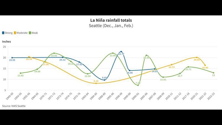
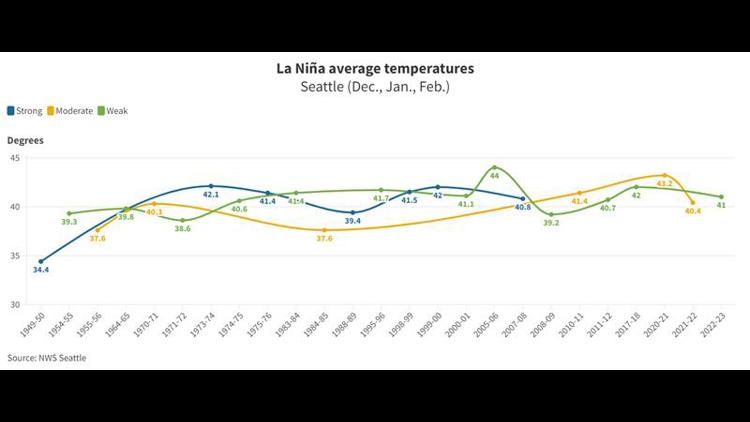
However, data from the National Weather Service shows the variability in La Niña impacts. Since 1954, there have been 25 La Niña patterns. Just seven of those were considered strong.
Within the 25, 14 brought below normal temperatures to Seattle, with the average temperature just 2 degrees cooler than normal.
Precipitation had more variability, with a split of about half above and half below normal in Seattle.
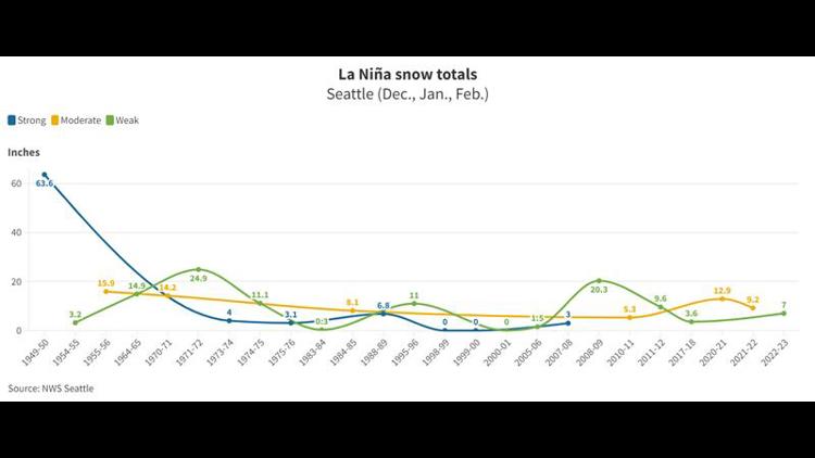
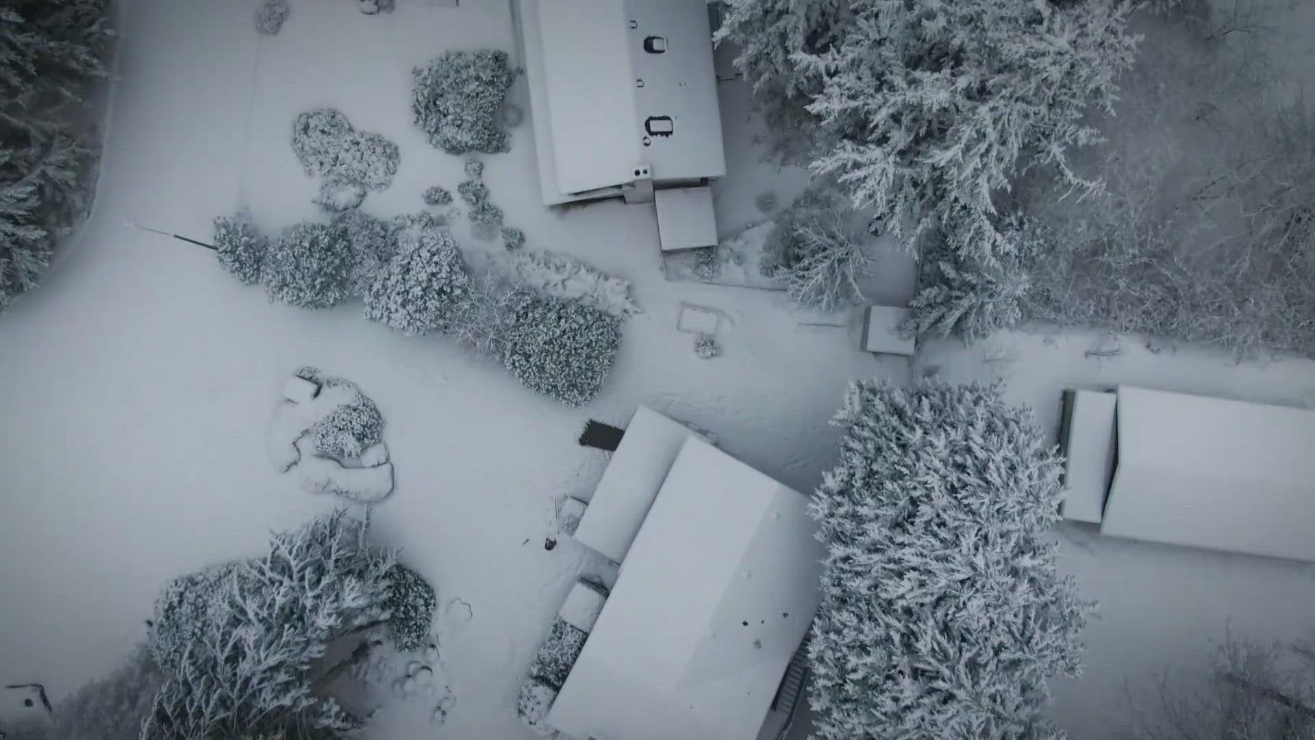
Seattle snow totals have typically been higher than normal during La Niña winters. Normal for the season is 5 inches but the 25 La Niña winters averaged 11.5 inches per year. It should be noted that a few anomaly years impact that average, including the 63.6” of snow that fell in the 1949-1950 winter.
Mauger also pointed out that with a changing climate, our “normal” is changing and conditions are warming, so La Niña winters likely won’t be what they were decades ago.