SEATTLE — This spring has been quite chilly across western Washington with temperatures running well below normal. The month of April has experienced temperatures nearly 5 (4.9) degrees below normal at Seattle-Tacoma International Airport.
February and March were also abnormally cool with temperatures around 3 degrees below normal (February: 3.3 degrees below normal, March: 2.7 degrees below normal).
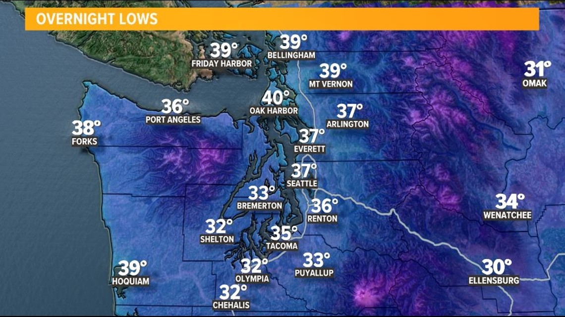
We are expected to hold onto the cooler temperatures over the next several days with parts of the area approaching the freezing mark tonight. Favored areas to approach or hit 32 degrees are around South Sound, the Kitsap Peninsula, and near the Hood Canal. Luckily, a hard freeze is not expected, and temperatures only briefly touch the 32-degree mark, but if you have already planted the spring flowers or gardens in these areas, you may want to protect your sensitive vegetation.
Isolated areas in Kitsap County, Mason County, Thurston County, and Piece County will see some freezing temperatures recorded by Thursday morning. Seattle is currently expected to stay above freezing but a few interior areas in King County could hit 32.
Though tonight's temperatures are forecast to be cold, they're far from record territory. Olympia's forecast low is 32. The record is 26, set back in 1951.
Overnight low temperature forecast


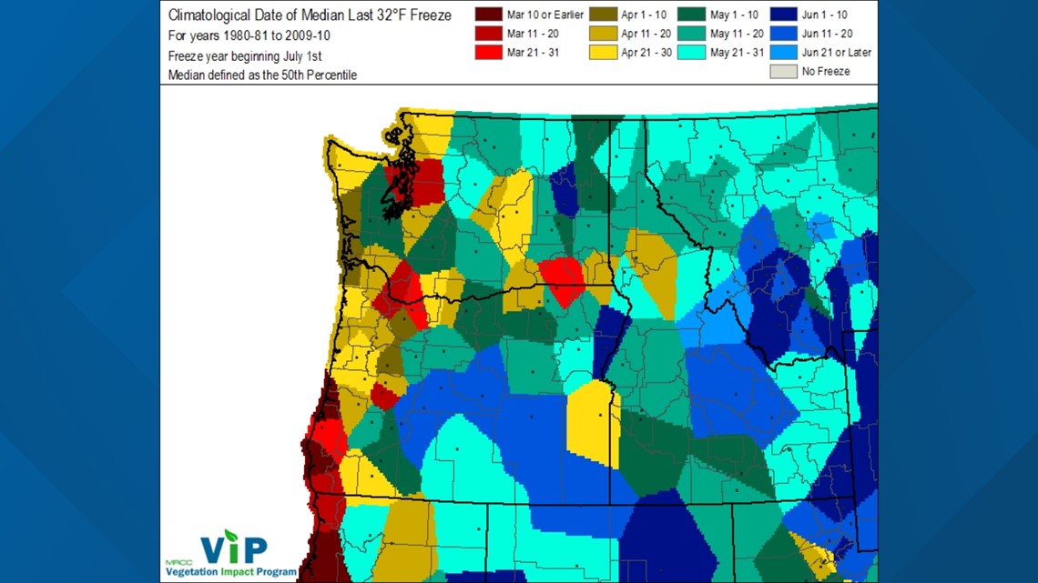
This may seem late in the spring season for a freeze, but some areas around western Washington typically record the last freeze in the months of April and May.
In Olympia, the normal last freeze occurs on May 3. The normal last freeze in Bellingham is on April 5. Everett sees its last freeze on March 12 and Tacoma typically sees its last on March 10.
Seattle normally sees its last freeze quite a bit earlier in the year than in Olympia or Bellingham with the last freeze occurring on March 8. Despite the typical last freeze date of March 8 in Seattle, freezes later in the season can occur. In 1954, Seattle recorded a freezing low temperature on May 1.
Typical last freeze around all of western Washington courtesy of the Midwest Regional Climate Center


The numbers above were calculated with the new 30-year normal. The period for the conventional normal is now 1991-2020, replacing the 1981-2010 normal. With the new normal, areas around western Washington see the typical last freeze date a few days earlier.

