SEATTLE — Western Washington's weather may already feel a bit like winter, but it doesn't officially start until Saturday, Dec. 21.
The winter solstice is at 1:20 a.m. PST. It is the official start to winter and the shortest day and longest night of the year.
The Northern Hemisphere will get less than 12 hours of daylight.
During the solstice, the sun will be at its lowest point in the sky for the year because the northern half of the Earth is tilted its farthest away from the sun due to the planet's axis, according to NASA. Meanwhile, south of the equator, people will experience the longest day of the year - the summer solstice.
Following the solstice, days will slowly become longer.
Winter weather outlook
La Niña conditions are still most likely to emerge through January, according to the latest from the National Weather Service Climate Prediction Center. Chances, however, have decreased.
In September, the weather service reported a 74% chance of La Niña conditions for November through January. That's down to a 59% chance per the latest predictions.
During a La Niña weather pattern, trade winds along the equator strengthen, pushing warm ocean water away from Peru, which is then replaced by colder water. This pushes the jet stream more to the north, keeping the southwest parts of the U.S. drier and the northwest cooler and possibly more wet.
Since 1954, there have been 25 La Niña patterns. Just seven of those were considered strong.
Within the 25, 14 brought below normal temperatures to Seattle, with the average temperature just 2 degrees cooler than normal.
Precipitation had more variability, with a split of about half above and half below normal in Seattle.
Seattle snow totals have typically been higher than normal during La Niña winters. Typical for the season is 5 inches but the 25 La Niña winters averaged 11.5 inches per year. It should be noted that a few anomaly years impact that average, including the 63.6” of snow that fell in the 1949-1950 winter.
An El Niño pattern is the opposite of La Niña, when trade winds weaken and warm water stays to the east, collecting off the coast of Peru. That impacts the jet stream, which is essentially a pathway that pushes storms along the United States. The warm water pushes the jet stream south, driving storms into the southwest parts of the country, but keeping the northwest warmer and typically drier.
El Niño and La Niña are phases of El Niño Southern Oscillation, which measures sea surface temperatures across the Central Pacific Ocean.
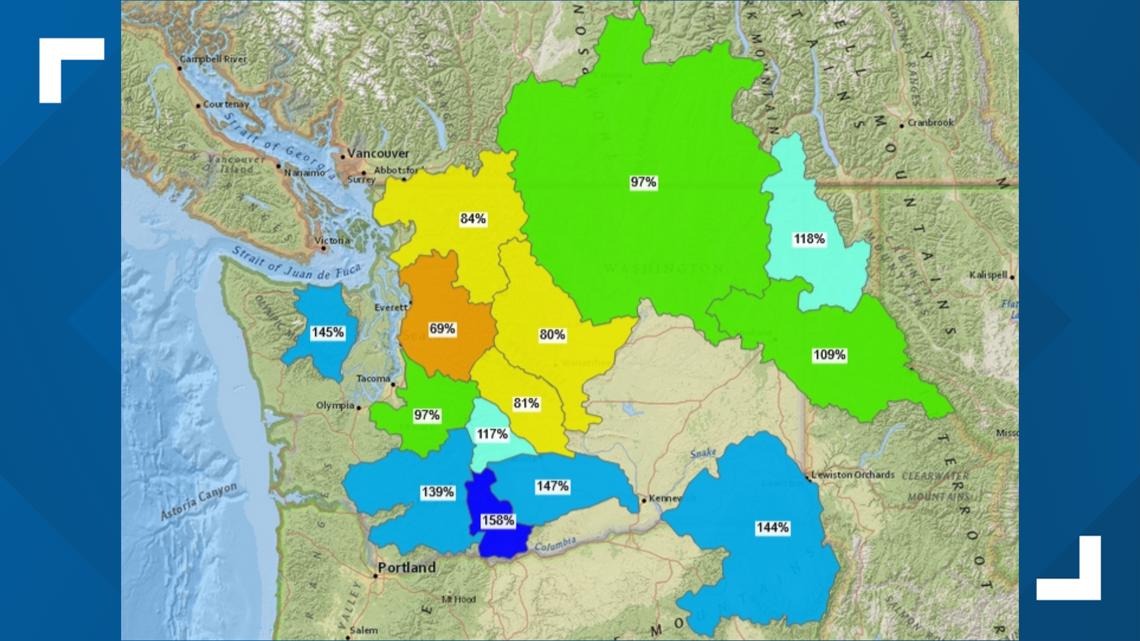
As far as snowpack goes, conditions are near or above average in the Olympics and southern Cascades, according to the United States Department of Agriculture.
It's a different story in the central and northern Cascades, where snowpack is slightly below normal.


