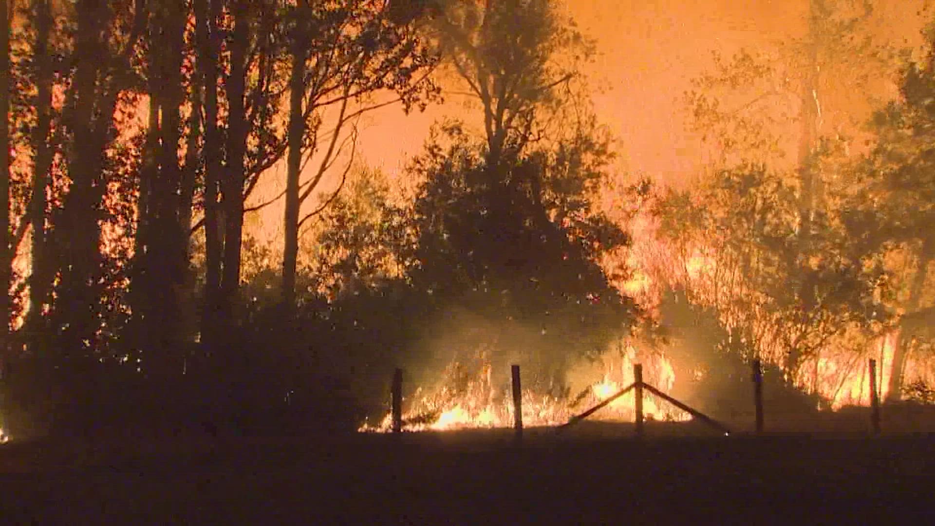
SEATTLE — Editor's note: The above video on Washington state taking many preventative measures against wildfires originally aired February 23, 2022.
Last summer was one to remember and one for the record books for western Washington.
The stretch of triple-digit heat shattered many records and set the new all-time hottest temperature on record for the state of Washington. Hanford, Wash. hit a scorching 120 degrees.
Coming off of the record-setting summer of 2021, many are wondering if western Washington can expect another summer of above-average temperatures or a repeat of the high heat extremes.
Washington State Climatologist Dr. Nick Bond says that's unlikely.
"It's important to emphasize that a heatwave of the severity that occurred last summer is highly unlikely," said Bond.
Even with heatwaves increasing in frequency and intensity in western Washington during the summer months, a repeat in the severity of last summer's heatwave is unlikely over the next decade or two according to Bond.
While a repeat of last summer is not expected, a summer featuring above-average temperatures with below-average precipitation appears to be in the works.
"The upcoming summer is expected to be on the warm and dry side relative to long-term historical norms," said Bond.
The prediction of above-average temperatures and below-average precipitation from Bond is heavily based on a consensus of the seasonal climate models along with observations over a couple of decades.
The latest summer outlook from the Climate Prediction Center (CPC) published this month sides with the odds being in favor of temperatures being above average for much of western Washington.
Coastal Washington has equal chances for above-average or below-average temperatures according to this outlook.

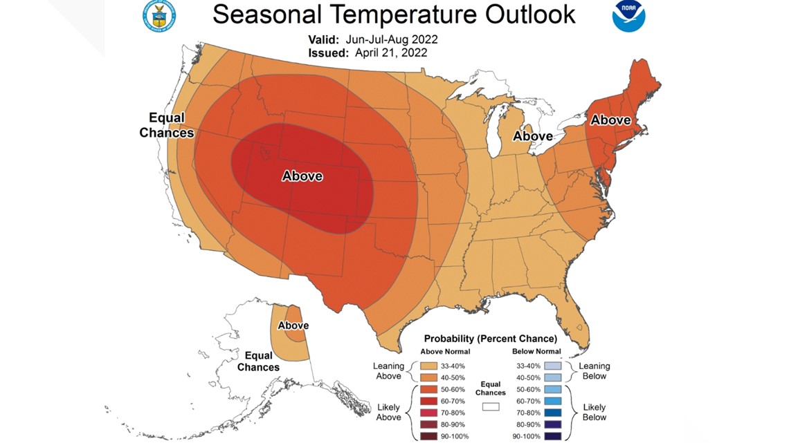
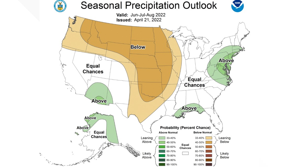
The outlook from the CPC also suggests increased odds for below-average precipitation for all of western Washington this summer.

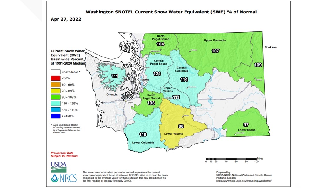
Coming off of an active, cooler April, this has allowed the snowpack to increase for the mountains. The current snowpack for the Olympics and Cascades is above average.
This increase in the snowpack will help initially curve the fire danger.
"The cool and wet weather is helping us hold on to our snowpack and help prevent an early start to the fire season," said Bond.
The latest report on the snowpack for the state of Washington shows the Olympics and Cascades are well-positioned to hold onto some of the snowpack deeper into the warm months due to the current above-average snowfall.

Due to the recent heavy snowfall, some local ski resorts are extending the season into May.
Crystal Mountain announced they're extending the ski season through May 30 due to over five feet of new snow in April, which is one of the deepest spring snowfalls on record for the mountain.
With the forecast calling for warmer and drier conditions this summer, the snowpack will inevitably melt away. This could quickly kick the fire season into full gear especially near the end of the upcoming summer, according to Bond, despite the possible slower start to the fire season due to the recent precipitation.
The fire seasons over the past few decades have grown increasingly violent and longer in duration for the western United States.
The latest data from Climate Central indicates the West, including parts of Washington, has experienced an increase in fire weather days. This means the fire season is becoming extended for parts of Washington.

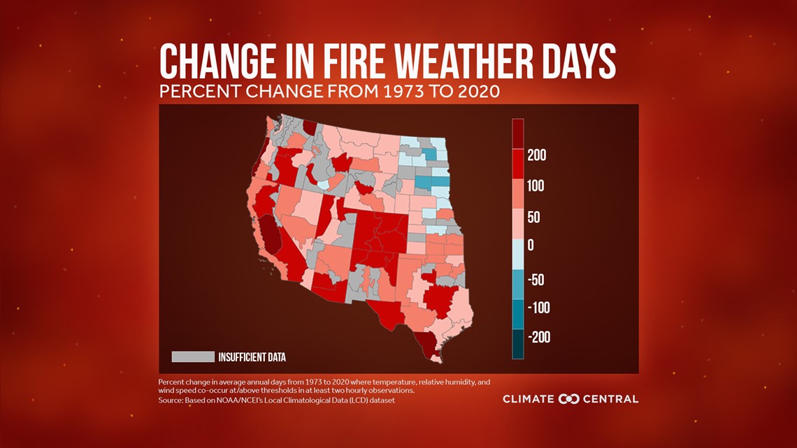
This is particularly concerning given the CPC's temperatures and precipitation outlook suggesting the anomalously warm and dry conditions through the summer, extending into the upcoming fall for western Washington.
While we're weeks away from hot temperatures, here are some good tips to help your family and you stay cool in the warm days ahead.
In the meantime, enjoy the cooler temperatures. The CPC suggests temperatures will be below average for western Washington over the next few weeks.

