SEATTLE — We have seen a lot of lightning and thunderstorms across western Washington recently, including the lightning show many saw Wednesday night.
If you think thunderstorms are increasing around the region, you are not wrong and there's data to support that conclusion.
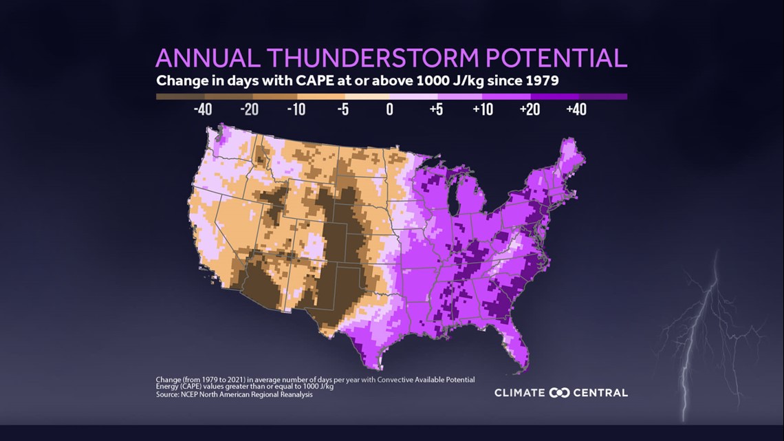
Climate Central recently (2022) analyzed data from the National Oceanic and Atmospheric Administration and produced a study showing increasing thunderstorm potential across nearly the whole state of Washington with a more drastic upward shift around Puget Sound.
The study explored what is known as convective available potential energy, or CAPE, to identify which areas saw an increase in thunderstorm likelihood. CAPE is a measure of instability in the atmosphere, and when the CAPE is higher, there's increased potential in thunderstorm potential.
A big reason for the change in thunderstorm potential from 1979 to 2021 is the warming temperatures across the state. Since the beginning of the 20th century, temperatures in Washington have risen by nearly two degrees Fahrenheit. Increasing temperatures, and the potential for the atmosphere to hold more moisture with warmer temperatures, result in higher levels of instability in the atmosphere and as a result, increases the thunderstorm potential.
For western Washington, there's been a small increase in thunderstorm potential during the fall and spring, but the largest rise has been experienced in the summer, which again correlates to the increasing summer temperatures. Annually, parts of Puget Sound have experienced a 10-20 day increase in days with CAPE values sufficient to support thunderstorm development.
This graphic from the study shows the change in days with CAPE greater than 1,000 J/kg since 1979. CAPE values this high is an important values to determine thunderstorm potential.


Increased thunderstorm potential means there's an increase in the risk of lightning, hail, and thunderstorms winds, and if other ingredients are in place, an increased potential for tornadoes.

