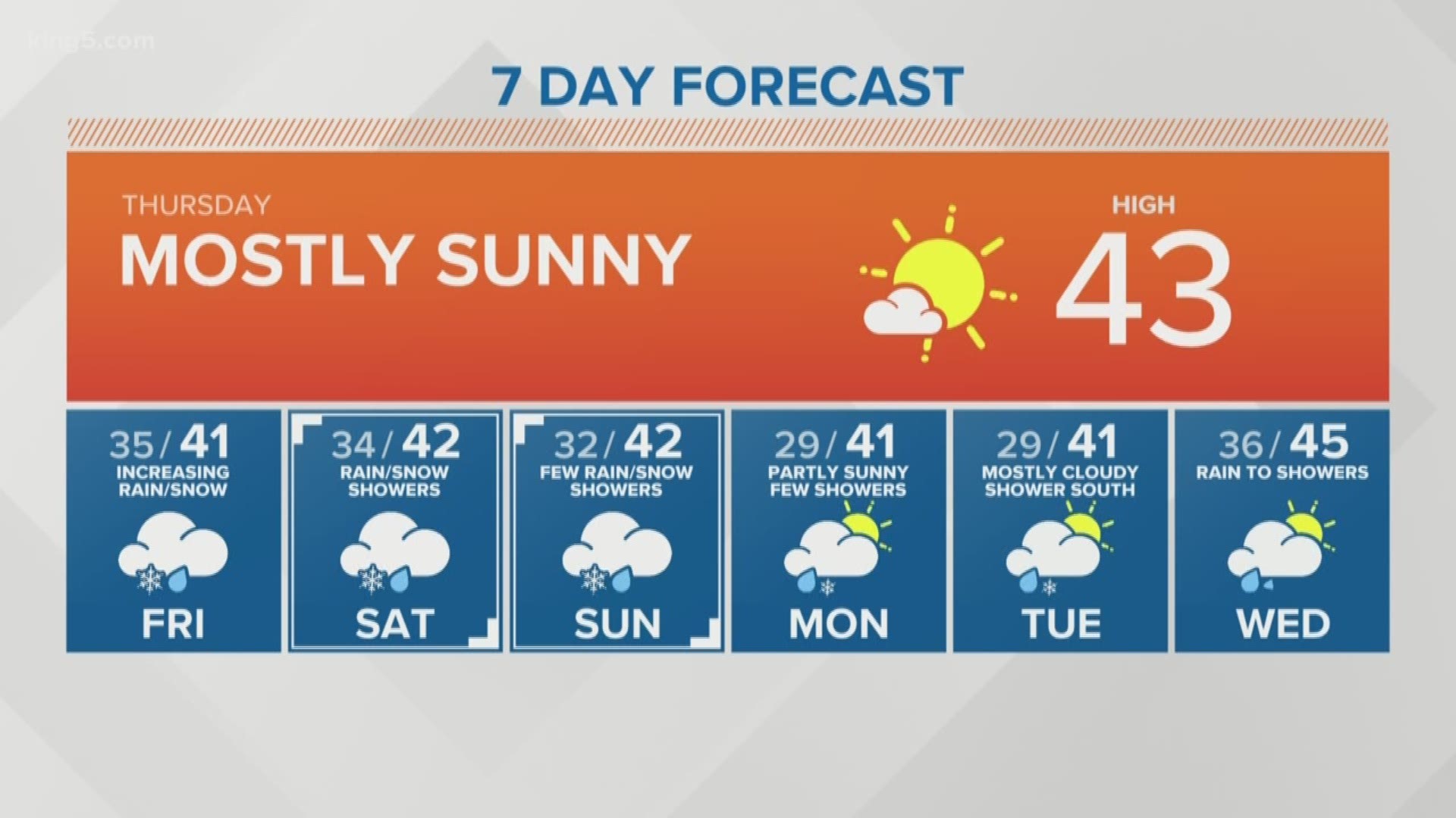
Thursday will be partly to mostly sunny around Puget Sound as a high-pressure system keeps the rain and clouds at bay, but temperatures will stay below normal in the mid-40s.
Enjoy Thursday's break in the rain, because it won't last long.
WATCH: Full forecast


Friday
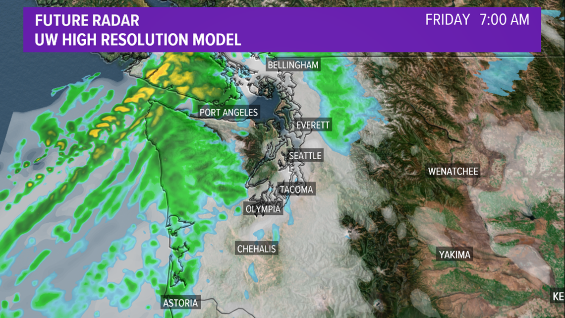
The next weather system could arrive as early as Friday morning. By 7 a.m. showers are expected to arrive on the coast, and could move into the interior as early as mid-to-late morning.


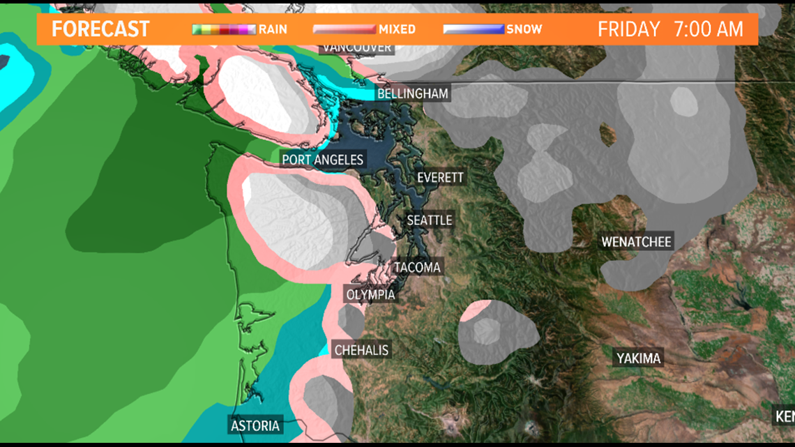
With temperatures on the cooler side, this may start as rain-snow mix, but we’re not expecting a lot of accumulation with this next system. With snow levels between 500-700 feet, the higher hillsides may see a dusting up to an inch of snow, but areas at sea level will probably just get chilly rain.


Saturday-Sunday
Rain or snow showers could linger into Saturday morning but will decrease Sunday.
Monday-Tuesday
Our best chance of lowland snow might be Tuesday when a warm front moves in over the south. However, we'll have to get closer to the event to get specifics on timing, location, and accumulation.

