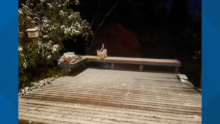
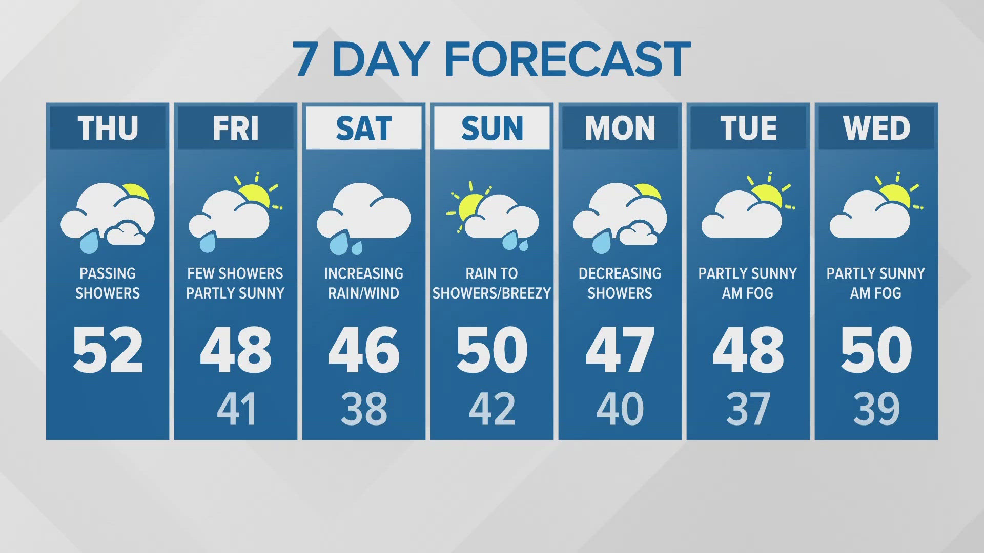
SEATTLE — Parts of western Washington woke up to a light dusting of snow Monday morning, including Hobart and Issaquah near 800 feet of elevation.
While the snow is not expected to be heavy or widespread enough to create travel impacts for the lowlands, do not be surprised if you see a few snowflakes mix in with the rain showers early Monday morning.
Weather setup
The lowland snow potential and setup is the classic lowland million-dollar question of whether or not the moisture and cold air overlap to allow for snow.
A cold front responsible for the Sunday morning rain and mountain snow is ushering in a chilly airmass at the same time an upper area of low pressure off the Washington coast swings in some very chilly air at the mid and upper levels of the atmosphere.
The low pressure will slowly meander and move south along the Pacific Northwest Coast, keeping spotty precipitation chances in the forecast Sunday night into Monday.
This setup of enough energy and lift to spark spotty areas of precipitation and colder air filtering into the region at the surface creates the potential for a few areas of a lowland rain/snow mixture.
Timeline
Overnight rain could mix with a couple of snowflakes overnight into early Monday morning for the Puget Sound Lowlands. This does include Olympia, Tacoma, Seattle, and Everett.
The favored areas, however, would be the higher hills near these areas above 400 feet. Areas below 400 feet will likely see mainly rain but again a wet snowflake or two is possible.
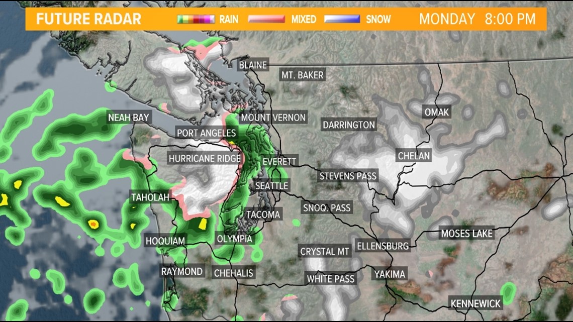
Early Monday morning radar

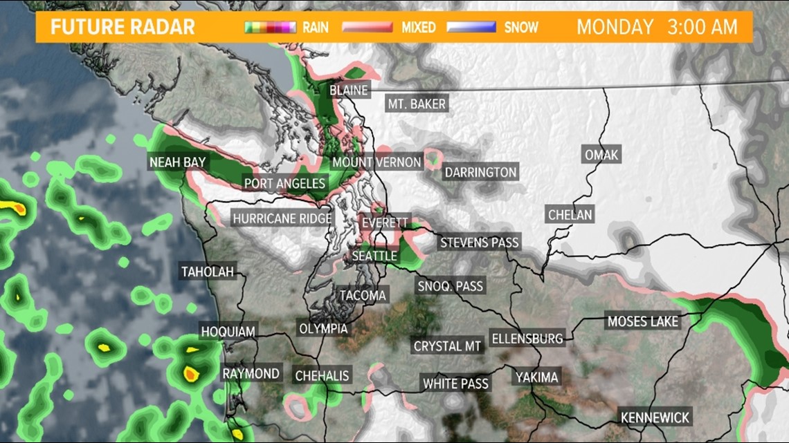
The snow chances increase just in time for the rush hour for the lowlands in Skagit and Whatcom counties as a northeasterly wind filters colder air into western parts of these counties. Clallam County could also get in on the light snow Monday morning. Interstate 5 and Highway 101 could see this light snow mixture for the Monday morning commute but widespread travel impacts are not currently expected. If a heavy enough burst of snow occurs Monday morning in Skagit and Whatcom counties, with the colder temperatures, there could be brief, light accumulations near Interstate 5.
Spotty lowland rain/snow showers could continue Monday afternoon for the same areas in Clallam County and extend south along the Hood Canal and into the Kitsap Peninsula. The northern portion of the Hood Canal has the best chance to see light accumulations Monday afternoon and evening.
With the possibility of enhanced upslope snow near Highway 101 in Clallam County Monday afternoon and evening, some light accumulations on elevated surfaces and potentially some of the side roads are possible. If this occurs, minor travel impacts are possible at times for this area.
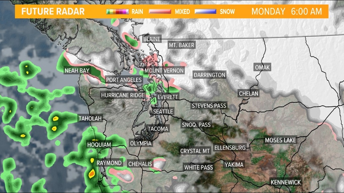
Mid-Monday morning radar

Monday afternoon radar

Video timeline discussion
Lowland areas that have the best chance for a rain/snow mix
It needs to be reemphasized that this isn't expected to be an impactful event for the Puget Sound Lowlands at this time and most areas should see more in the way of rain than snow with temperatures above freezing for many areas.
Despite the temperatures hovering just above freezing, there is enough cold air and moisture that could lead to a rain/snow mixture early Monday morning for Olympia, Tacoma, Seattle, and Everett. Farther north, into Skagit and Whatcom counties, slightly colder air could increase the snow potential for western areas in the counties.
While widespread accumulations are not expected, a burst of heavier snow rates could lead to minor accumulations on grassy and elevated surfaces anywhere across the lowlands of western Washington. It is too difficult to pinpoint which areas could see heavier snow that could lead to some minor accumulations.
A broad overview shows the favored areas to see snow that could lightly accumulate would be in northern Clallam county near Highway 101, western Whatcom county near Interstate 5, and along the Hood Canal near Highway 101. This includes Port Angeles, Sequim, Shelton, Blaine, and Bellingham.
If you do observe light accumulations on roadways, please give yourself extra time on your commute. Temperatures are expected to remain near or just above freezing Monday morning so any light accumulations would quickly melt throughout the day Monday.
Modeled snow accumulation forecast

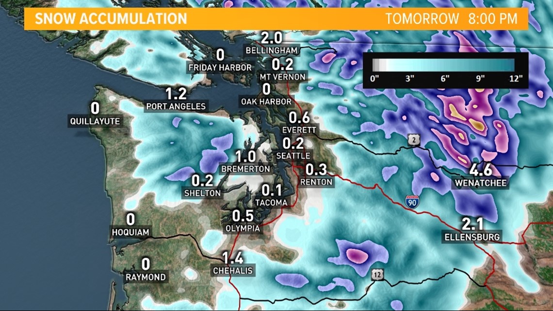
DISCLAIMER: It should be noted this modeled snowfall accumulation is used to depict which areas are favored to see snow. Take the exact accumulation forecasts with a grain of salt.
As you know, lowland snow forecast can be difficult and only minor changes in temperature, moisture, and even wind direction can lead to significant changes to the snowfall forecast. Keep checking back for updates on this fluid, evolving forecasts.


