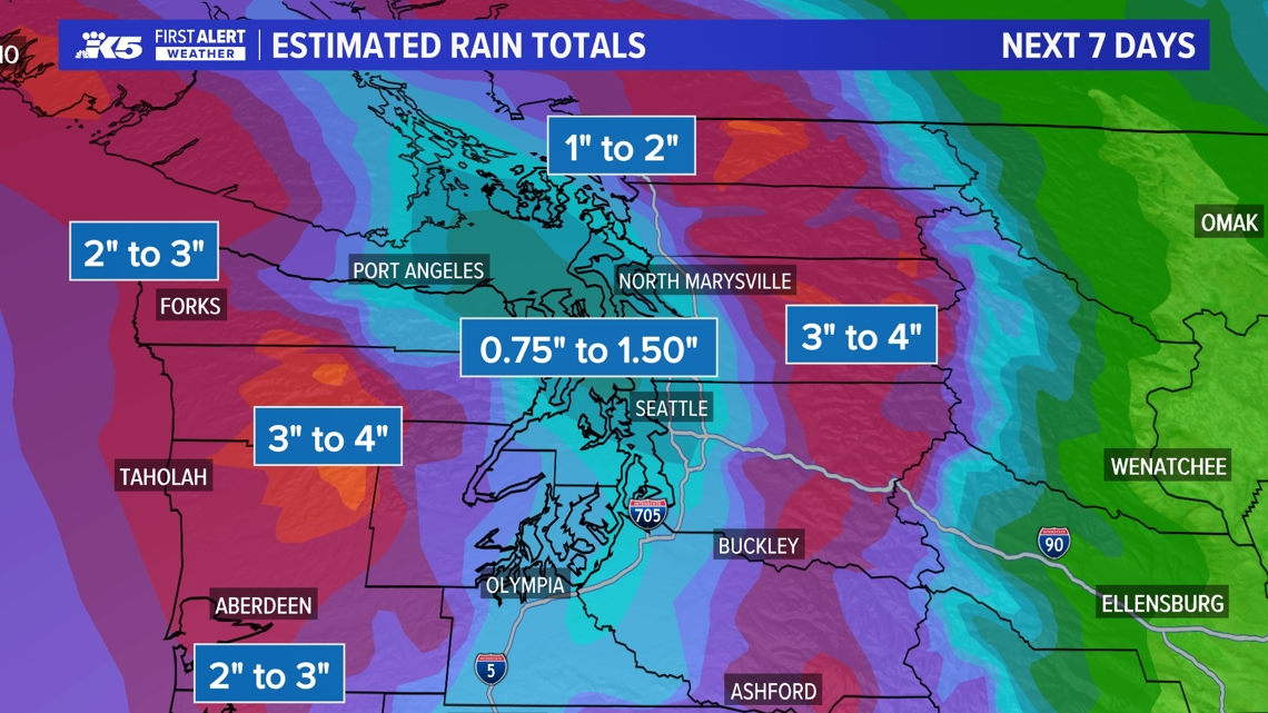
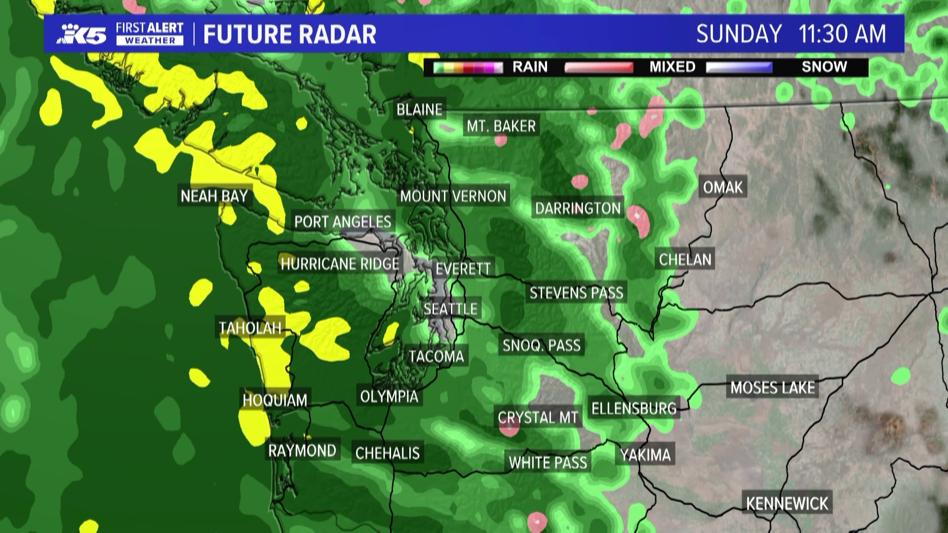
SEATTLE — An unseasonably strong system has the potential to drop around 1.5 inches of rain in western Washington on Sunday and into the early part of next week, according to the KING 5 Weather Team.
This weather system would be more typical of the winter but is "much wetter" than usual for early summer, according to KING 5's Rich Marriott.
The National Weather Service issued a Flood Watch for some areas of western Washington Sunday through Wednesday morning. That includes King, Mason, Pierce, Snohomish, and Skagit counties.
The lowlands will likely pick up 1 to 2 or more inches of rain through Tuesday, which would exceed the normal monthly rain totals for the entire month of June.
The mountains and some areas of the peninsula could see between 2 and 4 inches of rain, with a potential 0.75 inches to 1.5 inches in the lowlands by Monday. Throughout the month of June, SeaTac usually sees 1.49 inches of rainfall total.
The Snohomish, Skykomish, White, Skagit and Skokomish rivers are forecast to approach Action Stage, with the Snoqualmie River forecast to approach minor flood stage in Carnation on Monday. Rivers are expected to crest between Sunday evening and Tuesday afternoon, according to the National Weather Service.
The heaviest rainfall is expected to occur on Sunday into Monday with the greatest accumulations projected for the Olympic Peninsula, Southwest Interior and the Cascade Mountains.


Rain showers will linger into Tuesday before conditions dry out mid-week. KING 5's Rich Marriott says the second week of June appears to be sunny and warm, with more clarity in the forecast expected in the coming days.

