SEATTLE — After three straight years of La Niña, the weather pattern El Niño is back with the potential to shape what we experience this winter.
Here’s what El Niño is and what other phenomena could impact our weather over the next few months.
What is El Niño?
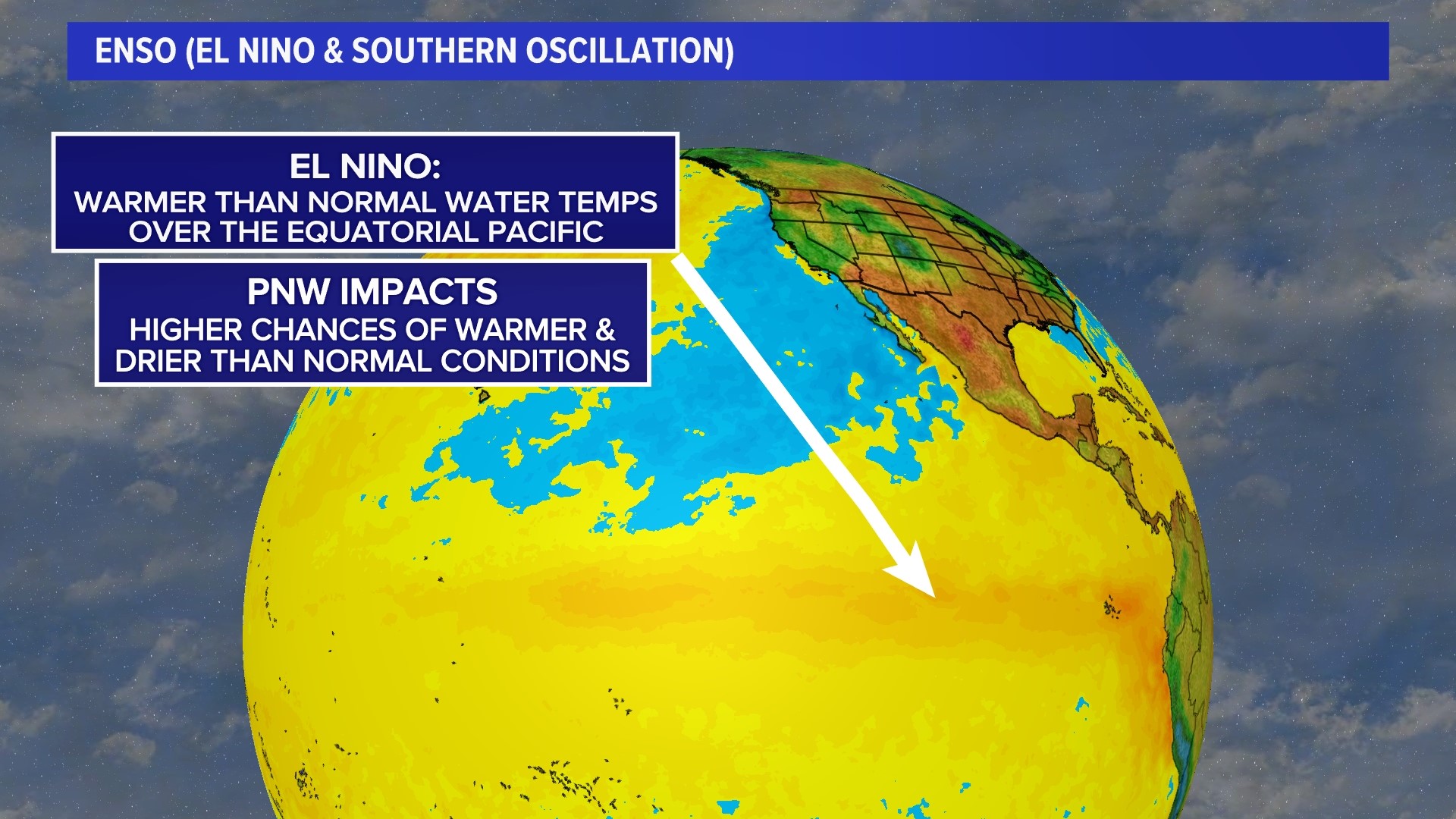
Water temperatures across the Pacific Ocean show conditions are warmer than normal. Temperatures are currently exceeding the threshold of 0.5 degrees Celsius, which indicates El Niño conditions.

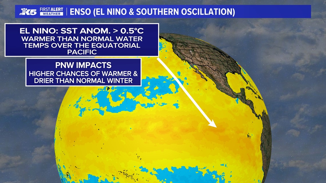
El Niño conditions are currently in strong El Niño territory, meaning temperatures near the equatorial Pacific have exceeded normal by about 1.5 degrees Celsius in three of the four index values.
El Niño conditions are expected to stay the entire winter.
How El Niño impacts precipitation
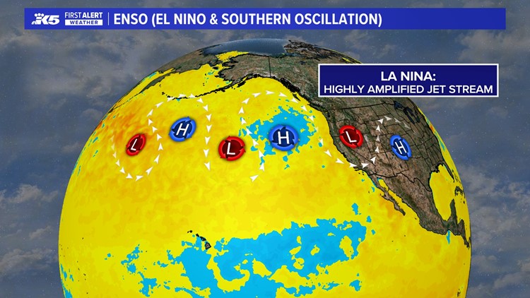
In the past few years, La Niña gave us more of a highly amplified jet stream that produces high latitude blocking as well as a pattern that could stick around for weeks at times.
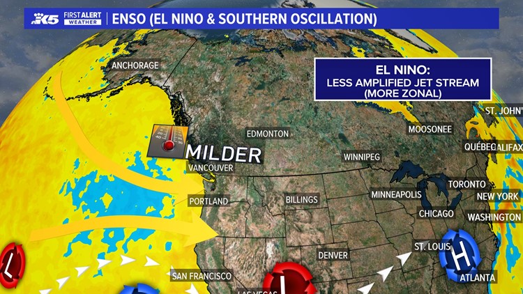
El Niño years produce less of an amplified jet stream. Those systems are able to freely move across the atmosphere, and the subtropical jet stream starts to really get ramped up.
That means the southern part of the country may get more moisture from weather systems. The Pacific Northwest is not able to tap into some of that subtropical moisture to bring as much precipitation as the region typically sees.
With a lot more of a zonal pattern coming off of the ocean, typically that means that the Pacific Northwest gets that airmass off of the water, which is going to be warmer than what’s coming from the landmass from Canada.
Jet stream under El Nino and La Nina conditions
Keeping an eye on snow cover in Eurasia
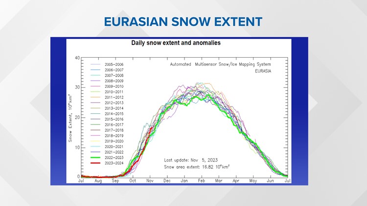
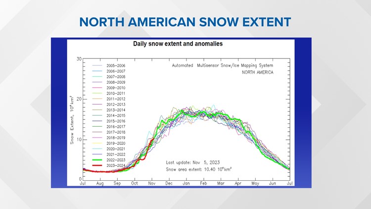
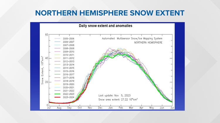
Snowpack is influenced by El Niño, and the Eurasian snow extent could provide clues to how it fares this winter.
Over Eurasia, especially Siberia, colder air builds and eventually, it makes its way across the poles to North America. We like to see more snow extent on the ground because once that cold air starts to work its way toward us, the snow helps refrigerate it. As the air moves southward, it could start to modify more easily without snow on the ground.
The data shows the Eurasian snow extent is sitting in the middle to just above average compared to the previous 18 years, which could be helpful snow-wise.
Snow extent in Eurasia, North America and Northern Hemisphere
What about the polar vortex?
The polar vortex, which is a big circulation across the northern part of the globe, could play a role.
In El Niño years, the polar vortex usually stays strong, and it keeps a lot of cold air bottled up. But if it is disrupted, it could allow cold air to move south. Systems can tap into that and bring that colder air even farther south.


The Arctic oscillation index shows how strong the polar vortex is and whether it's going to be weakening.

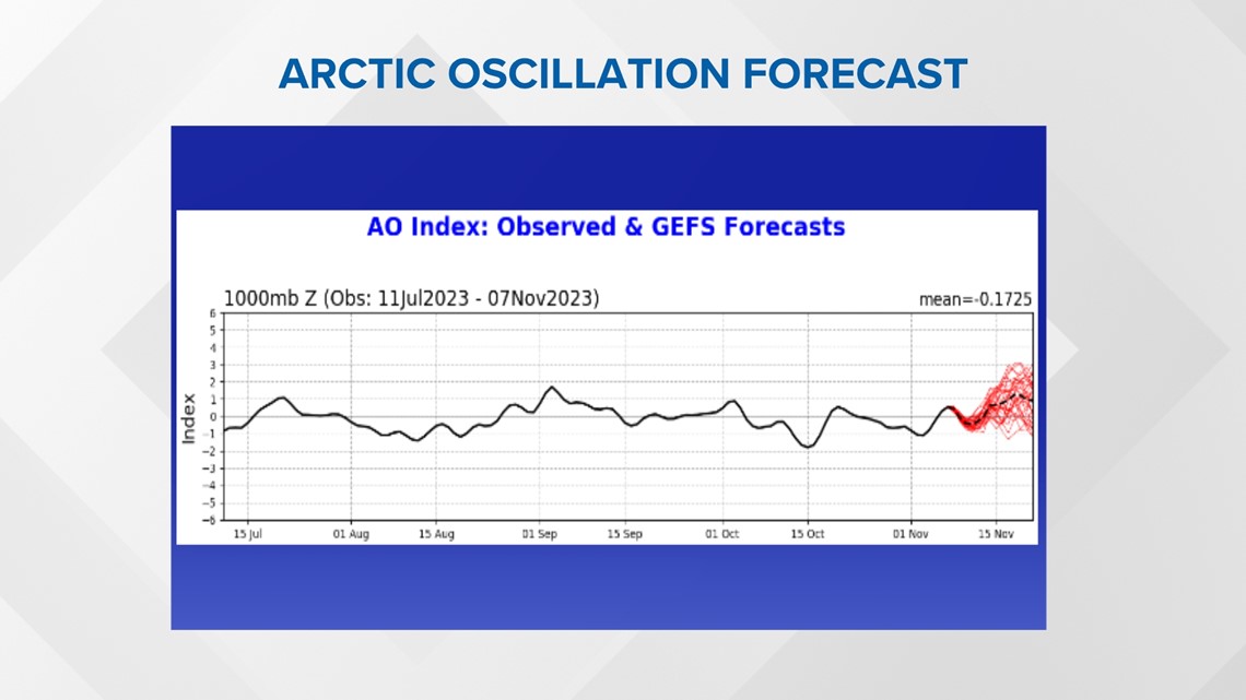
Sometimes it takes two to three weeks, maybe even a month before that really starts to show up downstream more of the U.S.
The American models call for some of that colder air to work its way farther south as we head into mid to late December, possibly even into early January. The European models show a similar outcome.
2023-24 El Niño forecast
Taking all that into consideration, this is what we're expecting for the upcoming winter season.
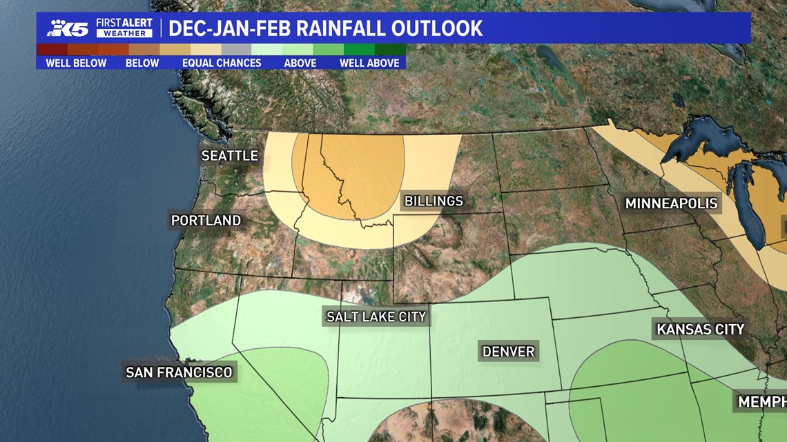
During a typical El Niño year, you sometimes see a lot of moisture staying farther to the south. And that's what the American model shows: above-normal precipitation across the southern tier of the U.S., especially across the southeast. The European model does not show as much precipitation across California or Arizona.
Western Washington is expected to have near-normal precipitation, as opposed to eastern Washington to Montana, which is expected to be rather dry.

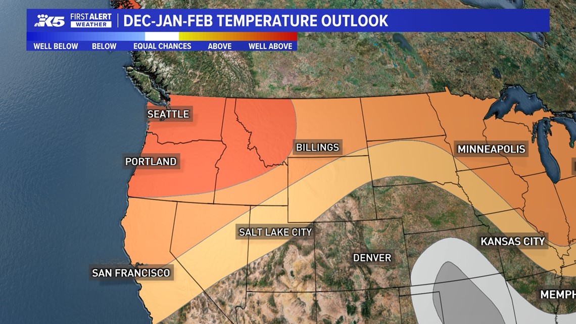
Warmer than normal conditions are expected across the Pacific Northwest.
Those conditions are expected in December, January and February.

While El Niño may favor these conditions, they are not a guarantee. There could be outliers. For example, in February 2019, which was a weak El Niño year, Sea-Tac Airport recorded its snowiest winter on record with over 20 inches of snow.
Mother Nature is always going to have the final say.

