SEATTLE — Daylight has been steadily decreasing and the average temperature has started to fall, but western Washington will be reminded it's still summer through much of this week.
The most pronounced heat wave of the season began Sunday and is expected to last through Thursday. During this five-day stretch of abnormally warm temperatures, high temperatures will climb in the mid to upper 80s and lower to mid-90s for many areas.
Favored locations to see high temperatures in the 90s will be areas away from water and regions south of Seattle along with the Cascade foothills and valleys. The Cascade valleys, Southwest Interior, including southern Mason County, could approach triple-digit heat this upcoming week.

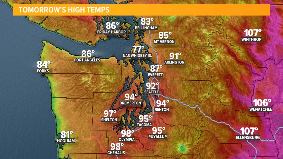
Seattle is forecast to be on either side of 90 much of the week, potentially doubling the number of 90-degree days so far this year.
Prior to the heat wave, Seattle-Tacoma International Airport recorded two days of high temperatures of 90 degrees or warmer. Back on July 5 and July 15, Seattle saw a high temperature of 91 degrees, which is the warmest temperature of the year so far.
The Emerald City could see its hottest temperature of the year this week with forecast highs in the low 90s. Seattle typically sees around three days of highs 90 degrees or warmer each year although that's been increasing over the past decade.


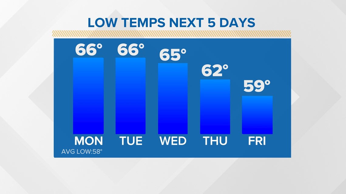
Overnight lows are forecast to remain mild during this heat wave, increasing the risk for heat-related illness as there will be little time for bodies and homes to cool. Lows will remain in the mid to upper 60s in Seattle and other areas with a high density of paved surfaces as these surfaces and environments hold in the heat from the afternoon sun.

The heat wave will develop as a strong high pressure controls the weather pattern for much of the upcoming week. This high pressure is developing over the eastern Pacific this weekend and will build across the West Coast, locking in place, and causing the extended stretch of high temperatures running 10-20 degrees above normal with low temperatures running 5-10 degrees above normal.


There's also an Excessive Heat Warning for most of western Washington in effect through Tuesday night and for the Seattle-Bellevue area through Wednesday night, signaling a major risk for heat-related illnesses. A Heat Advisory is in effect through Tuesday night for Everett, western Whatcom and Skagit counties and the Olympics.


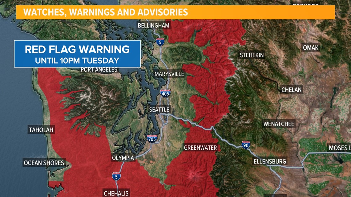
The fire danger will be elevated this week due to the ongoing drought conditions, high temperatures, low relative humidity, and light offshore winds. These environmental and atmospheric conditions will favor the development and spread of wildfires.
A Red Flag Warning is in effect through Tuesday evening for the western slopes of the Cascades above 1,500 feet. The Red Flag Warning for southwest Washington and the Washington coast expires Monday night, because onshore flow will begin to affect those areas sooner.

Seattle has experienced a long stretch of mild high temperatures. The Emerald City is currently within a 55-day streak of high temperatures of 70 degrees or warmer. This ties 1981 for the fifth-longest streak, and there's no end in sight. The longest stretch is 72 days back in 2017. A big reason for high temperatures staying above 70 degrees over the past two months is because of the summer season but also due to abnormally warm water temperatures off the Washington coast. Water temperatures are running 1.5 to 2.5 degrees above normal. This helps lessen the cooling effect of onshore winds, thus, keeping Seattle in the lower 70s for highs during an onshore flow instead of the upper 60s.