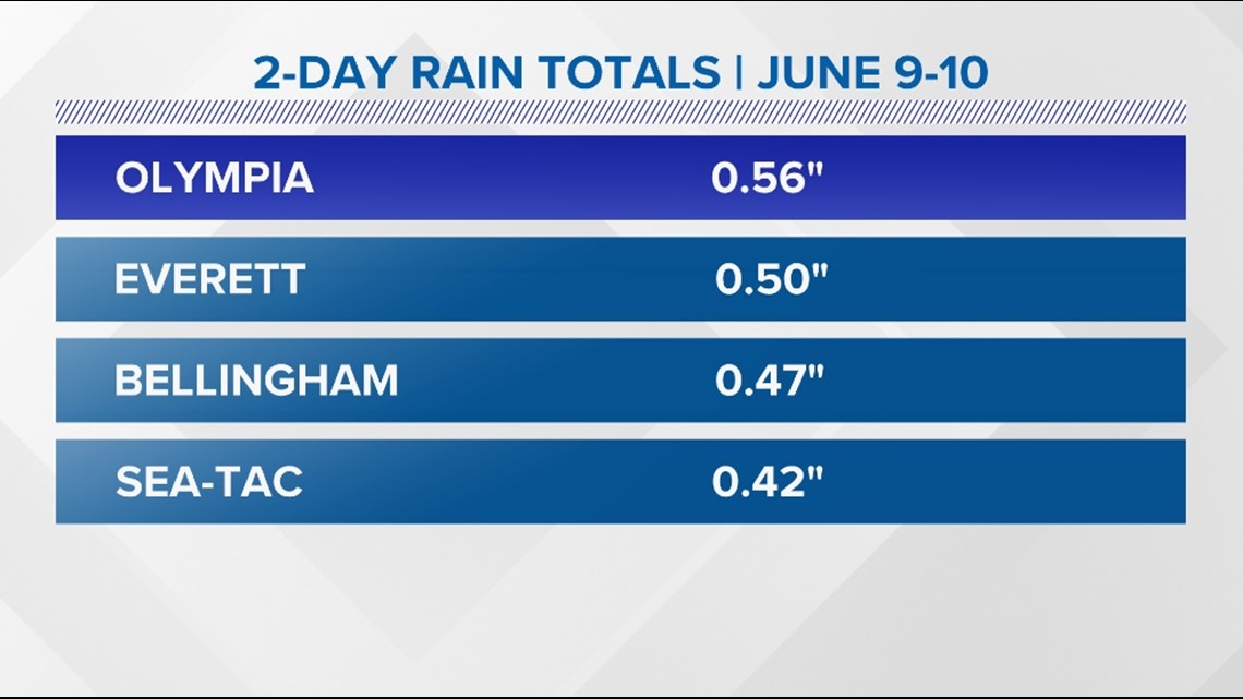
SEATTLE — Much-needed rain fell across western Washington Friday and Saturday with many areas receiving wetting rain totals over a quarter of an inch.
Some lucky locations saw half an inch or more of rain, including Olympia and Everett. Sea-Tac and Bellingham picked up just under half an inch of rain during the 48-hour period.
Despite the much-needed rainfall over the last two days, western Washington is still abnormally dry for the month and for the entire year of 2023 so far.
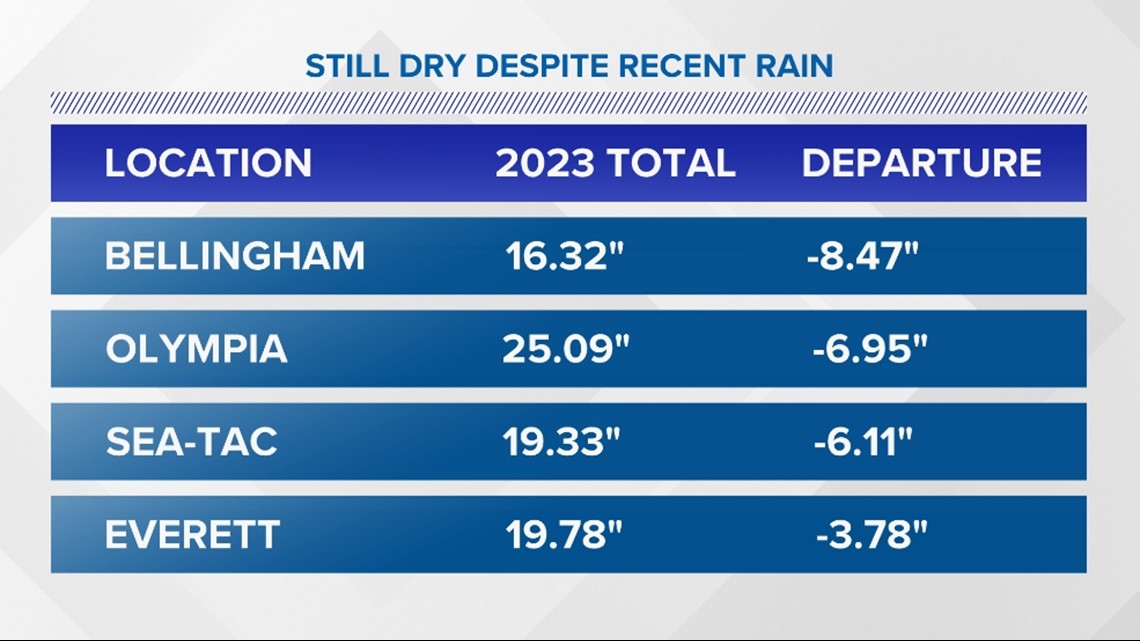
Most of western Washington is running a few to several inches of rainfall below normal for the year. Sea-Tac and Olympia are over half a foot of rain below normal and Bellingham is a whopping eight and a half inches below normal. Everett is better, but still dry, at nearly four inches lower than normal.
June 9-10 rainfall totals from around western Washington

Precipitation departure from normal for the year around western Washington

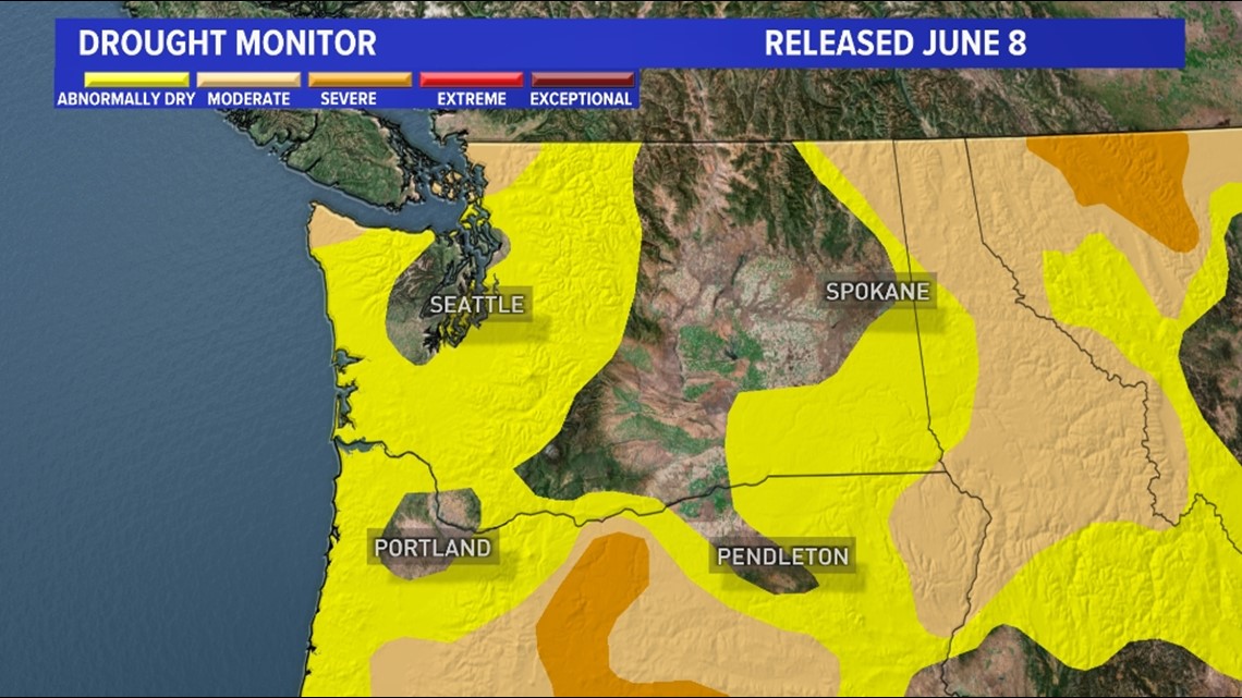
Because of the abnormally dry weather, parts of the KING 5 viewing area have slipped into drought conditions according to the latest update on the drought monitor that was released on June 8.
The latest update from the drought monitor shows parts of Clallam County, San Juan County, Whatcom County, and Skagit County are now included in a moderate drought. The rest of western Washington from the Cascades to the coast is included in abnormally dry conditions, approaching the threshold for a moderate drought.
The latest update from the drought monitor released June 8

Going forward into the dry season, the seasonal outlook from the Climate Prediction Center favors temperatures running above normal with below-normal precipitation.
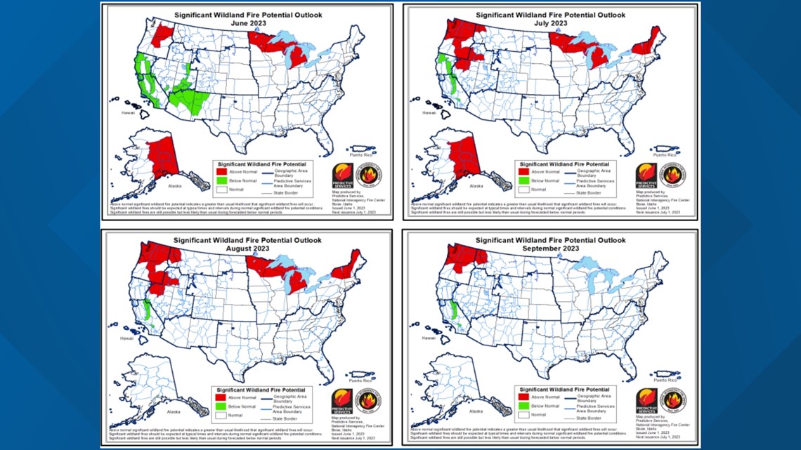
This outlook paired with the ongoing dry conditions will tend to favor above-normal significant fire potential for the months of July, August and September for all of Washington, including the entire KING 5 viewing area.
Significant fire potential outlook from June through September

