SEATTLE — Several systems are forecasted to pass through the region over the span of the next week bringing rain, gusty winds and mountain snow to western Washington.
Here's what you should know.
Timeline: When each system will arrive
A second system will begin to move into the region into Monday. Expect off-and-on showers on Monday. There is a slight chance for a few thunderstorms during the day on Monday. Additionally, winds will be gusty at times, especially for the North Interior and the coast.
As of now, snow levels are expected to stay relatively high, mainly in the 5,000-6000' range on Sunday before dropping down to around 4,000' on Monday.
The third system will send moderate to heavy rain, gusty winds, and heavy mountain snow (mainly above 4,500') into western Washington late Tuesday into Wednesday. Snow levels will be in the 3,500-4,500' range, which means accumulating snow is expected in Stevens Pass and potentially in Snoqualmie Pass.
Potential rain totals
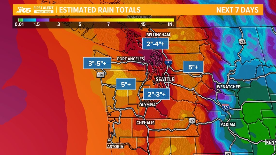
Seven-day rain totals look to be around 2-3" for Puget Sound with locally higher amounts likely. Meanwhile, over the Olympic Peninsula and mountains, rain totals will likely be over 5", which means we may need to watch out for river rises.


