Western Washington experienced another record-breaking day of heat Tuesday.
Sea-Tac Airport reached 79 degrees as of 1:45 p.m., shattering the old daily record high of 63 degrees, which was set in 1951. It's also the warmest winter day and March day on record, breaking the 2004 record of 78 degrees.
The National Weather Service reports that Tuesday was the hottest day on record from November to March since record-keeping started in Seattle in 1894.
RELATED: Watch full forecast
On Tuesday the Emerald City was toastier than Tampa Bay, a high of 64, and Houston, a high of 71, while being just a degree shy of Cancun's 80 degree beach day.
Sea-Tac Airport got to 76 degrees on Monday, breaking the old warm weather record of 70 degrees, which was set in 1996. The average high for this time of year is 54 degrees.
Monday broke another record, marking the warmest day during the winter season and the earliest day in the calendar year to hit 74, according to the National Weather Service.
March 18 is now tied for the second warmest March day on record.
Quillayute also broke a record high Monday reaching 74 degrees. The old record was 68 degrees, also set back in 1996. Hoquiam reached 75 degrees on Monday, breaking the record high of 69 degrees set in 1996. Olympia also broke a record high Monday by reaching 74 degrees. The old record of 72 degrees was set back in 1956, the National Weather Service said.
Consecutive days with highs in the 70s in March is pretty rare for Seattle. The last time we had several days in a row with highs above 70 degrees was March 27-29, 1994, according to the National Weather Service. Since records started being kept in the 1890s, there have only been four times that western Washington has seen more than one day in a row of highs in the 70s in March.
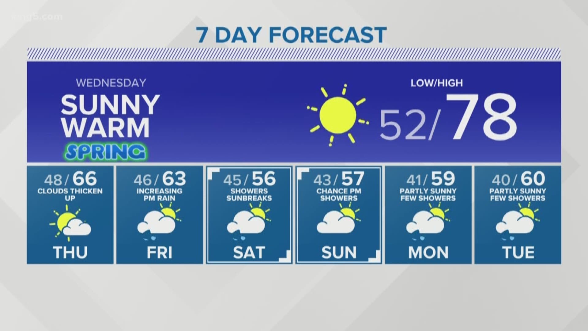
The summer-like weather looks like it will stick around Wednesday with highs in the mid 70s. Thursday will cool slightly with highs in the mid 60s, and rain is expected to return Friday with highs in the low 60s.
After a stretch of frigid weather in February, western Washington is finally back above normal high temperatures. A high of 54 degrees was recorded at Sea-Tac Airport on Thursday, which was 1 degree warmer than normal. That balmy 54 broke a 40-day streak of below normal high temperatures.
The last time we got to at least 65 degrees was back in October.


