SEATTLE — The spring-like warmth with temperatures in the 70s is already a distant memory. Sea-Tac Airport officially hit the 70-degree mark on Thursday for the first time in 2022, with a high of 73 degrees, while some areas hit the mid to upper 70s.
However, significantly colder temperatures have moved into western Washington, and they are here to stay for the foreseeable future.
The average high is 58 degrees for Seattle for this time of year, but this weekend many areas stayed in the 40s for highs and that's expected to be the case this upcoming week. Upper 40s and lower 50s is in the forecast for the foreseeable future.
Lowland snow forecast and potential accumulations
The colder temperatures will not only make you reach for a jacket if you have any outdoor plans but it'll also drop the snow levels.
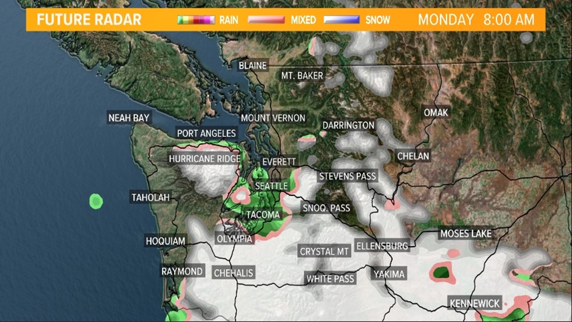
Snow levels were expected to fall overnight Sunday to around 200 feet by Monday morning as our next storm system approaches. This system will spread moisture and lift into the region allowing for a rain/snow mixture or wet snow for the Central Coast, Southwest Interior and eventually the Hood Canal and South Sound by Monday morning.

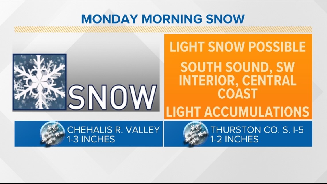
The mentioned areas have a chance to see a dusting of snow to a few inches, especially for the higher hilltops.
Chehalis to Olympia to Shelton is a favored area to see between 1 to 3 inches of snow with isolated higher amounts. That area extends into the lower Chehalis River Valley along with areas farther north for the rest of the Hood Canal and parts of the western Kitsap Peninsula.
Temperatures near or above freezing along with mild ground temperatures should prevent high accumulations and should allow for heavily traveled roads to be okay Monday morning, but a few slick spots are definitely possible, especially on less-traveled roadways.
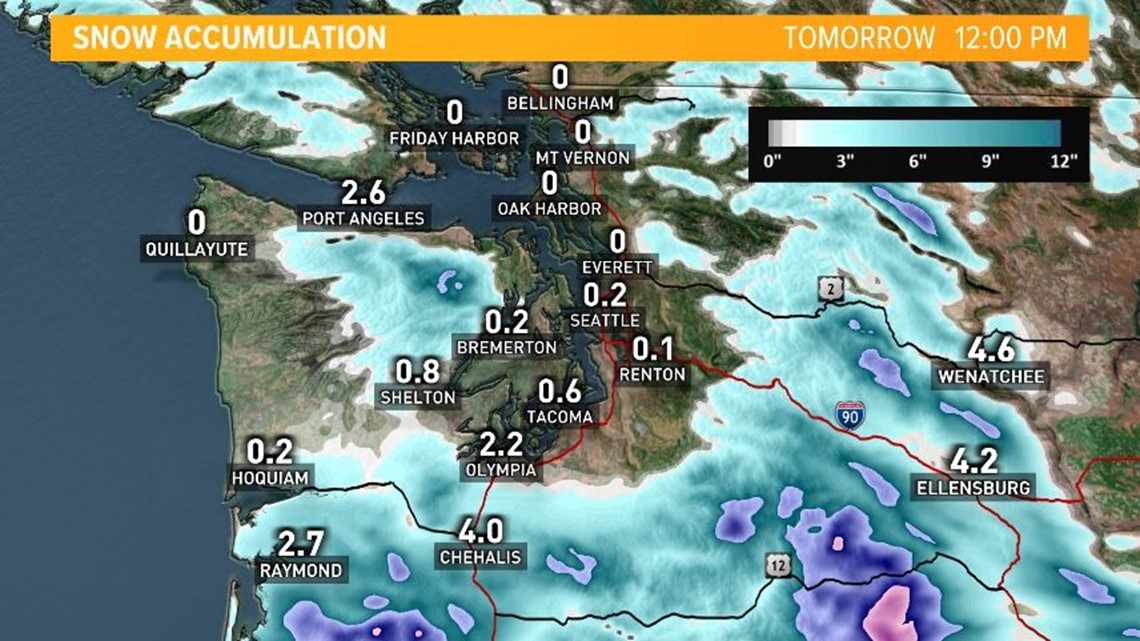
It's possible the rain/snow mixture extends into Tacoma, but right now most of the wintry mixture should stay just outside of Seattle. But a brief snowflake or two cannot be ruled out for Seattle if the moisture makes it this far north.

Monday morning
The area of snow looks to continue into mid to late Monday morning. Snow will fall from the South Sound extending to the Oregon state line along I-5.
Moisture could try to sneak into Tacoma and possibly south Seattle Monday morning but accumulations are not expected for the Central Sound.

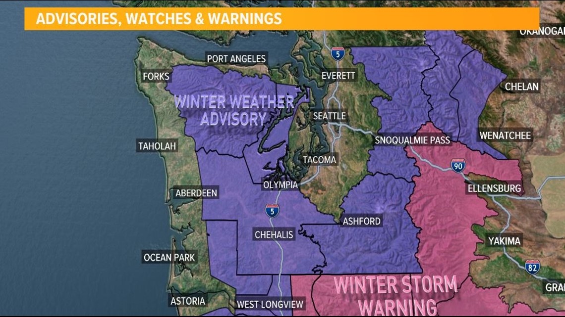
Winter Weather Advisory
A Winter Weather Advisory is in effect until 11 a.m. Monday for the lowlands of Thurston, western Lewis, and south Mason counties.
This includes Harstine Island, Olympia, Centralia, and Toledo and south Mason County and the interior lowlands of Grays Harbor County, including Matlock, McCleary, and Montesano.

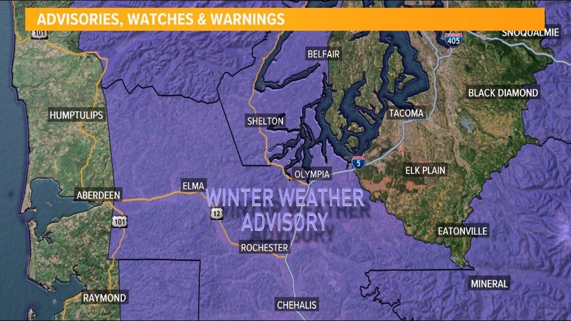
A wet, slushy 1 to 3 inches of snow is possible in the Winter Weather Advisory.
A Winter Storm Warning goes into effect tonight for the central and south Cascades. Check the latest pass conditions before traveling over the mountains.