SEATTLE — Western Washington is entering the warmest part of the year: late July into early August. Climatologically, this is when temperatures are typically the hottest and rainfall is the lowest.
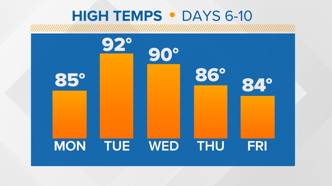
Right on cue, it’s looking increasingly likely we will see some areas of western Washington reach high temperatures in the low 90s next week.
As is often the case with our warm weather, high pressure is expected to build inland and bring in warmer air, cutting off our onshore winds and turning off our ocean air conditioning. This will begin warming parts of the Puget Sound region up over the weekend, peaking Tuesday or Wednesday with highs in the 80s and some areas into the low 90s.


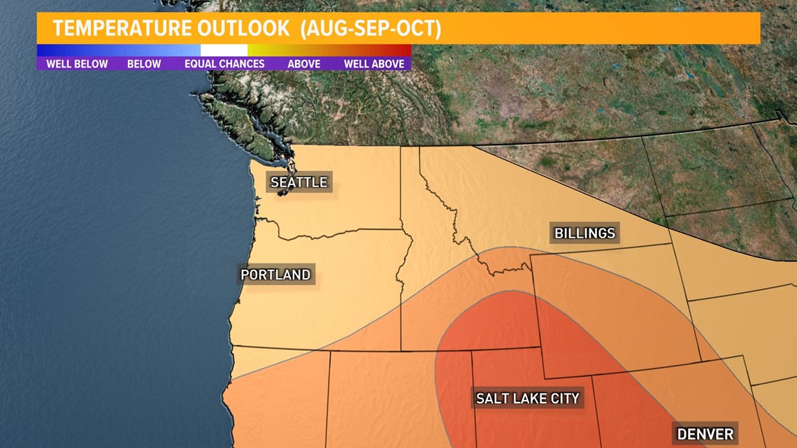
The Climate Prediction Center sees a signal within the models that favors warm to hot temperatures for the region and has included western Washington as an area with a high likelihood to see above-average temperatures next week.
The average high for Seattle right now is in the upper 70s.
Hot temperatures in the second half of July are common in the Puget Sound region. Most high-temperature records for the last two weeks of July are in the mid to upper 90s, with two record days in triple digits. It reached 100 degrees on July 20, 1994, and 103 degrees on July 29, 2009.
Looking ahead, The Climate Prediction Center forecasts above-average temperatures, paired with below-average precipitation through the late summer and into early fall.


With the warmer and drier weather, the fire danger will continue to increase, especially east of the Cascades. Residents are advised to check local outdoor burning restrictions and burn bans.


