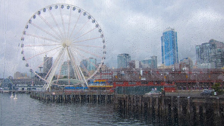
SEATTLE — Autumn may have just started but we have quickly flipped the switch from sunny and warm to rainy and cool.
A long stretch of wet days is on the way this week and it's already brought more rain than we saw during the entire summer season.
Now summer is usually a dry part of the year for our region with average rainfall near 3 inches (June-August), but this year has been drier than normal with only 1.06 inches of rain (excluding this Saturday). Between Sunday afternoon and Tuesday morning, 1.43 inches of rain fell at Seattle-Tacoma International Airport, according to the National Weather Service.
Forecast
A large low spinning off the coast is going to keep western Washington wet off and on through most of the work week.
Another weather system will spread increasing rain into Puget Sound later Tuesday morning.
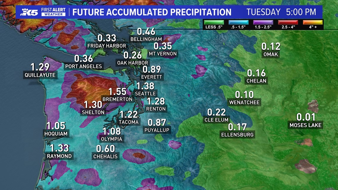
There will be a noticeable rain shadow over some of our island communities. Most island communities will see over 1 inch of rainfall by Tuesday at 5 p.m. Parts of the northern interior and the islands will see up to half an inch of rainfall.

The rain should continue into early Wednesday morning, when the front will finally move through, leaving behind off-and-on showers mixed with sunbreaks in the afternoon. Another weaker system gives us another round of rain Thursday morning changing to off-and-on showers mixed with sunbreaks for the afternoon.

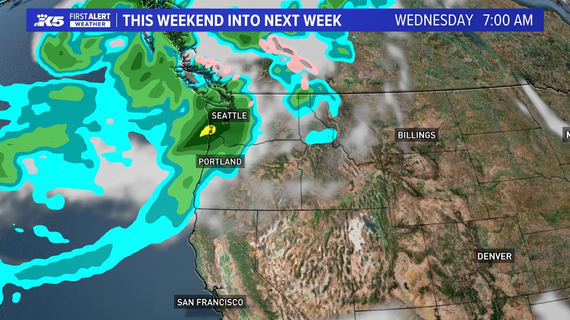
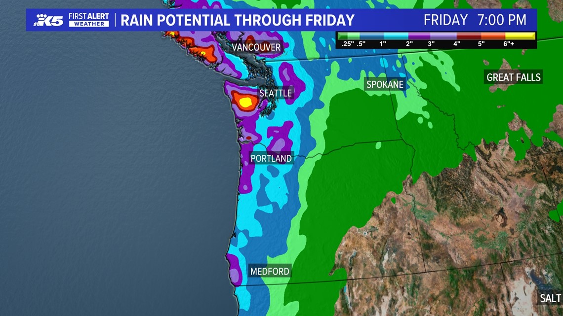
By Friday, rainfall amounts will range between 1-3 inches for most, with locally higher amounts for parts of the coast and Olympic Peninsula.

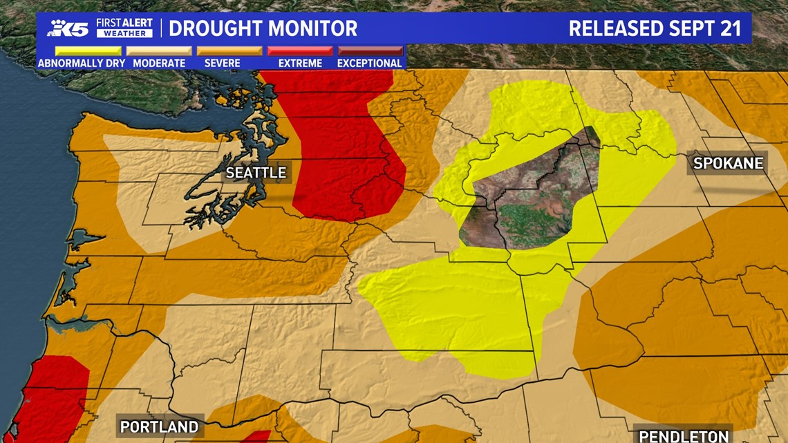
We need that rain. The latest Drought Monitor released Sept. 21 shows severe conditions in the Puget Sound region and extreme conditions over the north and central Cascades.

High pressure moves through the Pacific Northwest over the weekend for sunshine with highs in the upper 50s to mid-60s.


