SEATTLE — You've probably heard the saying, "the flap of a butterfly's wings in Brazil can set off a tornado in Texas." The butterfly effect is a phenomenon in fluid dynamics, relevant in weather too given the atmosphere is fluid. Even the smallest perturbations in the atmosphere can lead to substantial differences over a period of time, reminding us that everything is connected.
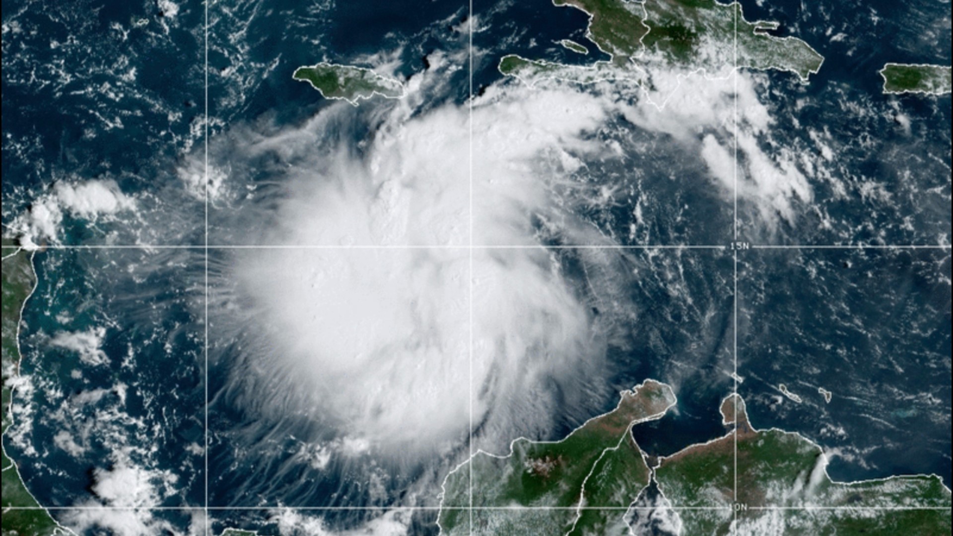
Weather in Washington has implications and impacts on the weather in other parts of the U.S. This is particularly magnified currently as the weather pattern over the Pacific Northwest will have important impacts on the eventual track and evolution of Hurricane Ian in the northern Caribbean.
A developing ridge of high pressure over the Pacific Northwest will bring warmth to Washington, but more importantly, downstream will influence the development of a trough of low pressure. The Pacific Northwest ridge is an arc-like, northward curve in the jet stream, whereas the trough downstream will be a southward movement of the jet stream.
This southward dip of the jet stream will play a role in influencing the track of Ian, which strengthened from a tropical storm into a hurricane early Monday morning, by influencing just how far west or east the system tracks before getting scooped up to the north.
Tropical systems are influenced by the position and strength of troughs as the tropical systems move north into higher latitudes. This is because the direction of movement of tropical systems is generally in the opposite direction of winds associated with troughs. The closer a tropical system moves to a trough, the less western motion a tropical system will have, taking more of a northerly turn.
This illustrates the importance of our current weather, showing everything is truly connected. Because of this connectivity, the National Hurricane Center (NHC) asked the Seattle and Spokane National Weather Service (NWS) offices, along with other NWS offices across the U.S., to participate in more frequent balloon launches over the next few days.
The additional balloon launches will help the NHC better forecast Ian by having more data feed into the weather models used to forecast.
Weather balloons are launched twice daily from 92 stations across North America and the Pacific Islands. There are also 10 operations in the Caribbean. The balloon has an instrument known as a radiosonde attached that collects temperature, humidity, pressure, wind speed, and wind direction measurements from the ground up throughout the atmosphere upwards of 100,000 feet, or nearly 20 miles, above the ground.
The instrument attached to the balloon communicates every 1 to 2 seconds with equipment on the ground to record and collect the data.
Data from the additional balloon launches will be ingested into the weather models, helping the models get a better idea of the current state of the atmosphere, helping them more accurately depict future states of the atmosphere and thus the track and intensity of Ian.
This will help the NHC make the most informed and accurate forecasts possible going forward with Ian.
Additional balloon launch requests are nothing new. This commonly happens with high-impact weather events such as large winter storms, severe weather outbreaks, and tropical cyclones, but this is the first time some offices in the Pacific Northwest have been asked to participate in additional balloon launches, according to the Spokane NWS office.

