SEATTLE — Relief from the wildfire smoke has finally arrived and the days of hazardous air quality in western Washington appear to be over thanks to a weather system moving into the region.
The shift to onshore flow helped push fresh, coastal air to the Puget Sound region early Friday morning. Data from the state Department of Ecology showed most areas in the region had good air quality by 6 a.m. Friday.
The Air Quality Alert that was in effect for the past week in western Washington expired at 10 a.m. Friday.
RELATED: Western Washington Forecast
While the system helped improve our air quality, it also will bring the first significant rain and mountain snow event of the season.
From lowland rain to mountain snow, below is a look at what to expect from our first significant front since early June.
Rain and snow timeline
The heaviest rain accumulations are expected for the Pacific Coast and the Cascade foothills, where 2-3 inches of rain could fall from Friday through Monday.
The National Weather Service (NWS) said showers will continue to linger over portions of Western Washington before another weather system moves through our area Tuesday afternoon. A front will move through theregion on Wednesday with lingering showers. Multiple fronts will swing through into the weekend, continuing our wet and cooler trend.
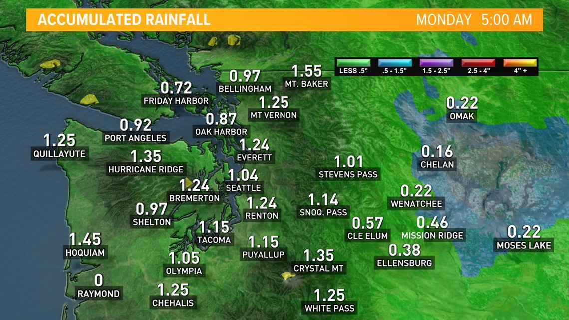
Lighter amounts are expected for the Puget Sound lowlands, but we are still anticipating a good soaking with around 0.75-1 inches possible by Sunday morning. A few areas in Snohomish and King counties could see higher amounts from enhanced Convergence Zone action.


Seattle could pick up more than an inch of rain. This is more rain than the city has seen in four months. Since June 18, Seattle has only received 0.55 inches of rain, going down as one of the driest stretches in the city's history.
Snow will fall in the higher elevations of the Olympics and Cascades. The highest passes will be impacted by either wet snow or a rain/snow mixture as snow levels dip down to 3,500 feet in some spots Saturday, with the potential for a rain/snow mixture.
Gusty winds are possible at times with each weather-maker. While sustained winds generally remain below 20 miles per hour, some gusts could exceed 30 to 40 miles per hour, with higher gusts near the Strait and for gap areas. While these winds should not be enough to cause widespread tree or powerline issues, with foliage remaining on trees, some branches could come down and isolated power outages are possible. This is not expected to be a major or widespread concern at this time.
Western Washington got a good soaking Friday and cleaner air along with much cooler temperatures. The cooler temperatures also brought snow to the mountains above 4,000 feet.
Saturday brought gradually decreasing showers with some clearing.
Sunday
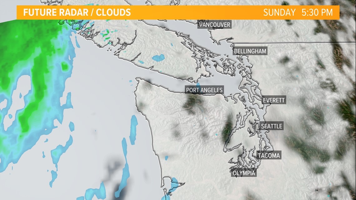
Sunday should see mostly sunny skies after some morning fog, but another system is expected to move in late Sunday night bringing increasing rain.
The snow levels will slightly rise with this system as there's less cold air, but snow levels will still range between 4,500 feet to 5,000 feet late Sunday into Monday.


Monday and beyond
Drivers should prepare for a wet morning commute as rain is expected to stick around Monday morning.
The steady rain will change to off-and-on showers Monday afternoon and decrease, but another system will move in with more rain during the day on Tuesday.
Storms will continue to march through the northwest with wet weather expected to continue off and on into the following weekend.
Flood risk
The flood risk is currently expected to remain low, but this will be closely monitored. As always, if you live in a flood-prone area or near recent burn areas, it is always best to stay weather aware.
The areas near burn scars have a higher chance to see isolated flooding and even debris flows. There is a particular concern near the Bolt Creek Fire.
The NWS tweeted about guidance for preparing for debris flow. They advise having an emergency kit and an evacuation route planned.
The (WSDOT) urged people living near the Bolt Creek Fire to go to the grocery store, pick up prescriptions and restock emergency supplies in case debris forces U.S. 2 to close.
Burn bans lifted
Pierce County lifted its burn ban at 8 a.m. Monday after the recent rain and future forecast indicating more rainfall were on the way.
The county said lifting the burn ban does not affect areas in Pierce County where burning is prohibited because of environmental or pollution laws or in areas where the local fire district limits or prohibits burning.
Burning is restricted to natural vegetation from the burn site only, the county said in a release. The burning of garbage, paper, or other refuse is strictly prohibited.
Snohomish County lifted its burn ban starting Tuesday.
That means people who have a current residential burn permit for yard debris will now be allowed to burn, but the burn pile must not exceed 4’ x 4’ x 3’. Recreational fires are allowed in approved fire pits without a burn permit. However, the fire pit must be constructed of noncombustible material such as concrete or metal and shall be a minimum of 25 feet from structures, according to the county.
Officials said a recreational fire by definition is a cooking fire or campfire using charcoal or firewood. These fires may not be greater than three feet in diameter and/or two feet in height. Water must also be immediately available.
The county said residents living in Arlington, Brier, Darrington, Edmonds, Everett, Granite Falls, Gold Bar, Index, Lake Stevens, Lynnwood, Marysville, Mill Creek, Mountlake Terrace, Monroe, Mukilteo, Snohomish, Stanwood or Sultan should contact the local fire department for more burn restrictions.
Watch the mountain and pass cameras as snow falls
Interested in seeing the first snow of the season or just want to check the latest road conditions for some of the local passes?
Watch the latest conditions at areas of mountains and passes as the snow begins to fall over the weekend.
Top of Mount Rainier gondola at Crystal Mountain, 6,872 feet:
White Pass US 12, 4,500 feet:
Stevens Pass US 2, 4,061 feet:
Snoqualmie Pass I-90, 3,022 feet:
This an important reminder to give yourself extra time on area roadways with rain moving in. It has been a while since we have experienced widespread wetting rain, so area roadways could become slick due to dust, smoke, and oil buildup.


