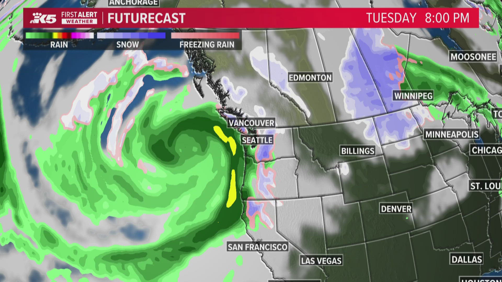
WASHINGTON, USA — It seems that over the past few years, weather terms have become more sensationalistic. “Polar vortex,” “atmospheric river” and “bomb cyclone” come to mind.
As this next storm system approaches, you’ll hear the term “bombogenesis” thrown around. The first thing to know is that there are no bombs involved! However, people who are in the path of the gusty winds may beg to differ.
To understand bombogenesis, you need to first remember the basics of high and low pressure. High pressure tends to clear the skies and calm the winds. Low pressure tends to pull in wetter air and gusty winds. Thus, the higher the pressure, the calmer it’ll be, and conversely, the lower the pressure, the stormier it’ll be.
Pressure? Yes, we measure the state of the atmosphere in millibars. “Static” or standard low pressure is about 1013 mb. Low-pressure systems tend to be in the upper 900 mb range.
As a storm forms, we refer to its “genesis” to borrow the biblical term - it is growing. If a storm grows quickly, it’s called rapid intensification. If a storm’s central pressure drops more than 24 mb in 24 hours, that’s bombogenesis.
Bombogenesis can happen when a cold air mass collides with a warm air mass, such as air over warm ocean waters.
This system originated in the northern latitudes. The ocean is relatively warm compared to it. The greater the difference between the warm and the cold, the faster and stronger the intensification will be.
In our case, 990 mb on Monday is expected to be around 950 mb by Wednesday.
What can Washingtonians expect from the forecasted bomb cyclone?
- Mountain snow: An expected 3-6 inches of snow is expected to fall Monday night and an additional 4-12 inches overnight Tuesday.
- Coastal flooding: Due to the current King Tide conditions, there could be minor flooding of parking lots and roadways.
- Blustery wind: Winds will pick up Tuesday afternoon and be strongest through the Cascade foothills.

