Autumn's arrival is announced by falling leaves, less daylight, and the ever-pressing question: what about winter?
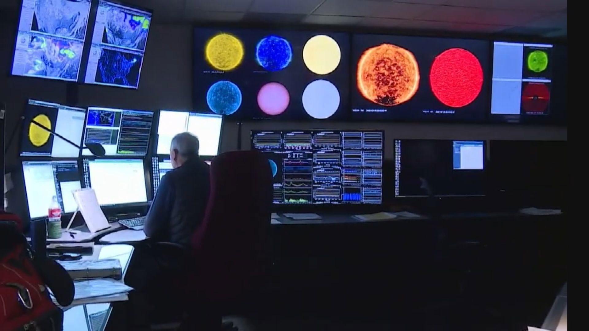
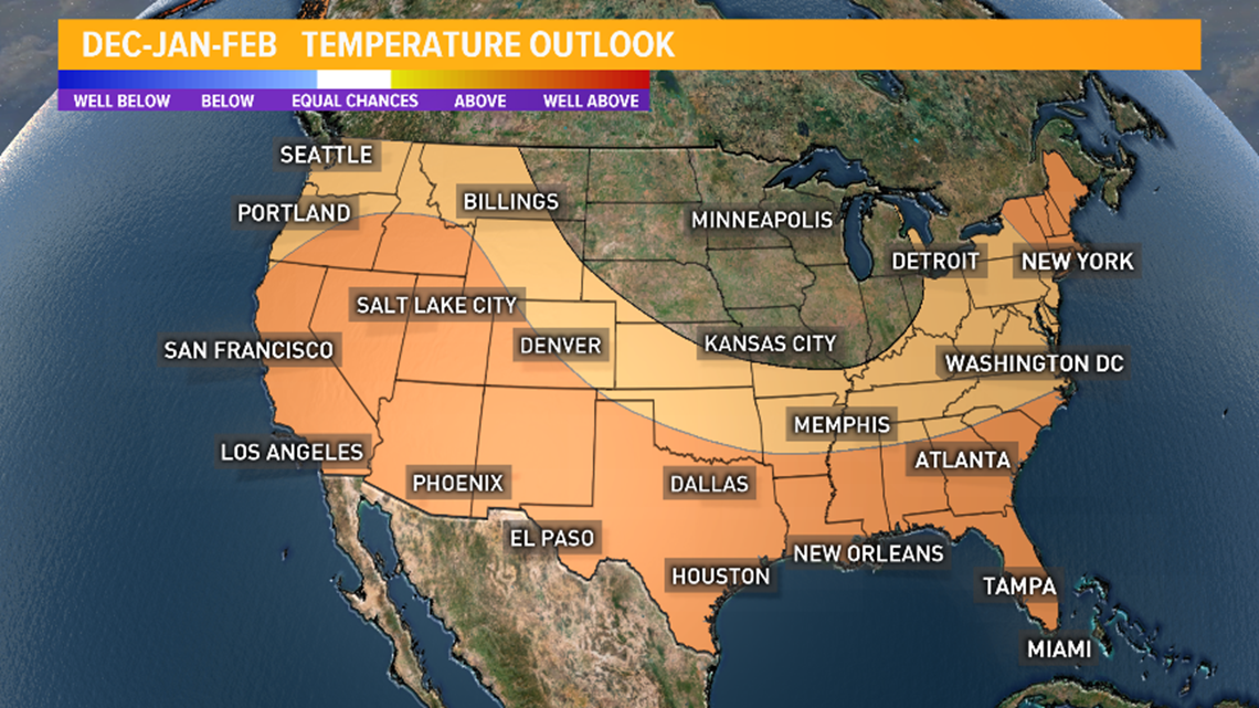
NOAA's Climate Prediction Center has put out its official winter forecast for the Pacific Northwest. Our region and much of the country for that matter is predicted to get above-normal temperatures this winter.
Here in the KING 5 Weather Center, I also think our winter will have above-normal temperatures, partly because of the "Blob" off the coast, and partly due to the recent trend of winters being warmer. Rainfall may end up being a little bit more than normal – but not by much. Finally, due to the changeability of a neutral winter, there will probably be a least one cold snap where we might see snow for lower elevations, but amounts are impossible to predict for a whole season. But after last February's official 21" of snowfall at Sea-Tac, having two heavy snow winters in a row seems less likely.
VIEW | Current forecast here

El Nino and La Nina are the best predictors of how our upcoming winter will trend. These systems are tied to the "sea surface temperatures" (SSTs) in a specific part of the Tropical Central Pacific Ocean.
When the SSTs are warmer than normal, we call it El Nino. And we tend to have warmer than normal winters with no clear-cut trend in rainfall.
When SSTs are below normal, it's La Nina. And we tend to have winters that are cooler and wetter than normal. But “tend” is the critical word here.

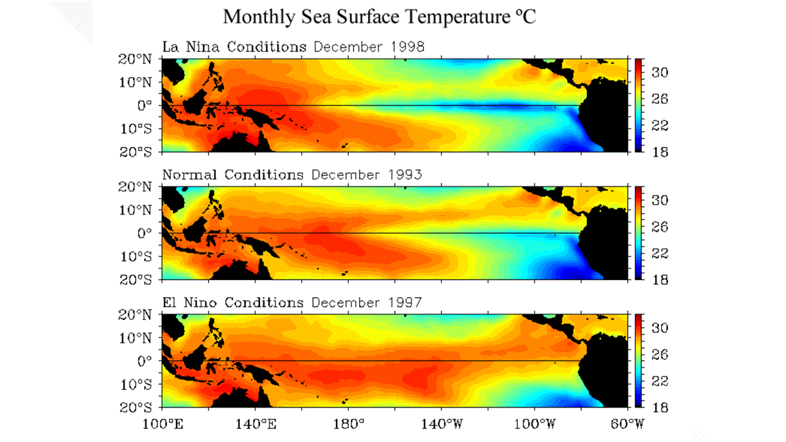
The systems may push our winters in a certain direction, but other less predictable processes can affect the outcome for a winter. The best analogy is that they load the dice for one outcome or another, but don’t guarantee it on every roll of the dice.
And even when the forecast is correct for the winter, it may not feel correct. Last winter was a classic example of this.
It was an El Nino winter and the forecast was for “above-normal temperatures.” But what do people remember about last winter? How cold and snowy it was in February. However, last winter's forecast was right overall.
Summer flower pots were still blooming when the snow hit in February because November, December, and January were in the top 10 warmest ever recorded for each of those months.

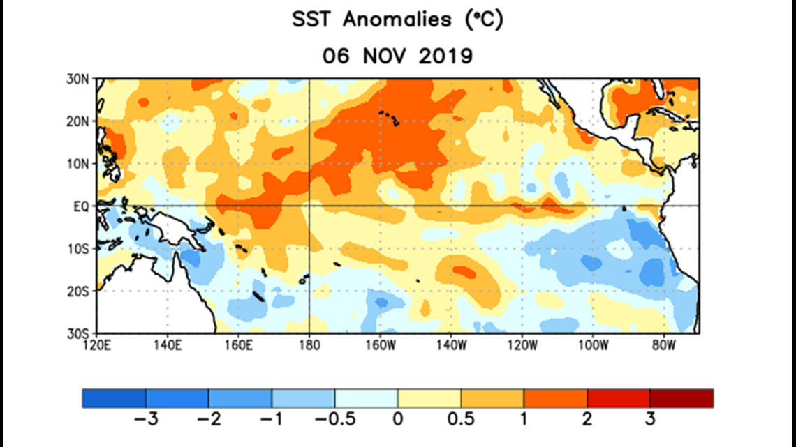
Forecasts for a whole season are tricky. And even trickier than usual this year.
Rather than having an El Nino or a La Nina, we are expected to have “neutral conditions,” which means the SSTs in the critical part of the Pacific are normal.
So this winter, the dice are not loaded for anything and that tends to give us changeable winters where we can be locked into one pattern for a while — just to have it change to another pattern for a while. But there doesn’t seem to be a significant push for one type of weather over another for the Pacific Northwest.

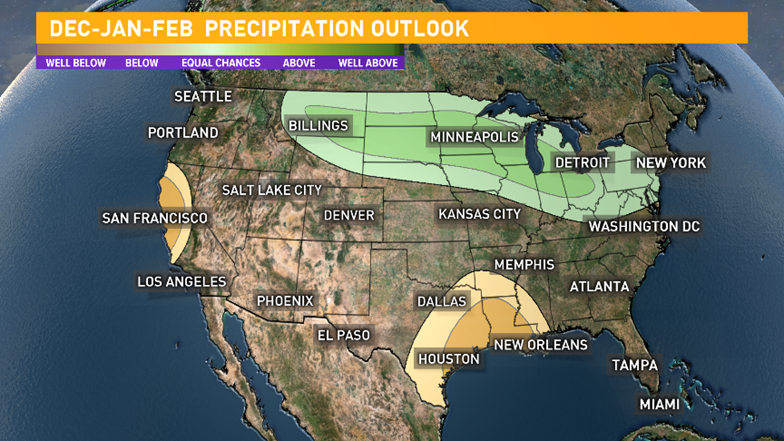
VIEW | Current forecast here
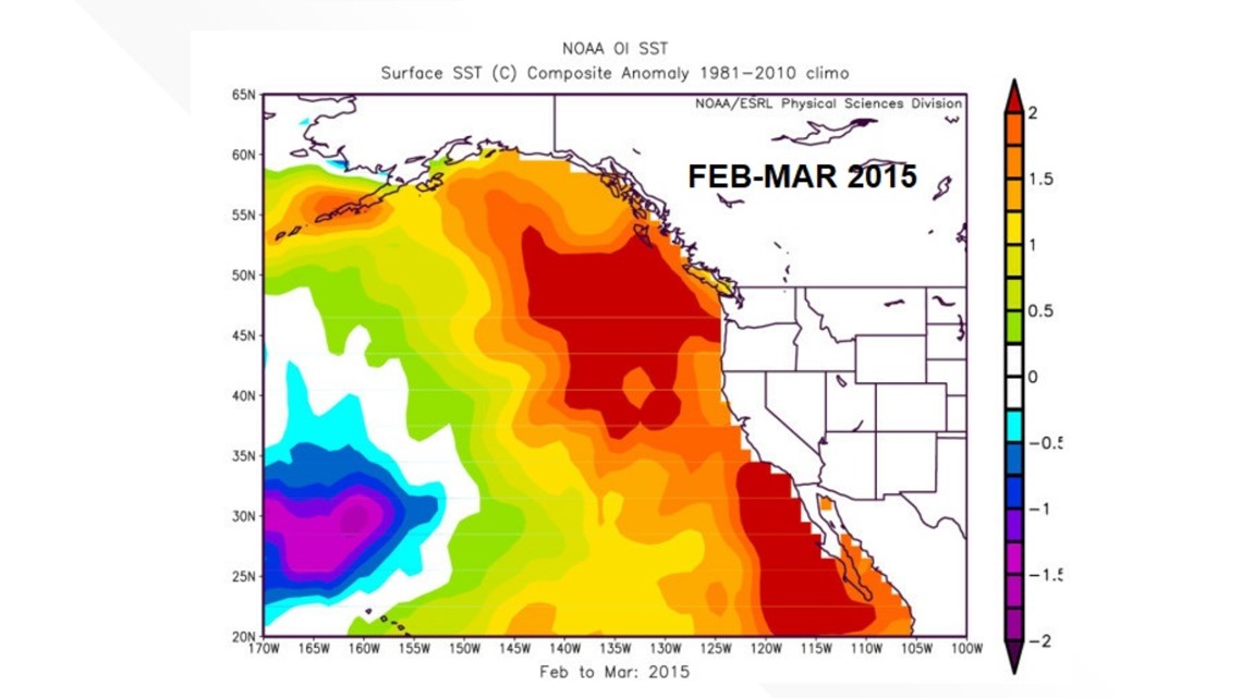
You may recall the “Blob” of unusually warm water off the Pacific coast of North America in 2013-2016. It is more technically called a marine heatwave.
The Blob was associated with the Pacific Northwest snow drought in the winter of 2014-2015, when the mountains received mostly rain rather than snow.
Well, it's back again and has been described by Washington State Climatologist and UW Associate Professor Nick Bond as the “Daughter of Blob.”
This pool of warm water is still a wild card, as it appears weaker than the previous Blob and shallower, so it could be more easily broken up.
Importantly, 2014-2015 was an El Nino year, so it may have added to the warm winter that brought rain rather than snow to the mountains.

Finally, one last complicating factor for our winter forecast is climate change. We know how El Nino, La Nina and neutral conditions have affected our weather in the past. But with a changing climate, we really can’t be sure that they will have the same effect in the future.
As you can tell, there is plenty of room for error.
With all this uncertainty, the best forecast may come from the Magic 8-Ball:
“The future is hazy – ask again later! “

