SEATTLE — Additional chances for lowland snow are in the forecast for Tuesday morning.
A Winter Weather Advisory is in effect through Tuesday at 10 a.m. for the southwest interior, north and central Washington coast, Chehalis Valley, Bremerton and Hood Canal area.
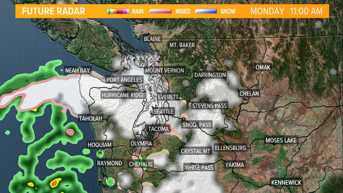
Some of this wet snow, or a rain/snow mixture, attempts to sneak into Seattle and Everett late Monday morning. No accumulations are expected in or around Seattle but a coating of wet snow is possible for the Olympic and Kitsap Peninsula.
Monday morning future radar

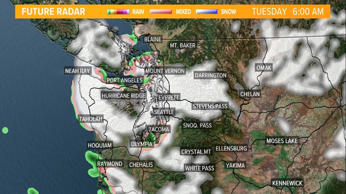
Another round of potentially more notable lowland wet snow or a rain/snow mix moves into Seattle and the rest of the Puget Sound lowlands overnight Monday into Tuesday morning. The favored area to see wet snow will be Central Puget Sound.
Tuesday morning future radar

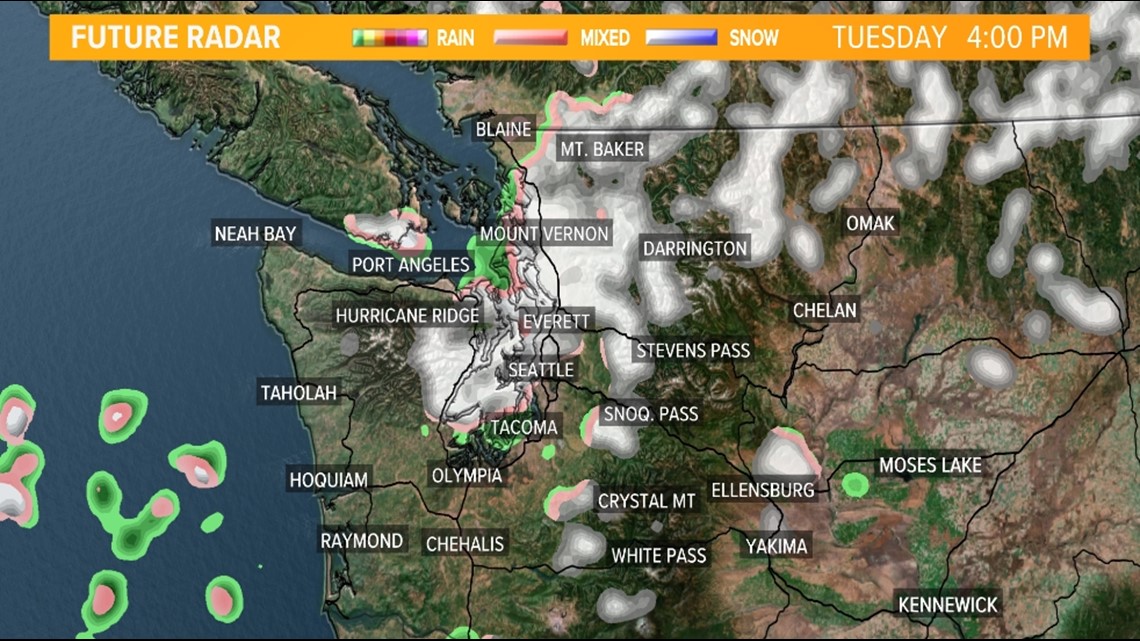
Some of the rain/snow showers could stick around into Tuesday afternoon around Central and North Puget Sound.
Tuesday afternoon future radar

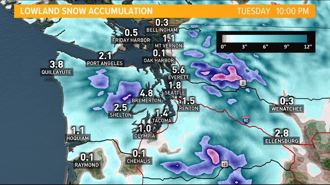
Light accumulations are possible Tuesday on grassy and elevated surfaces especially from the Kitsap Peninsula into Central Puget Sound areas. Around 1 inch can be expected but some higher totals of 2-3 inches are possible for the hilltops and away from water.
Modeled snow accumulation forecast Tuesday

Wednesday's weather calms a bit with mostly sunny skies and daytime highs in the 40s.
The possibility of a rain/snow mix returns Thursday with highs in the low to mid-40s.
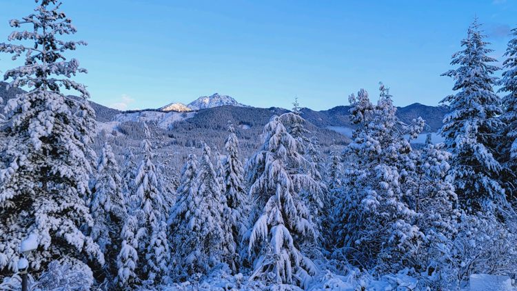
Snow made an appearance for many across western Washington on Sunday. Rain/snow showers transitioned into spotty rain/snow flurries later in the day.
A coating of snow was recorded in downtown Seattle with 1.6 inches recorded at Sea-Tac Airport, which is higher in elevation and farther away from water than downtown.


