SEATTLE — Punxsutawney Phil promised six additional weeks of winter and that prediction looks spot on for western Washington.
The setup
Confidence is increasing that western Washington will see another batch of modified arctic air by mid-next week. This air mass will send temperatures well below average and increase the potential for some areas of lowland snow.
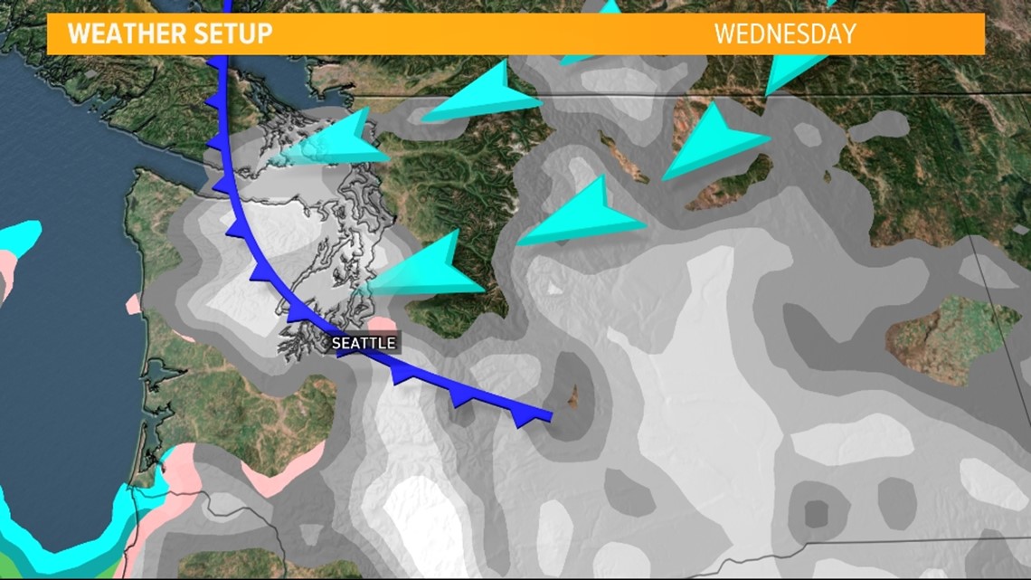
The change in the weather pattern is still several days out so the finer details are unknown, but what we do know is colder air and gusty winds will move through the Fraser Valley and Cascade gap areas on Tuesday, continuing to sneak toward coastal Washington Wednesday.
Temperature outlook
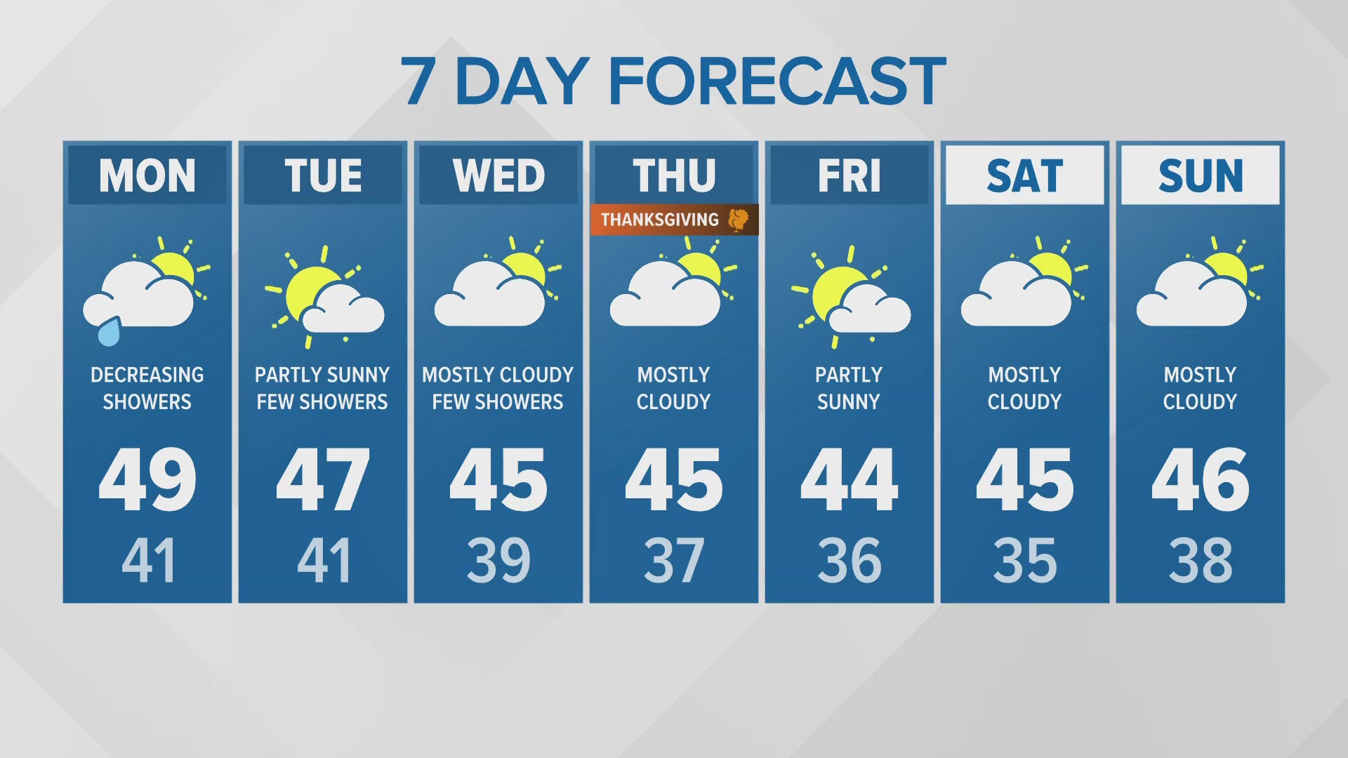
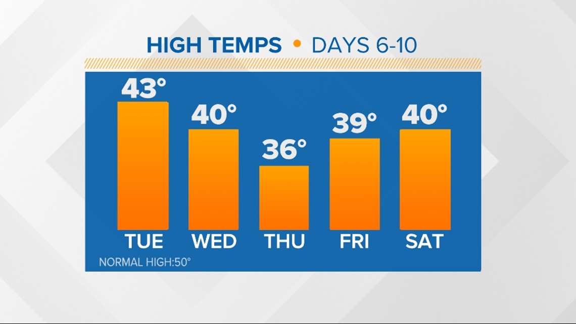
This air mass has arctic origins, which will keep many areas in the 30s for highs by Wednesday in western Washington with highs likely staying this cold through the end of the week.
The normal high this time of the year is around 50 degrees so temperatures will run 10 to 15 degrees below the seasonal normal.
Temperatures in central and eastern Washington will be significantly colder, staying in the 20s for highs.

Overnight lows will also be quite frigid in the teens and 20s.
Lowland snow outlook
With the cold air mass in place, the big question is if any moisture will overlap the cold air. This is always the million-dollar question as snow levels will fall below 500 feet late Tuesday and Wednesday.
A preliminary look at the setup does suggest the potential for areas of lowland snow late Tuesday and Wednesday.

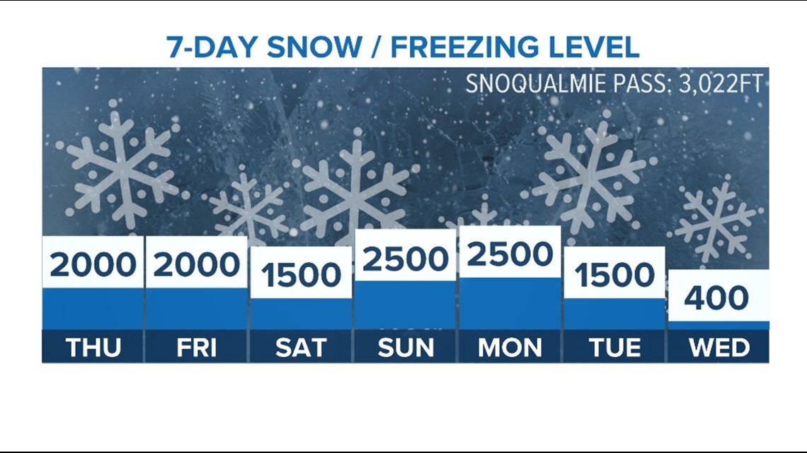
It's too early to determine accumulation amounts or pinpoint which areas will see snow, but the setup paired with weather model guidance does suggest there's the potential for lowland snow that could lead to some light accumulations by the end of the day Wednesday with just dry cold air Thursday and Friday.

The details will become clearer as we get closer to the event, so keep checking back for updates as the KING 5 First Alert Weather Team finetunes the forecast over the coming days.
Don't like the cold weather? Don't worry, the spring equinox is only 32 days away.