SEATTLE — Puget Sound Extended Forecast
Thursday: Showers and sunbreaks. Calm winds, but increasing in the Cascade foothills late tonight. Highs in the mid-40s to near 50. Snow level near 3,500 feet.
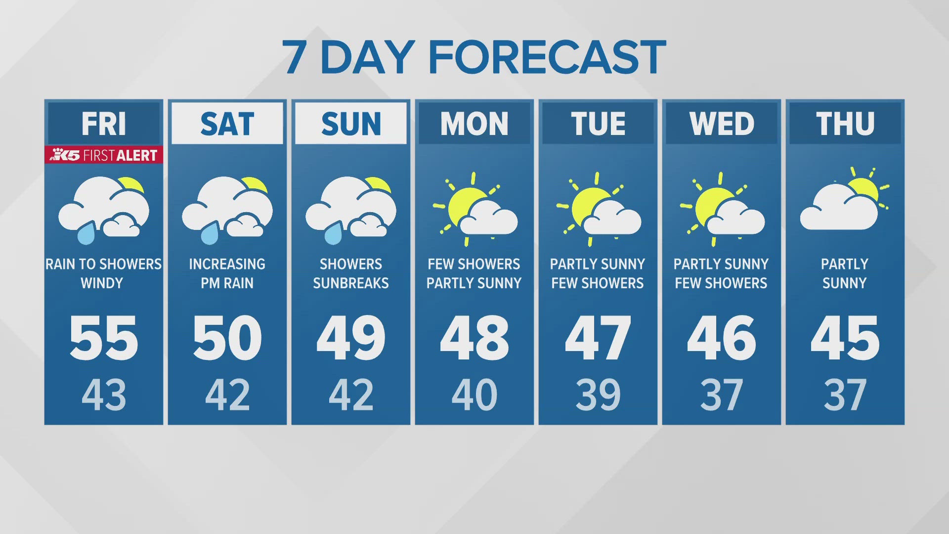
Friday: First Alert Weather Day: Increasing rain and increasing east winds during the early AM hours becoming windy in the Cascade foothills. Southeast winds increasing in Puget Sound by mid-late morning. Remaining windy in the afternoon and evening except for winds decreasing in the foothills. Steady rain changes to showers in the afternoon. Lows in the 40s. Highs in the upper 40s to lower 50s. Snow level near 4,500 feet.
Saturday: Showers and sunbreaks and breezy north of Seattle. Lows in the 40s. Highs in the upper 40s to lower 50s. Snow level near 2,500 feet.
Sunday: Showers and sunbreaks. Lows in the 40s. Highs in the upper 40s. Snow level near 2,000 feet.
Saturday: Increasing rain in the afternoon and breezy north of Seattle. Lows in the 40s. Highs in the upper 40s to lower 50s. Snow level near 2,500 feet.
Sunday: Showers and sunbreaks. Lows in the 40s. Highs in the upper 40s. Snow level near 2,000 feet.
Monday: Few showers under partly sunny skies. Lows in the 30s and 40s. Highs in the mid to upper 40s. Snow level near 2,000 feet.
Tuesday-Wednesday: Partly sunny and chilly. Lows in the 30s and 40s. Highs in the mid to upper 40s. Snow level near 2,000 feet.
Discussion:
We see a break between weather systems today with only showers sunbreaks and calm winds as the remnants of the bomb cyclone move farther west and weaken.
However, another blustery weather system will move in early on Friday morning. Like Tuesday night's storm, Friday's storm will develop as it rotates around a large upper-level low pressure off the coast. This storm will pass by off the coast Thursday even closer than Tuesday's, but it will be much weaker than the bomb cyclone so it will produce much less wind.
This low will give western Washington increasing rain and wind (but not as windy as Tuesday night) early on Friday. The rain should should turn to showers by midday on Friday. However, the gusty winds will start and end at different times on Friday depending on the location. Below are the three main areas.
Cascade foothills: East winds will begin to increase after about 10 pm Thursday and it should become windy after midnight with maximum wind gusts to 35-45 mph. On Friday morning, winds will turn more southeasterly by 7 am, and wind gusts will decrease to about 25-35 mph. Winds will become southerly in the afternoon but wind gusts remain in the 25-35 mile range. Winds will gradually decrease in the evening.
Puget Sound lowlands: Winds will be north to northeasterly early on Friday morning. But switch to south to southeasterly around midday with wind gusts to 25-35 mph. Remaining windy in the afternoon then slowly decreasing during the evening.
Coast: Winds will become easterly gusting 20-35 mph after midnight. Maximum wind gusts will increase during the day becoming southerly 45-55 mph during the evening Friday. Wind gusts will then gradually decrease during the morning hours on Saturday.
Saturday should see showers and sunbreaks and decreasing winds. Sunday there will be decreasing showers with more sun. Right now it looks like Monday will only see a few showers mixed with sunshine. Tuesday and Wednesday should be partly sunny after the morning fog.

