SKAGIT COUNTY, Wash. — Editor's note: This story is no longer being updated. Find the latest updates in a new live blog here.
Efforts are underway to help those impacted by the latest storm that brought heavy rain and strong winds to western Washington.
Agencies throughout western Washington are warning of continued flooding, even as rain decreases.
The National Weather Service (NWS) said river flooding is expected to be the biggest impact from the latest storm.
Below is a live blog of current developments and a list of helpful resources as residents recover from the atmospheric weather event:
Live blog with latest updates:
Wednesday
4:55 a.m.: WSDOT has closed State Route 9 south of Francis Road through Clear Lake, Washington due to water over the roadway.
1:15 a.m.: WSDOT says closed State Route 9 at Sumasdue to water over the roadway.
Tuesday
11:20 p.m.: Residents of Fir Island and Sterling have been recommended to evacuate. The City of Mount Vernon has canceled voluntary evacuation orders for the West Mount Vernon and the Riverbend / Freeway Drive area.
The National Weather Service extended the flood warning for the Skagit River through late Thursday night, November 18, stating: “The area will dry out with the end of the rainfall for a few days. However, with so much water in the system, it will take some time to drain the floodwaters. In addition, the dams on the Skagit were able to absorb a significant part of the flood but with the reservoirs near maximum pool levels, that water must start being released. This will slow the recession of the river levels downstream.”
10 p.m.: Whatcom County residents and first responders remain in the rescue and response phase following the storm that brought severe flooding to the area.
Soon, however, officials will move into the damage assessment phase, officials said Tuesday night.
Information on how to work with disaster recovery entities such as FEMA will be released in the coming days, after assessments can be made.
7:30 p.m.: All roads into and out of the Lummi peninsula are closed due to flooding, according to Whatcom County officials.
That includes the area's evacuation route.
The Whatcom County Sheriff's Office previously advised Lummi Island residents to shelter in place. The sheriff's office said peninsula residents should be prepared to evacuate.
5 p.m.: More than 100 water rescues were performed in Whatcom County amid severe flooding on Tuesday, according John Gargett, deputy director of the Whatcom County Sheriff's Office Division of Emergency Management.
Many of those water rescues occurred because people ignored road closures.
During a press conference Tuesday evening, one official said he wouldn't be surprised if damages to roads and levees ends up being in the $7 million to $10 million range due to flooding around the Nooksack River.
Estimates on flooding damage is only just beginning as flood waters begin to recede.
3:30 p.m.: The northbound lanes of I-5 near Bellingham could remain closed until Tuesday evening, according to the Washington State Department of Transportation.
The southbound lanes reopened Tuesday morning after an overnight closure.
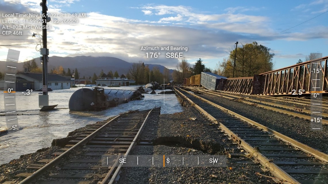
1:56 p.m.: Twelve rail cars derailed off the tracks in Sumas during peak high flood stage Monday night, according to Sumas Mayor Kyle Christensen.
Several other cars remain on the tracks, which are on unstable and damaged rails, according to Christensen.
According to BNSF, "we had approximately six cars carrying" tip over. The cars are carrying asphalt and nothing is compromised, according to BNSF.
When the water recedes, BNSF will access the situation and make necessary repairs.

12:51 p.m.: Lummi Island residents are asked to shelter in place, and Lummi Peninsula residents should prepare to evacuate due to flooding, according to the Whatcom County Sheriff's Office.
Most routes off Lummi Peninsula are closed, but the sheriff's office shared an evacuation route for emergencies and first responders that it aims to keep open as long as possible. Drivers should prepare for heavy traffic and long delays.
Fire Districts 7 and 11 and Medic One have prepositioned on Gooseberry Point in case the peninsula is cut off from the mainland, according to the sheriff's office.
12:50 p.m.:The Blaine Police Department (BPD) is asking everyone to stay home as both lanes of I-5 near Ferndale and other surface roads in the area are expected to close shortly.
Additionally, BPD said that anyone living in Bellingham may not be able to cross the Nooksack River floodway for up to two days beginning this afternoon.
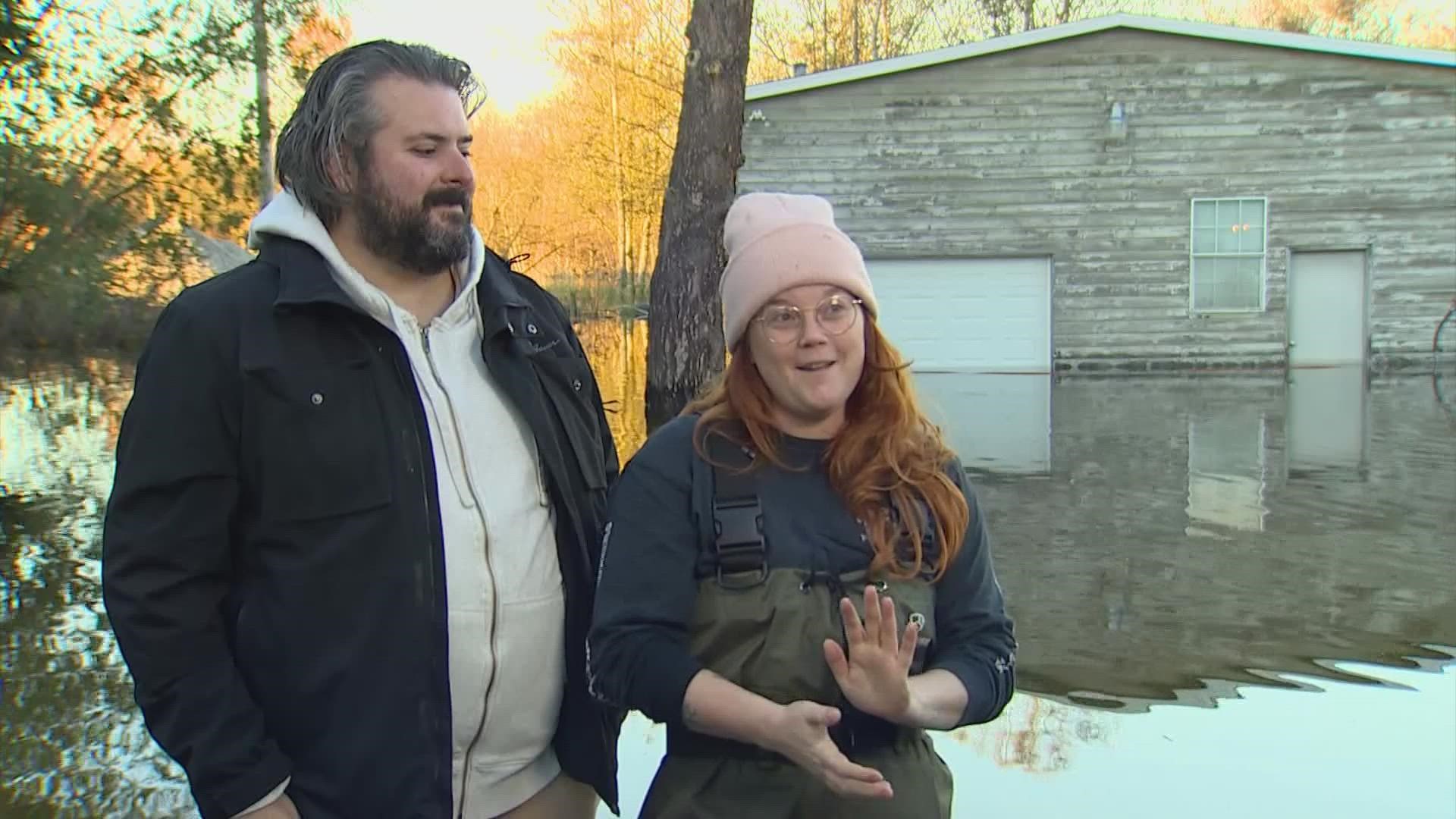
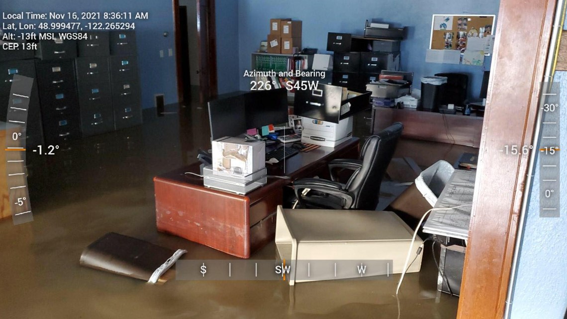
12:03 p.m.: The city of Sumas estimates over 75% of homes have water damage from flooding. Volunteers and first responders helped rescue and evacuate hundreds of people, according to the city.
"The damage is devastating to our city," the city said in a Facebook post.

10:55 a.m.: The evacuation of Mount Vernon businesses along Freeway Drive has been lifted after officials determined the Riverbend Dike is secure.
The city previously issued an evacuation alert for people near Riverbend Road out of concern that the levee could fail. However, Dike District 17 assessed the dike and determined there was no damage to its integrity.
The remaining concern is for damage to Riverbend Road.
10:17 a.m.: Ferndale is requesting the voluntary evacuation of all residents and businesses south of Main Street between 4th Avenue and Nooksack River. There is potential for the river to breach its levee.
Evacuees should head to the north. They can head to the temporary emergency shelter at the Ferndale High School cafeteria. This can be accessed off Golden Eagle Drive or Shuksan Drive from Vista Drive or Washington Street. Any questions can be directed to 360-384-4006.
9:44 a.m.: In Whatcom County, SR 9 (Lawrence Road) between Siper Road and SR 542 (Mount Baker Highway) was washed out in the storm and is closed to traffic. Cascade Natural Gas is fixing an exposed gas line at the location.
9:36 a.m.: The city of Mount Vernon is asking residents and businesses on and around Riverbend Road west of I-5 to evacuate immediately to the east side of I-5.
The evacuation is due to a bulge in the Riverbend Dike, which could signal a potential failure in the levee. Everyone in the area is urged to use East Stewart Road and College Way to move east since Freeway Drive to the south is still closed.
A flash flood watch has been issued for the area, too.
5:29 a.m.: Drivers heading north on I-5 to Ferndale from Bellingham will be detoured to Slater Road due to water on the roadway. The WSDOT said drivers will be directed east to Northwest Avenue, north to Smith Road, east to SR 539 (Guide Meridian) and then use SR 539 north to access Lynden/Ferndale and the Canadian border.
5 a.m.: The Northwest River Forecast Center said the Skagit River in Mount Vernon was at 35.15 feet and “appears to have crested.”
The Skagit River in Concrete crested on Monday morning at 38.93 feet, and the Samish River crested Monday at 13.99 feet.
The county said there are still several state and county road closures due to high water. Click here for a complete list of current road closures in Skagit County.
4:20 a.m.: The southbound lanes of I-5 reopened at North Lake Samish Dr (milepost 247) after closing overnight due to flooding and active landslides threatening the highway.
The northbound lanes remain closed at Nulle Road (milepost 246). Drivers traveling on northbound I-5 will be directed to exit at Nulle Road (exit 242) and can get back on the interstate at the North Lake Samish on-ramp. Read more
Road Closures
Where to find sandbags
Sandbag options are also available throughout King County. Several locations are open 24/7. Obtaining sand at these sites is free of charge.
Also, anyone needing sandbags in Skagit County should contact the county's department of emergency management at 360-416-1850.
Power Outages
School Closures
Washington State Ferries
Updates from Monday:
9 p.m.: Efforts to restore power is being hindered by flooding and landslide risk, according to Puget Sound Energy.
More than 60,000 PSE customers remain without power from south of Olympia to the Canadian border.
Hardest-hit areas include Whidbey Island, King Pierce, Thurston, Kitsap, Whatcom, and Skagit counties. Most outages are the result of fallen trees and limbs due to strong winds and saturated soil.
Several roads in Skagit, Whatcom and Island counties are inaccessible due to flooding.
6:50 p.m.: The City of Mount Vernon is recommending people on the west side of the city to evacuate due to severe flooding.
A flood is threatening areas west of the SR 536 bridge.
The bridge closes when the Skagit River reaches 35 feet. The bridge is likely to close at 9 p.m., according to the city.
A shelter has been set up at the Bethany Covenant Church at 1318 South 18th Street.
5 p.m.: Gov. Jay Inslee declared a severe weather state of emergency for more than a dozen counties.
The weather emergency applies to: Clallam, Grays Harbor, Island, Jefferson, Lewis, King, Kitsap, Pierce, Mason, San Juan, Skagit, Snohomish, Thurston, and Whatcom counties.
The storm that has caused flooding, landslides and power outages throughout the region has created a need to establish alternate transportation routes, evacuations and impacted local utility services, the emergency order states.
The emergency order directs procedures from the state's Comprehensive Emergency Management Plan are implemented.
State agencies and departments are being directed to do "everything possible" to assist affected areas.
4:40 p.m.: School districts in Whatcom County are canceling class Tuesday due to flooding damage and concerns over additional damage overnight.
The Sedro-Woolley School District has canceled all activities Monday and is closing school Tuesday. The district will reassess conditions Wednesday morning.
The Mount Vernon School District canceled all after-school activities Monday and will remain closed Tuesday.
3:40 p.m.: All northbound lanes of I-5 remain blocked at milepost 245 south of Bellingham, near Lake Samish.
The Washington State Patrol warns there isn't much of a detour available.
"From what I understand, Hwy 9 and SR 11 are both closed, Trooper Ricky Oliphant tweeted.
Drivers should expect significant delays or avoid traveling in the area altogether, Oliphant said.
3:30 p.m.: Power outages are increasing throughout the region even as rain and winds begin to calm.
Puget Sound Energy is reporting 645 active outages impacting 104,000 customers.
Snohomish PUD is reporting more than 25,000 customers without power.
Tacoma Public Utilities is reporting scattered outages throughout the city.
Seattle City Light reports just over 500 customers without power.
2:20 p.m.: The United State Coast Guard evacuated 10 people from a flooded residential area west of Forks near Highway 110.
The evacuation comes as state crews deal with numerous closures on the Olympia Peninsula, with roads blocked by downed tress, standing water and landslides.
1:45 p.m.: A landslide is blocking all northbound lanes of I-5 at milepost 245, five miles south of SR 11 in Whatcom County.
A tree has also fallen onto the freeway.
The Washington State Patrol warns of a long closure.
Three vehicles are involved. No serious injuries are being reported.
1:45 p.m.: Strong crosswinds caused a semi-truck to tip over while crossing the Deception Pass Bridge.
12:35 p.m.: Deputies with the Whatcom County Sheriff's Office are in Everson working to rescue any stranded residents in the floodwaters.
12:34 p.m.: Orcas Island Fire and Rescue is urging residents to stay home, saying that Point Lawrence Road at Doe Bay Resort is washed out.
Additional closures include:
- Orcas Road at Swan Road
- Orcas Road at the Old Trout Inn
12:30 p.m.: The Red Cross is opening an emergency shelter in Mount Vernon at 6 p.m. at the Bethany Covenant Church, 1318 18th Street.
11:30 a.m.: The U.S. Coast Guard (USCG) said it was helping evacuate residents west of Forks near Highway 110 Monday morning. The USCG said about 10 people were in danger due to rising floodwaters in the area. No injuries have been reported at this time.
11:28 a.m.: Northbound I-5 was reopened at Nulle Road south of Bellingham after trees and debris blocking all lanes were cleared.
11:11 a.m.: Washington State Ferries (WSF) was also forced to cancel sailings on two routes Monday morning from Port Townsend and Coupeville due to weather conditions. However, the routes are returning to service with 11 a.m. departure from Port Townsend and 11:45 a.m. departure from Coupeville.
The 11:35 a.m Friday Harbor departure was canceled, resulting in the cancellation of the following sailing.
- 11:35 a.m. Friday Harbor to Shaw
- 12:20 p.m. Shaw to Orcas
- 12:40 p.m. Orcas to Lopez
- 1:05 p.m. Lopez to Friday Harbor
Reservation holders will not be penalized for not showing. Cancellations will be decided upon sailing by sailing.
11 a.m.: Five Mile Drive at Point Defiance Park in Tacoma has closed due to danger from falling trees. The trails at the Tacoma Nature Center have also closed due to flooding and high winds.
10:56 a.m.: The ground stop at Sea-Tac airport was lifted.
10:30 a.m.: Current weather-related closures across western Washington include:
- At least 50 in Whatcom County, especially the northern part of the county with rural areas around towns like Lynden seeing the majority of the closures.
- King County reported 13 closures due to water over the roadway. Most of these closures are concentrated in the eastern part of the county from Snoqualmie up north through Duvall, as well as Woodinville.
- Pierce County has closed the road at 249th Street E. and Orville Road E. as well as at Brooks Road E. just east of the Puyallup River due to leaning trees near utility lines.
10:07 a.m.: The Federal Aviation Administration issued a ground stop for Seattle-Tacoma International Airport due to high winds.
10:01 a.m.: Northbound I-5 at Nulle Road south of Bellingham blocked due to downed trees and a partial landslide on the roadway.
8:39 a.m.: The COVID-19 vaccination and testing site at Skagit County Fairgrounds is also closed Monday and Tuesday due to high winds and flooding.
The site is expected to reopen on Thursday at 3 p.m. Those with appointments during the closure will be contacted by the Skagit County Health Department to reschedule. To see other testing and vaccination options, visit the county's website.
8:30 a.m.: Snohomish County has closed about a dozen roads due to flooding, mainly around the Sultan and Gold Bar area where the Skykomish River is under a Flood Warning from the NWS. The county also closed old Snohomish Monroe Road south of Snohomish due to water over the roadway, and Pioneer Highway between Hevly Road and 236th Street NW closed due to flooding.
6:50 a.m.: State Route 539 is closed just north of Kelly Road near Bellingham due to water over the roadway, according to the Washington Department of Transportation.
Skagit County has more than 30 roads closed either due to water over the roadway or powerlines and trees down. The closures are throughout the entire county with the latest closures coming around the Hamilton area where the Skagit River is causing widespread flooding. Dozens of other roads throughout the county are considered under road hazards due to flooding but are not closed to traffic.
6:45 a.m.: Sumas police near the Canadian border told residents that there is "no reasonably safe way" to get to Bellingham without putting lives at risk. Also, Cherry Street, the road leading into Canada, is closed.
6:42 a.m.: The Red Cross opened a shelter Sunday night in Sedro Woolley for residents escaping flooding in the area. The shelter is located at the Hamiton First Baptist Church, 797 Hamilton Cemetery Road. Assistance at the shelter includes food cots and other needs.
Anyone heading to the shelter is encouraged to bring any prescriptions or emergency medication, extra clothing, pillows, blankets and hygiene supplies.
6:30 a.m.: The mayor of Mount Vernon declared a civil emergency for Monday, deploying flood walls in downtown and closing the Skagit Riverwalk and Plaza. Also, Edgewater and Lions parks are closed.
6:15 a.m.: On Monday, a number of districts closed due to flooding, power outages and road conditions, including Bellingham, Ferndale, Mount Baker, Orcas Island, and Meridian public schools and Lynden Christian schools.
Sunday
9:10 p.m.: An emergency proclamation was issued in Whatcom County due to flooding. Residents near Everson, Nooksack and Sumas are being told to prepare for high water. Whatcom County Public Works said drivers should prepare for flood-related closures through Monday.
3:57 p.m.: Service on the Northline Sounder train has been canceled Monday due to potential mudslides south of Everett.

