SEATTLE — After a rather chilly start to 2023, May and the first half of June ran unusually warm.
In fact, this May was the second warmest on record, falling short of the warmest May, May 2018, on record by only three-tenths of a degree at Sea-Tac.
And so far in June, Sea-Tac is running around a degree and a half above normal.
An abrupt change to the warmer than normal conditions arrive just in time for Father's Day weekend. Expect cooler, cloudier, and at times damp, weather this weekend. High temperatures will be hard-pressed to reach 60 degrees on Saturday and Sunday for the lowlands.
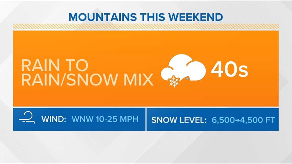
The mountains will see high temperatures stay in the 40s with the highest peaks colder in the 30s. It will feel much cooler with strong wind gusts Saturday and Sunday.
Father's Day Weekend mountain forecast


Along with the colder temperatures than normal and increased precipitation chances, there is a chance for snow in the higher peaks of the Cascades on Saturday night and Sunday as the moisture overlaps falling snow levels.
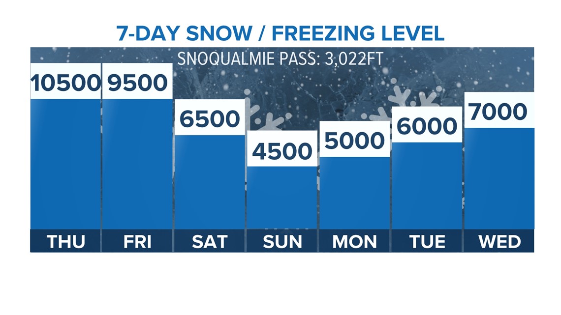
Snow levels are forecast to fall down to around 4,000 to 5,000 feet overnight Saturday into the first half of Sunday. Enough moisture should be around for snow showers to produce light accumulations in the Cascades above 4,500 feet.
Snow level forecast next 7 days


While impactful accumulations are not expected, and this won't impact travel for the passes, it could impact your plans if you plan on celebrating Father's Day by camping or hiking in the mountains.
If you do plan on enjoying the outdoors this weekend, make sure you plan accordingly for the colder temperatures and light snow in the mountains.
This weekend moisture and colder temperatures are much needed as most of western Washington, including in the Cascades, is running abnormally dry, substantially increasing the fire danger.
This weather pattern over the weekend will at least temporarily lower the fire weather conditions.


